Brandon, County Kerry

Last updated
Cé Bhréannain
Brandon
Village
Brandon beach - geograph.org.uk - 219615.jpg
Ireland adm location map.svg
Red pog.svg
Cé Bhréannain
Location in Ireland
Coordinates: 52°16′05″N10°09′41″W / 52.268026°N 10.161409°W / 52.268026; -10.161409 Coordinates: 52°16′05″N10°09′41″W / 52.268026°N 10.161409°W / 52.268026; -10.161409
Country Ireland
Province Munster
County County Kerry
Elevation 24 m (79 ft)
Population (2002)
   Urban 133
Irish Grid Reference Q520148
Cé Bhréannain is the only official name.

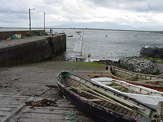
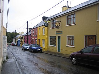
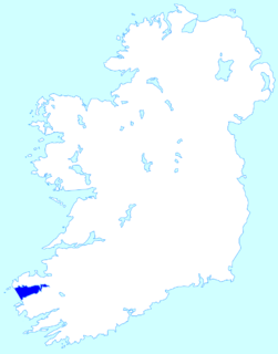
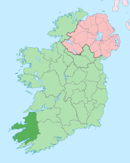
Cé Bhréannain or Bréanainn (anglicized as Brandon) [1] is a Gaeltacht village on the northern coast of the Dingle Peninsula in County Kerry, Ireland. It lies directly north of Dingle, at the foot of Mount Brandon and on the shores of Brandon Bay. [2]

Gaeltacht primarily Irish-speaking region in Ireland

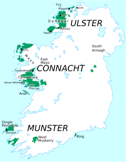
Gaeltacht is an Irish-language word for any primarily Irish-speaking region. In Ireland, the term Gaeltacht refers individually to any, or collectively to all, of the districts where the government recognises that the Irish language is the predominant vernacular, or language of the home.

Dingle Peninsula

The Dingle Peninsula is the northernmost of the major peninsulas in County Kerry. It ends beyond the town of Dingle at Dunmore Head, the westernmost point of Ireland and arguably Europe.

County Kerry County in the Republic of Ireland

County Kerry is a county in Ireland. It is located in the South-West Region and forms part of the province of Munster. It is named after the Ciarraige who lived in part of the present county. Kerry County Council is the local authority for the county and Tralee serves as the county town. The population of the county was 147,707 at the 2016 census.

Contents

The ancient Celtic harvest festival, a pre-Christian celebration called Féile Lughnasa , takes place yearly in the village and surrounding area on the last Sunday of July. [3]

Harvest festival type of festive celebration

A harvest festival is an annual celebration that occurs around the time of the main harvest of a given region . Given the differences in climate and crops around the world, harvest festivals can be found at various times at different places. Harvest festivals typically feature feasting, both family and public, with foods that are drawn from crops that come to maturity around the time of the festival. Ample food and freedom from the necessity to work in the fields are two central features of harvest festivals: eating, merriment, contests, music and romance are common features of harvest festivals around the world.

Lughnasadh

Lughnasadh or Lughnasa is a Gaelic festival marking the beginning of the harvest season. Historically, it was widely observed throughout Ireland, Scotland and the Isle of Man. In Modern Irish it is called Lúnasa, in Scottish Gaelic: Lùnastal, and in Manx: Luanistyn. Traditionally it is held on 1 August, or about halfway between the summer solstice and autumn equinox. However, in recent centuries some of the celebrations shifted to the Sundays nearest this date. Lughnasadh is one of the four Gaelic seasonal festivals, along with Samhain, Imbolc and Beltane. It corresponds to other European harvest festivals such as the Welsh Gŵyl Awst and the English Lammas.

Windsurfing

Brandon Carter Bay is one of the top windsurfing locations in Ireland. Host of three PWA professional wave sailing events in 2000, 2001 and 2002, it is home to several windsurfing schools catering to all levels from beginner to advanced. The Maharees, a sandy peninsula between Brandon Bay and Tralee Bay, is where most windsurfing activity is based. Great locations include Sandy Bay for beginners, Scraggane Bay for intermediates on flat water and Brandon Bay itself for advanced wave sailing. Surfing is also growing quickly in the Maharees, with wave conditions as big as anything in Ireland. [4] [5] [6]

Windsurfing water sport

Windsurfing is a surface water sport that combines elements of surfing and sailing. It consists of a board usually 2 to 2.5 metres long, with displacements typically between 45 and 150 litres, powered by wind on a sail. The rig is connected to the board by a free-rotating universal joint and consists of a mast, boom and sail. On “short” boards The sail area generally ranges from 1.5 to 12 square metres depending on the conditions, the skill of the sailor, the type of windsurfing being undertaken and the weight of the person windsurfing. On long boards, upon which the sport was first popularized -sail areas and board lengths are typically larger and the athleticism required is much less.

Maharees Place in Munster, Ireland

Maharees or Magharees is a 5 km long ayre located on the northern side of the Dingle Peninsula in County Kerry, Ireland.

Scraggane

Scraggane is a fishing port located on the Maharees peninsula near Castlegregory in County Kerry, Ireland.

Twin towns

Cloghane and Brandon (An Clochán agus Bhréanainn) are jointly twinned with the village of Plozévet in France.

Cloghane Village in Munster, Ireland

An Clochán is a village and townland on the Dingle Peninsula of County Kerry, Ireland, at the foot of Mount Brandon. In 1974 the village was added to the Corca Dhuibhne Gaeltacht. It has a population of 297.

Plozévet Commune in Brittany, France

Plozévet is a commune in the Finistère department of Brittany in north-western France.

France Republic with mainland in Europe and numerous oversea territories

France, officially the French Republic, is a country whose territory consists of metropolitan France in Western Europe and several overseas regions and territories. The metropolitan area of France extends from the Mediterranean Sea to the English Channel and the North Sea, and from the Rhine to the Atlantic Ocean. It is bordered by Belgium, Luxembourg and Germany to the northeast, Switzerland and Italy to the east, and Andorra and Spain to the south. The overseas territories include French Guiana in South America and several islands in the Atlantic, Pacific and Indian oceans. The country's 18 integral regions span a combined area of 643,801 square kilometres (248,573 sq mi) and a total population of 67.3 million. France, a sovereign state, is a unitary semi-presidential republic with its capital in Paris, the country's largest city and main cultural and commercial centre. Other major urban areas include Lyon, Marseille, Toulouse, Bordeaux, Lille and Nice.

Related Research Articles

Tralee Town in Munster, Ireland

Tralee is the county town of County Kerry in the south-west of Ireland. The town is on the northern side of the neck of the Dingle Peninsula, and is the largest town in County Kerry. The town's population including suburbs was 23,691 as of the 2016 census making it the 8th largest town, and 14th largest urban settlement in Ireland. Tralee is well known for the Rose of Tralee International Festival which has been held annually in August since 1959.

Mount Brandon Mountain in Kerry, Ireland

Mount Brandon or Brandon at 952 metres (3,123 ft), is the 8th–highest peak in Ireland on the Arderin scale, and the 9th–highest according to the Vandeleur-Lynam scale. Brandon is the highest Irish peak outside of the MacGillycuddy's Reeks range, and has the greatest prominence of any Irish peak except Carrauntoohil, Ireland's highest mountain. Brandon is named after Saint Brendan and is the end of a Christian pilgrimage trail known as Cosán na Naomh. Brandon is at the centre of the Brandon Group of mountains in the Dingle Peninsula in Kerry.

Fenit Village in Munster, Ireland

Fenit is a small village in County Kerry, Ireland, located on north side of Tralee Bay about 10 km (6 mi) west of Tralee town, just south of the Shannon Estuary. The bay is enclosed from the Atlantic by the Maharee spit which extends northwards from the Dingle peninsula. Fenit harbour is a mixed function sea port, where fishing, freight import and export, and a 136 berth marina are the main forms of business. The population was 527 in the 2011 CSO census compared to 427 in 2006.

Ventry Village in Munster, Ireland

Ventry, an anglicization of Fionntrá, is a Gaeltacht village in County Kerry, Ireland, on the Dingle Peninsula, 7 kilometres west of Dingle. Due to its long sandy beach, Ventry is a popular tourist destination.

Castlegregory Village in Munster, Ireland

Castlegregory is a village in County Kerry, Ireland. It is situated on the north side of the Dingle Peninsula, halfway between Tralee and Dingle. As of the 2016 Census, Castlegregory had a population of 250.

Fahamore is a small hamlet/village on the Maharees peninsula in County Kerry. It consists of about 50 houses and one famous pub, Spillane's. Fahamore was historically much larger than it is now as evidenced by two old schoolhouses in the village, one dating from 1849 and the other from 1911. Fahamore is located on the shore of Brandon Bay and is a centre for diving, surfing, windsurfing and sea bass fishing.

Dingle Bay bay located in County Kerry, Ireland

Dingle Bay is a bay located in County Kerry, western Ireland. The outer parts of the Dingle Peninsula and Dingle Bay mark one of the westernmost points of mainland Ireland. The harbour town of Dingle lies on the north side of the bay.

Brandon Creek is a village located at the Dingle Peninsula in the most westerly point of the island of Ireland.

Tralee Bay

Tralee Bay is located in on the west coast of County Kerry, Ireland. It is situated between Kerry Head on the north side and the Maharees on the west and extends eastwards as far as the bridge at Blennerville. Several small rivers feed into the bay through the town of Tralee. Villages around the bay include; Ballyheigue, Fenit, Kilfinora, Spa, Blennerville, Camp and Castlegregory.

Dingle Way

The Dingle Way is a long-distance trail around the Dingle Peninsula in County Kerry, Ireland. It is a 162-kilometre (101-mile) long circular route that begins and ends in Tralee and is typically completed in eight days. It is designated as a National Waymarked Trail by the National Trails Office of the Irish Sports Council and is managed by the Dingle Way Committee and Kerry County Council.

Knocknadobar mountain in Ireland

Knocknadobar is one of the main mountains of the Iveragh Peninsula in County Kerry, Ireland.

Sidi Kaouki is a small town located 25 km south of Essaouira. It is a rural commune in Essaouira Province of the Marrakech-Tensift-Al Haouz region of Morocco. At the time of the 2004 census, the commune had a total population of 4335 people living in 902 households.

Mount Eagle (Ireland) mountain in Ireland

Mount Eagle is a mountain in County Kerry, Ireland.

R561 road (Ireland)

The R561 road is a regional road in Ireland. It is on the Dingle Peninsula in County Kerry. Part of the road is on the Wild Atlantic Way.

R560 road (Ireland)

The R560 road is a regional road in Ireland. It is a road on the Dingle Peninsula in County Kerry. The road forms part of the Wild Atlantic Way.

References

  1. Placenames Database of Ireland
  2. "Dingle peninsula guide" . Retrieved 11 February 2016.
  3. "Festival of Lughnasa" . Retrieved 11 February 2016.
  4. "Radio Kerry" . Retrieved 11 February 2016.
  5. "Afloat Magazine" . Retrieved 11 February 2016.
  6. "World Champion to be crowned" . Retrieved 11 February 2016.

See also