
Meerut is a city in Meerut district of the western part of the Indian state of Uttar Pradesh. The city lies 80 km (50 mi) northeast of the national capital New Delhi, within the National Capital Region and 480 km (300 mi) west of the state capital Lucknow.

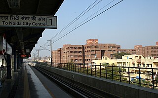
Noida, short for New Okhla Industrial Development Authority, is a city located in Gautam Buddha Nagar district of the Indian state of Uttar Pradesh. Noida is a satellite city of Delhi and is a part of the National Capital Region. According to the 2021 Delhi Master Plan, Noida is a part of CNCR or DMA. As per provisional reports of Census of India, the population of Noida in 2011 was 642,381. The city is managed by New Okhla Industrial Development Authority (NOIDA). The district's administrative headquarters are in the nearby city of Greater Noida.
Mayur Vihar is an upmarket residential area in East Delhi close to the city's Noida-Delhi border, situated just across the Yamuna River, and is divided into three distinct phases. As the name suggests, it has been the dwelling (vihar) of peacocks (mayur). Even today, the area has a closed sanctuary dedicated to the conservation of peacocks.

Ghaziabad is a city in the Indian state of Uttar Pradesh and a part of Delhi NCR. It is the administrative headquarters of Ghaziabad district and is the largest city in western Uttar Pradesh, with a population of 1,729,000. Ghaziabad Municipal Corporation is divided into 5 zones - City Zone, Kavi Nagar Zone, Vijay Nagar Zone, Mohan Nagar Zone and Vasundhara Zone. The Municipal Corporation comprises 100 wards. Well connected by roads and railways, it is a major rail junction for North India. It is part of the Meerut Division of Uttar Pradesh.

The National Capital Region (NCR) is a planning region centered upon the National Capital Territory (NCT) of Delhi in India. It encompasses Delhi and several districts surrounding it from the states of Haryana, Uttar Pradesh, and Rajasthan. The NCR and the associated National Capital Region Planning Board (NCRPB) were created in 1985 to plan the development of the region and to evolve harmonized policies for the control of land-uses and development of infrastructure in the region. Prominent cities of NCR include Delhi, Faridabad, Ghaziabad, Gurgaon and Noida.

Gautam Buddha Nagardistrict is a district of Uttar Pradesh, named after Gautama Buddha. It is a part of Delhi National Capital Region (NCR) and is divided into 3 sub-divisions (Tehsils) of Noida, Dadri and Jewar. Greater Noida is the administrative headquarters of Gautam Buddha Nagar district. Noida, Greater Noida, Dadri, Jewar, YEIDA city and Dankaur fall under this district.

Ghaziabad district is a largely suburban district of Uttar Pradesh state in northern India. It is also a core part of the National Capital Region. The city of Ghaziabad is the administrative headquarters of the district. This district is part of Meerut Division. It has become a major bedroom community for Delhi.

Greater Noida is a planned city located in the Gautam Buddha Nagar district of the Indian state of Uttar Pradesh. The city was created as an extension of the area under the UP Industrial Area Development Act, of 1976. Situated 30 km (19 mi) southeast of the capital city of New Delhi, it takes around 30 minutes to travel between the cities via the Noida-Greater Noida Expressway. The city is administered by the Greater Noida Industrial Development Authority (GNIDA). It is part of Meerut Division in Uttar Pradesh.
Chandpur is a town and a municipal board in Bijnor district in the Indian state of Uttar Pradesh, India.

Dadri is a town and a municipal board in Gautam Buddha Nagar District in the state of Uttar Pradesh, India. Noida, Dadri and Jewar are the 3 sub-divisions of GB Nagar district, each headed by a SDM.

Dankaur is a town and a nagar panchayat in Gautam Buddha Nagar district in the Indian state of Uttar Pradesh. It is situated on Yamuna Expressway, south of Greater Noida.
Jewar is a town and a nagar panchayat in Gautam Buddha Nagar district in the Indian state of Uttar Pradesh. Noida, Dadri and Jewar are the 3 sub-divisions of GB Nagar district, each headed by a SDM.
Loni is a town, near Ghaziabad city in Ghaziabad district in the state of Uttar Pradesh, India and Loni town is governed by Loni Municipal Council which comes under Ghaziabad Metropolitan Region.

Noida International Airport, also known as Jewar Airport, is an upcoming international airport being constructed near Jewar in Gautam Buddha Nagar District, Uttar Pradesh in India, which will serve the National Capital Region (NCR). The airport is situated in the new planned YEIDA city.
The Faridabad–Noida–Ghaziabad Expressway or FNG Expressway is an under-construction 56 km long, 6-lane wide expressway in Delhi NCR region of India. It will connect Faridabad in Haryana with Noida and Ghaziabad in Uttar Pradesh.

Khora is a locality in Ghaziabad city in the Ghaziabad district of Uttar Pradesh, India. Its official census population is approximately 190,000 residents (2011), but reports suggest a population closer to 1,500,000 residents inside the city's area of 10 square kilometers. It is located on the NH-24 highway, near Gaziabad and Delhi, and is within the National Capital Region of India. It is bound on the west and southwest by the village of Ghazipur, on the north and northwest by Hindon Canal, on the northeast by Indirapuram (Ghaizabad), and on the east and southeast by Noida. The Chairman of Khora is Mohini Sharma
Sarita Vihar is a posh residential colony situated in South East Delhi,National Capital Territory of Delhi ,India. It is near the Kalindi Kunj- Noida Toll bridge or GD Birla Marg-Road 13A which connects the district to Noida.The area is situated close to Uttar pradesh border. It is believed that the site was primarily chosen as the construction site for the Games Village of the 1982 Asian Games, however on the insistence of the late Prime Minister Rajiv Gandhi, the plan was changed to convert it into an upscale residential housing locality. In 2013, it was awarded the "Greenest Colony in Delhi" tag by the then Chief Minister of Delhi, Ms. Sheila Dikshit, credited to the efforts of its RWA members who have aggressively worked towards improving the state of parks and green spots in the locality.

The Uttar Pradesh Expressways Industrial Development Authority (UPEIDA) is an authority set up in 2007 by the Government of Uttar Pradesh to develop expressway projects in the state. The headquarters of UPEIDA is located at Paryatan Bhawan in Gomti Nagar, Lucknow.
Ranhera is a village and a Gram Panchayat in Jewar block of Gautam Buddha Nagar District in the Indian state of Uttar Pradesh.
Vijay Nagar is a major residential, industrial and commercial area in Ghaziabad, Uttar Pradesh, India. It was developed with assistance of the Ghaziabad Development Authority. The suburb is located at the junction of Noida, Greater Noida, Crossings Republik, Pratap Vihar and Indirapuram. Vijay Nagar is known for its educational institutes, industrial areas, the Ghaziabad Junction Railway Station, the Meerut Expressway, NH-24 and the Vishwakarma Road. The area has witnessed rampant growth in infrastructure and civic development. Vijay Nagar is closely linked with the adjoining Pratap Vihar area having a residential area, upcoming real estate projects and the Santosh Medical & Dental College, a part of Santosh University.The adjoining Bhur Bharat Nagar is close to Ghaziabad Railway Station, the nearest railway station that serves this area.
