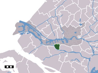
Heerjansdam is a village in the western Netherlands, in municipality of Zwijndrecht, South Holland. It has a population of 3,590.

The Spui is a small tidal river in South Holland in the Netherlands, separating the islands of Voorne-Putten and Hoekse Waard. Historically, it forked off the Oude Maas river at the town of Oud-Beijerland to end in the Haringvliet estuary, but as a (planned) result from the Delta Works, its flow has been reversed.
Voorne-Putten is an island between the North Sea, the Brielse meer and the rivers Oude Maas, Spui and Haringvliet in the province of South Holland in the Netherlands. Voorne-Putten consists of the two former islands Voorne and Putten. It used to be separated by the river Bernisse which silted up and made the two islands one. It has 160,000 inhabitants (2008). Recently the riverbed has been dredged, and the two islands have been reformed.
Hoogvliet is a borough of Rotterdam, Netherlands. As of 1 January 2004, it had 36,619 inhabitants. There is also a national chain of Dutch supermarkets with the same name.

Geervliet is a town in the Dutch province of South Holland. It is a part of the municipality of Nissewaard, and lies about 6 km northwest of Spijkenisse on the Brielse Maas. It received city rights in 1381.

Simonshaven is a village in the Dutch province of South Holland. It is a part of the municipality of Nissewaard, and lies about 4 km southwest of Spijkenisse.

Piershil is a village in the Dutch province of South Holland. It is a part of the municipality of Korendijk, and lies about 5 km south of Spijkenisse.
Biert is a hamlet in the Dutch province of South Holland. It is located in the municipality of Nissewaard, about 3 km west of Spijkenisse.

Goidschalxoord is a small village in the Dutch province of South Holland. It is located about 5 km east of Oud-Beijerland, in the municipality of Binnenmaas.

Heinenoord is a town in the Dutch province of South Holland on the island Hoekse Waard. It is located about 10 km south of Rotterdam, in the municipality of Binnenmaas.
Hofwegen is a hamlet in Molenwaard, which is a municipality in the Dutch province of South Holland. It is located on the south bank of the small river Graafstroom. It is now considered to be part of the village of Bleskensgraaf, which lies on the opposite bank.
Katendrecht is a former village in the Dutch province of South Holland. It is now a neighbourhood of Rotterdam, on the south bank of the Nieuwe Maas.
Kleine-Lindt is a hamlet in the Dutch province of South Holland. It is located about 10 km south the city of Rotterdam, in the municipality of Zwijndrecht.
Melissant is a village in the Dutch province of South Holland. It is located on the island Goeree-Overflakkee, in the municipality of Goeree-Overflakkee.
Nieuw-Helvoet is a former village in the Dutch province of South Holland. It is now a neighbourhood in the north of the town of Hellevoetsluis.

Schiebroek is a former village in the Dutch province of South Holland. It is now a neighbourhood of Rotterdam, and part of the borough of Hillegersberg-Schiebroek.
Schuddebeurs en Simonshaven is a former municipality in the Dutch province of South Holland. It was located about 4 km southwest of the town of Spijkenisse, and covered the two polders Schuddebeurs and Simonshaven, including the village of Simonshaven.
Zuidwijk is a former municipality in the Dutch province of South Holland. It was located southeast of the center of Boskoop.
Maartje Lena "Marleen" de Pater-van der Meer was a Dutch politician, she served as member of the House of Representatives for the Christian Democratic Appeal between 2001 and 2010. Before her time in the House she was active in the municipal politics of Zutphen. After her period as MP she was interim mayor of Muiden until her death.


