
Homeville in Nova Scotia
Homeville is a community in the Canadian province of Nova Scotia, located in the Cape Breton Regional Municipality.
Homeville is a community in the Canadian province of Nova Scotia, located in the Cape Breton Regional Municipality.

The Gulf of St. Lawrence is the outlet of the North American Great Lakes via the St. Lawrence River into the Atlantic Ocean. The gulf is a semi-enclosed sea, covering an area of about 226,000 square kilometres (87,000 sq mi) and containing about 34,500 cubic kilometres (8,300 cu mi) of water, at an average depth of 152 metres (500 ft).

The Marconi National Historic Site and the Marconi Wireless Station National Historic Site are two National Historic Sites located on Cape Breton Island, Nova Scotia. Both sites commemorate the efforts of Guglielmo Marconi to transmit transatlantic radio signals between North America and Europe in the first decade of the 20th century. The two sites are located within approximately 8 kilometres (5.0 mi) of one another, and are connected by the Marconi Trail.

The Musquodoboit River is a Canadian river located in central Nova Scotia in the northeastern part of Halifax Regional Municipality. The river is approximately 97 kilometres (60 mi) in length with roughly 88 kilometres (55 mi) being traversable by paddle. It has a watershed area of 1,409 square kilometres (544 sq mi)
Glace Bay-Dominion is a provincial electoral district in Nova Scotia, Canada, that elects one member of the Nova Scotia House of Assembly.
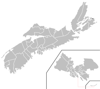
Route 255 is a collector road in the Canadian province of Nova Scotia.

Broughton was a former town in the Cape Breton Regional Municipality about 19 kilometers from the city of Sydney, Nova Scotia. It was going to be one of Canada's first planned towns, designed to eventually accommodate 10,000 residents. In reality, it was mostly abandoned when mining operations failed.
Lewis Lake, Nova Scotia could mean the following:
Caledonia is a community that is part of the former town of Glace Bay in the Canadian province of Nova Scotia, located in the Cape Breton Regional Municipality.
Port Caledonia is a small community in the Canadian province of Nova Scotia, located in the Cape Breton Regional Municipality on Cape Breton Island. It is located on the Donkin Highway, between the town of Glace Bay and the village of Donkin.
Coxheath is a community in the Canadian province of Nova Scotia, located north of the Sydney River in the Cape Breton Regional Municipality on Cape Breton Island. The community is home to Riverview Rural High School, a secondary school with approximately 900 students in Grades 10-12 and Coxheath Elementary.
Bateston is a community in the Canadian province of Nova Scotia, located in the Cape Breton Regional Municipality on Cape Breton Island. It is known for its flashing light at the center of town.

Mira Gut is a small community in the Canadian province of Nova Scotia, located in the Cape Breton Regional Municipality on Cape Breton Island where the Mira River enters into Mira Bay. It features both fresh and saltwater beaches and is a popular swimming area during the summer months.
Passchendaele is a community that is part of the former town of Glace Bay in the Canadian province of Nova Scotia, located in the Cape Breton Regional Municipality on Cape Breton Island.
Leitches Creek Station is a community in the Canadian province of Nova Scotia, located in the Cape Breton Regional Municipality on Cape Breton Island.
Birch Grove is a community in the Canadian province of Nova Scotia, located in the Cape Breton Regional Municipality on Cape Breton Island.
Catalone Gut is a community in the Canadian province of Nova Scotia, located in the Cape Breton Regional Municipality on Cape Breton Island. It is named after Gédéon de Catalogne, a French officer, who was a cartographer stationed at the Fortress of Louisbourg.
Round Island is a community in the Canadian province of Nova Scotia, located in the Cape Breton Regional Municipality on Cape Breton Island.
Table Head is a Neighborhood in the Canadian province of Nova Scotia, located in Glace Bay in the Cape Breton Regional Municipality on Cape Breton Island.
Scatarie Island is an island in the Canadian province of Nova Scotia, located off the coast of Baleine, Cape Breton Island.
Coordinates: 46°5′1.57″N59°53′55.49″W / 46.0837694°N 59.8987472°W
| | This Cape Breton County, Nova Scotia location article is a stub. You can help Wikipedia by expanding it. |