Washtenaw County is a county located in the U.S. state of Michigan. At the 2020 census, the population was 372,258. The county seat and largest city is Ann Arbor. The county was authorized by legislation in 1822 and organized as a county in 1826. Washtenaw County comprises the Ann Arbor Metropolitan Statistical Area. The county is home to the University of Michigan, Eastern Michigan University, Washtenaw Community College, and Concordia University Ann Arbor.

Lenawee County is a county located in the U.S. state of Michigan. As of the 2020 United States Census, the population was 99,423. The county seat is Adrian. The county was created in 1822, from territory partitioned from Monroe County. Its governing structure was organized in 1826.
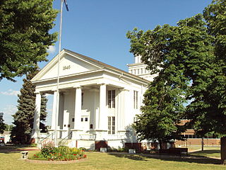
Lapeer County is a county located in the U.S. state of Michigan. As of the 2020 Census, the population was 88,619. The county seat is Lapeer. The county was created on September 18, 1822, and was fully organized on February 2, 1835. The name is a corruption of the French la pierre, which means "the stone". Lapeer County is located north of Detroit and east of Flint.

Ingham County is a county located in the U.S. state of Michigan. As of the 2020 Census, the population was 284,900. The county seat is Mason. Lansing, the state capital of Michigan, is largely located within the county. Lansing is the only state capital in the United States located in a county of which it is not also the seat of government. The county is home to Michigan State University, Lansing Community College, and the Class A minor league baseball team Lansing Lugnuts. Ingham County is included in the Lansing–East Lansing, MI Metropolitan Statistical Area. It is considered to be a part of Mid Michigan.

The Territory of Michigan was an organized incorporated territory of the United States that existed from June 30, 1805, until January 26, 1837, when the final extent of the territory was admitted to the Union as the State of Michigan. Detroit was the territorial capital.
The Thumb is a region and a peninsula of the U.S. state of Michigan, so named because the Lower Peninsula is shaped like a mitten. The Thumb area is generally considered to be in the Central Michigan region, east of the Tri-Cities and north of Metro Detroit. The region is also branded as the Blue Water Area.

Southeast Michigan, also called southeastern Michigan, is a region in the Lower Peninsula of Michigan that is home to a majority of the state's businesses and industries as well as slightly over half of the state's population, most of whom are concentrated in Metro Detroit.
Michigan's 13th congressional district is a United States congressional district in Wayne County, Michigan. It is currently represented by Democrat Shri Thanedar.
Michigan's 11th congressional district is a United States congressional district north of Detroit, comprising most of urbanized central Oakland County. Until 1993, the district covered the state's Upper Peninsula and the northernmost portion of the Lower Peninsula. In redistricting that year, it was shifted to the outer Detroit area. Its former geographical area is now the state's first district. Its current configuration dates from 2023.
Michigan's 9th congressional district is a United States congressional district located in The Thumb and northern portions of Metro Detroit of the State of Michigan. Counties either wholly or partially located within the district include: Huron, Tuscola, Sanilac, Lapeer, St. Clair, Macomb and Oakland. With a Cook Partisan Voting Index rating of R+18, it is the most Republican district in Michigan.
Central Michigan, also called Mid Michigan, is a region in the Lower Peninsula of the U.S. state of Michigan. As its name implies, it is the middle area of the Lower Peninsula. Lower Michigan is said to resemble a mitten, and Mid Michigan corresponds roughly to the thumb and palm, stretching from Michigan's eastern shoreline along Lake Huron into the fertile rolling plains of the Michigan Basin. The region contains cities of moderate size, including Flint, Saginaw, and the state capital of Lansing. Generally Central, or "Mid", Michigan is defined by governmental organizations as an area North of Jackson, and South of Clare.
Michigan's 4th congressional district is a United States congressional district located in the state of Michigan. The current 4th district contains much of Michigan's old 2nd district, and includes all of Allegan and Van Buren counties, as well as portions of Ottawa, Kalamazoo, Calhoun, and Berrien counties. In 2022, the district was redrawn to start in St. Joseph Township and extend north to Port Sheldon Township. The 4th is currently represented by Republican Bill Huizenga, who previously represented the old 2nd district.
Michigan's 2nd congressional district is a United States congressional district in Western Michigan. The current 2nd district contains much of Michigan's old 4th congressional district, and includes all of Barry, Clare, Gladwin, Gratiot, Ionia, Isabella, Lake, Manistee, Mason, Mecosta, Montcalm, Newaygo, Oceana, and Osceola counties, as well as portions of Eaton, Kent, Midland, Muskegon, Ottawa and Wexford counties. Republican John Moolenaar, who had previously represented the old 4th district, was re-elected to represent the new 2nd in 2022.
Michigan's 3rd congressional district is a U.S. congressional district in West Michigan. From 2003 to 2013, it consisted of the counties of Barry and Ionia, as well as all except the northwestern portion of Kent, including the city of Grand Rapids. In 2012 redistricting, the district was extended to Battle Creek. In 2022, the district was condensed to the greater Grand Rapids and Muskegon areas, including portions of Kent, Muskegon, and Ottawa counties. Redistricting removed Barry, Calhoun, and Ionia counties.
Michigan's 8th congressional district is a United States congressional district in Central Michigan. The district was first created in 1873, after redistricting following the 1870 census. From 2003 to 2013, it consisted of all of Clinton, Ingham, and Livingston counties, and included the southern portion of Shiawassee and the northern portion of Oakland counties. From 2013 to 2023, the district no longer covered Clinton or Shiawassee counties and instead covered more of Oakland County, including Rochester. In 2023, the district was redrawn to be centered on the city of Flint, and includes all of Saginaw and Bay counties, almost all of Genesee County, and portions of Midland and Tuscola counties.
Michigan's 6th congressional district is a United States congressional district in southeast Michigan. In 2022, the district was redrawn to be centered around Ann Arbor and Washtenaw County, as well as western and southern Wayne County, small part of southwestern Oakland County, and the city of Milan in Monroe County. In previous redistrictings, the 6th district consisted of all of Berrien, Cass, Kalamazoo, St. Joseph, and Van Buren, counties, and includes most of Allegan county.
The Michigan Department of Health and Human Services (MDHHS) is a principal department of state of Michigan, headquartered in Lansing, that provides public assistance, child and family welfare services, and oversees health policy and management.
MotorCities National Heritage Area or Motor Cities National Heritage Area is a federally designated National Heritage Area that commemorates and promotes the automobile industry in Metro Detroit, with portions of 16 counties in southern Michigan, United States.
George Howe was an American politician who served in the Michigan House of Representatives immediately after adoption of the state's first constitution.