Microsoft Streets & Trips

Last updated
Microsoft Streets & Trips
Developer(s) Microsoft
Initial release1988
Final release
2013 (19.00.18.2600) / July 1, 2012;10 years ago (2012-07-01) [1]
Operating system Windows XP and later [1]
Platform IA-32 [1]
Size 1.4 GB [1]
Type Route planning software
License Trialware [1]
Website microsoft.com/streets/ [ dead link ]

Microsoft Streets & Trips, known in other countries as Microsoft AutoRoute, is a discontinued [2] [3] mapping program developed and distributed by Microsoft. Functionally, the last version is a subset of Microsoft MapPoint targeted at the average consumer to do a variety of map related tasks in the North American region including the United States, Canada, and Mexico, such as route planning.

Contents

It was originally developed by NextBase Ltd., which was acquired by Microsoft in 1994. Its primary competitor was DeLorme, particularly its Street Atlas series of mapping software.

Region-based editions

The European version is branded as Microsoft AutoRoute and covers all of Europe, including European Russia, as well as Armenia, Azerbaijan, Georgia, Cyprus and all of Turkey. AutoRoute was also produced in several European languages besides English.

Early history

Originally released by NextBase Ltd in the 1988, [4] a UK company, under the name "Autoroute", it was sold for DOS based PCs and later for the Apple Macintosh, Atari ST and Psion PDA. In the early 1990s, it was ported to the Microsoft Windows operating system. The company created a version for the United States called Automap Road Atlas which it sold through its American subsidiary Automap Inc. in Bellevue, Washington. In 1994, the product was sold to Microsoft. Microsoft combined the Encarta World Atlas Mapping Technology with new routing technology derived from Autoroute to create Automap Streets/Streets Plus and Automap Road Atlas products. In Europe, the Autoroute brand was retained.

The initial products were 16-bit with Automap Streets Plus 5.0 (1997 version) being the first 32-bit version. Automap Road Atlas was later rebranded in a future release as Automap Trip Planner. [5] These were produced as two distinct products under the Microsoft Home division and were later rebranded for a few releases as Expedia Streets, Expedia Streets Deluxe and Expedia Trip Planner. [6] During these early versions, core new features were added like updated maps, pushpins, weather, traffic and construction updates. In 2000, they were merged into a single product called Microsoft Expedia Streets & Trips 2000. After Microsoft spun off Expedia, later releases were rebranded as Microsoft Streets & Trips. In 2000, Microsoft also developed Microsoft MapPoint as a business mapping program for geographic analysis, based on this technology. The technology was also used in MSN Maps which later became Bing Maps.

History of releases with Streets & Trips branding

Streets & Trips 2000 was the first version combining the 2 separate products. [7] Like Expedia Trip Planner, it also included a travel guide [8] with pictures and information on points of interest and tourist spots for a particular address. Streets & Trips 2001 dropped the travel guide but added the ability to run without the CD by copying all the map data to the disk drive.

Streets & Trips 2002 added a Pocket Streets for Windows CE devices. Like every yearly update, Streets & Trips 2002 [9] and 2003 were also database updates with Streets & Trips 2003 adding more than 300,000 miles of streets and highways. [10] Streets & Trips 2004 added drive-time zones, a feature to see on a map how far you could travel within a specified amount of time. [11] Streets & Trips 2005 significantly improved the GPS features with an on-screen compass and support for USB plug and play GPS receivers. [12]

The GPS version of Streets & Trips 2006 introduced voice-prompted directions, a hands-free option with turn-by-turn directional information/ [13] All versions starting with 2006 and later install the new text-to-speech voice, "Microsoft Anna" on Windows XP, which is part of Windows Vista, for the voice-prompt direction feature. Version 2006 of both Streets & Trips as well as AutoRoute is the last version for Windows 98 / Me and version 2007 is the last version for Windows 2000.

Streets & Trips 2008 added online services integration like MSN Direct and Live Search Maps for current traffic updates, and an automatic re-routing feature if the driver missed a turn or took a wrong turn. [14] Streets & Trips 2008 (and older) included 336 pushpin symbols and they were easy to spot due to the use of bright colors. Streets & Trips 2009 replaced these symbols with a new set of 46 pushpins and removed many pushpins, besides reducing their contrast. In response to this, the Streets and Trips user community created a default map template [15] which has the 2008 pin set in order to re-add them to the program. The former pushpins were restored in the 2010 version but still with the newer visual styling.

Streets & Trips 2009 [16] also added pronunciation of street names, as part of the voice directions prompts. The map of Mexico now includes street-level data of even small towns, but the address-find feature still has not been enabled for there. This release saw the first user interface update in many years with new colorful and optionally, large toolbar icons.

Streets & Trips 2010 [17] added hide/show pushpinsets, hide/show information balloons, import/export GPX files, export to GPS navigation device, export to mobile phone, and 348 new pushpin symbols were added, the majority restored former pins as mentioned above.

Streets & Trips 2011 [18] is mainly a database update adding 88,000 miles of new mapping to the program and the removal of support for the ending MSN Direct service and coupon data, while allowing direct map correction feedback to maps provider Navteq and the addition of cardinal direction guidance and alternate road names to direction data. This version came out in February rather than the traditional August/September release date. No reasons were given. There was no release called Streets & Trips 2012.

The last version, Streets & Trips 2013 was released on July 1, 2012 with a new online custom ratings and reviews feature [19] and Metro UI-style icons. [20] Despite previous reports that the 2013 version did not accept data from older versions, the 2013 version converts the old files for usage and the user can save them in that format.

A separate version of the product was always sold with a GPS (Global Positioning System) receiver to allow users to use the product as a satellite navigation system. Since version 2008, [21] Microsoft started requiring Product Activation for the retail versions of Streets & Trips, [22] although Volume License (VL) versions available through MSDN did not require activation.

Microsoft announced the discontinuation of Streets & Trips in 2014, with online support for existing users to end on July 14, 2015. [23]

All versions of Windows 10 include a free GPS-ready mapping app similar to Streets & Trips. This can be used offline, though the map data must be initially downloaded before use on a state by state, province by province basis. In the U.S. and Canada, actual (not calculated) residential and commercial street addresses are included. Voice navigation is provided to GPS-enabled devices. The drawing tools from Streets & Trips have been removed, however.

Compatibility

Streets & Trips 2006 and later are compatible with Windows Vista and later modern operating systems (Windows 7, 8, 8.1, 10).

The software had an incompatibility with Advanced Vector Extensions in x86 processors causing it to hang/freeze on the splash screen on Windows 7 SP1 64-bit. [24] Microsoft patched Windows 7 with hotfix KB2643882.

System requirements of the 2013 version

Related Research Articles

<span class="mw-page-title-main">Esri</span> Geospatial software & SaaS company

Esri is an American multinational geographic information system (GIS) software company. It is best known for its ArcGIS products. With a 43% market share, Esri is the world's leading supplier of GIS software, web GIS and geodatabase management applications. The company is headquartered in Redlands, California.

<span class="mw-page-title-main">MSN</span> Collection of Internet sites

MSN is a web portal and related collection of Internet services and apps for Windows and mobile devices, provided by Microsoft and launched on August 24, 1995, alongside the release of Windows 95.

<span class="mw-page-title-main">DeLorme</span> Personal satellite tracking and navigation technology company

DeLorme Publishing Company was a producer of personal satellite tracking, messaging, and navigation technology. In 2016, Garmin acquired the company's products and the DeLorme trademark. The company's main product, inReach, integrates GPS and satellite technologies. inReach provides the ability to send and receive text messages anywhere in the world by using the Iridium satellite constellation. By pairing with a smart phone, navigation is possible with access to free downloadable topographic maps and National Oceanic and Atmospheric Administration (NOAA) charts. On February 11, 2016, the company announced that it had been purchased by Garmin, a multinational producer of GPS products and services.

AutoRun and the companion feature AutoPlay are components of the Microsoft Windows operating system that dictate what actions the system takes when a drive is mounted.

<span class="mw-page-title-main">Microsoft MapPoint</span> Discontinued software by Microsoft

Microsoft MapPoint is a discontinued software program and service created by Microsoft that allows users to view, edit and integrate maps. The software and technology are designed to facilitate the geographical visualization and analysis of either included data or custom data. Numerous acquisitions have supplemented both data and feature integration.

<span class="mw-page-title-main">OpenStreetMap</span> Collaborative project to create a free editable map of the world

OpenStreetMap (OSM) is a free, open geographic database updated and maintained by a community of volunteers via open collaboration. Contributors collect data from surveys, trace from aerial imagery and also import from other freely licensed geodata sources. OpenStreetMap is freely licensed under the Open Database License and as a result commonly used to make electronic maps, inform turn-by-turn navigation, assist in humanitarian aid and data visualisation. OpenStreetMap uses its own topology to store geographical features which can then be exported into other GIS file formats. The OpenStreetMap website itself is an online map, geodata search engine and editor.

<span class="mw-page-title-main">Bing Maps</span> Web mapping service from Microsoft

Bing Maps is a web mapping service provided as a part of Microsoft's Bing suite of search engines and powered by the Bing Maps Platform framework. Since 2020, the map data is provided by TomTom.

<span class="mw-page-title-main">TomTom</span> Dutch manufacturer of automotive navigation systems

TomTom N.V. is a Dutch multinational developer and creator of location technology and consumer electronics. Founded in 1991 and headquartered in Amsterdam, TomTom released its first generation of satellite navigation devices to market in 2004. As of 2019 the company has over 4,500 employees worldwide and operations in 29 countries throughout Europe, Asia-Pacific, and the Americas.

<span class="mw-page-title-main">Point of interest</span>

A point of interest (POI) is a specific point location that someone may find useful or interesting. An example is a point on the Earth representing the location of the Eiffel Tower, or a point on Mars representing the location of its highest mountain, Olympus Mons. Most consumers use the term when referring to hotels, campsites, fuel stations or any other categories used in modern automotive navigation systems.

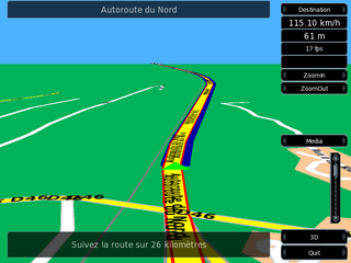
Microsoft AutoRoute is a discontinued travel planning program, and the European version of Microsoft Streets & Trips. It covers the United Kingdom and all of Europe, including European Russia, as well as Armenia, Azerbaijan, Georgia, Cyprus and all of Turkey. AutoRoute was produced in several European languages besides English, and in two separate editions: AutoRoute and AutoRoute GPS.

MapInfo Pro is a desktop geographic information system (GIS) software product produced by Precisely and used for mapping and location analysis. MapInfo Pro allows users to visualize, analyze, edit, interpret, understand and output data to reveal relationships, patterns, and trends. MapInfo Pro allows users to explore spatial data within a dataset, symbolize features, and create maps.

iGO (software)

The iGO Navigation Engine, developed by Hungary-based NNG LLC is a GPS navigation software package. NNG sells some versions of the software directly to users, as well as to device manufacturers, auto makers, network operators and professional transport specialists. Products based on iGO are available in brands including Becker, Clarion, Pioneer, Samsung and Vodafone.

Satellite navigation software or GNSS navigation software usually falls into one of the following two categories:

  1. Navigation with route calculation and directions from the software to the user of the route to take, based on a vector-based map, normally for motorized vehicles with some motorized forms added on as an afterthought.
  2. Navigation tracking, often with a map "picture" in the background, but showing where you have been, and allowing "routes" to be preprogrammed, giving a line you can follow on the screen. This type can also be used for geocaching.
<span class="mw-page-title-main">Satellite navigation device</span> Device that can calculate its geographical position based on satellite information

A satellite navigation device, satnav device or satellite navigation receiver is a user equipment that uses one or more of several global navigation satellite systems (GNSS) to calculate the device's geographical position and provide navigational advice. Depending on the software used, the satnav device may display the position on a map, as geographic coordinates, or may offer routing directions.

<span class="mw-page-title-main">Here Technologies</span> Netherlands-based mapping data company

Here Technologies is an American–Dutch multinational group specialized in mapping technologies, location data and related automotive services to individuals and companies. It is majority-owned by a consortium of German automotive companies and American semiconductor company Intel whilst other companies also own minority stakes. Its roots date back to U.S.-based Navteq in 1985, which was acquired by Finland-based Nokia in 2007. Here is currently based in The Netherlands.

<span class="mw-page-title-main">Digital mapping</span> Compiling data to create a visual image

Digital mapping is the process by which a collection of spatial data is compiled and formatted into a virtual image on a computer. The primary function of this technology is to produce maps that give accurate representations of a particular area, detailing major road arteries and other points of interest. The technology also allows the calculation of distances from one place to another.

<span class="mw-page-title-main">TeleType Co.</span>

TeleType Co., Inc. is a privately held company in the United States, specialized in developing software for GPS devices. It was founded in 1981, under the name TeleTypesetting Company and it is based in Boston, Massachusetts. The company's product line includes automotive and commercial GPS navigation systems and other products including GPS receivers and tracking units. It develops and sells the WorldNav software for PC and Windows CE, tools for converting third party maps into WorldNav maps, an SDK and an API that allow the customization of the WorldNav application. TeleType Co. also offers consultancy services for those interested in acquiring and adapting the source code of their software products.

<span class="mw-page-title-main">Turn-by-turn navigation</span> Feature of GPS navigation devices

Turn-by-turn navigation is a feature of some satellite navigation devices where directions for a selected route are continually presented to the user in the form of spoken or visual instructions. The system keeps the user up-to-date about the best route to the destination, and is often updated according to changing factors such as traffic and road conditions. Turn-by-turn systems typically use an electronic voice to inform the user whether to turn left or right, the street name, and the distance to the next turn.

Maptitude is a mapping software program created by Caliper Corporation that allows users to view, edit and integrate maps. The software and technology are designed to facilitate the geographical visualization and analysis of either included data or custom external data. The primary user type is business development professionals. The primary use type is for sales territory management.

<span class="mw-page-title-main">Here WeGo</span> Web mapping and navigation service since 2012

Here WeGo is a web mapping and navigation service, operated by HERE Technologies and originally developed by Nokia. In 2013, HERE Technologies released this web mapping application for Windows Phone and the World Wide Web as a revamped version of Nokia Maps. HERE Technologies released the HERE Maps application to the Android platform on December 10, 2014, and later for iOS on March 11, 2015. The company changed the product name to HERE WeGo in July 2016. It is the default maps service provider for the Amazon Fire tablets and smartphones.

References

  1. 1 2 3 4 5 "Streets & Trips 2013 Trial". Download Center. Microsoft. 1 July 2012. Retrieved 8 July 2014.
  2. Popa, Bogdan (7 July 2014). "Microsoft Kills Three More Software Products". Softpedia . SoftNews.
  3. Thurrott, Paul (7 July 2014). "MapPoint and Streets & Trips Step Aside for Bing Maps". Paul Thurrott's SuperSite for Windows. Penton Media. Archived from the original on 16 November 2016. Retrieved 8 July 2014.
  4. "NextBase and Automap Products". Archived from the original on 2012-03-21.
  5. Microsoft Debuts All-New Line of Automap Products
  6. Microsoft Launches New Version of Preferred Street-Finding Software
  7. New Microsoft Expedia Streets & Trips 2000 Offers All-in-One Mapping Solution
  8. Expedia Streets and Trips 2000
  9. Microsoft Streets & Trips 2002 Mapping Software Makes Travel a Snap
  10. Microsoft Streets & Trips 2003 Expands Coverage, Adds Tools For Fun, Fast and Accurate Road Travel and Trip Planning
  11. Microsoft Puts Drivers on the Map With Streets & Trips 2004
  12. New Microsoft Streets & Trips 2005 With GPS Locator Puts End to “Are We There Yet?”
  13. Microsoft Streets & Trips 2006 With GPS Locator: The Backseat Driver Consumers Will Be Glad to Have in the Car
  14. Microsoft Streets & Trips 2008 With Connected Services Drives Down Travel Costs and Eases Stressful Commutes
  15. "[Template] Old-style pushpins for Streets & Trips 2009 / MapPoint 2009 - Laptop GPS World". Archived from the original on 2008-10-21. Retrieved 2008-10-18.
  16. "Review: Microsoft Streets and Trips 2014 - Laptop GPS World". Archived from the original on 2008-08-29. Retrieved 2008-08-25.
  17. "Review: Microsoft Streets and Trips 2014 - Laptop GPS World". Archived from the original on 2009-09-04. Retrieved 2009-09-01.
  18. "Review: Microsoft Streets and Trips 2014 - Laptop GPS World". Archived from the original on 2016-11-16. Retrieved 2010-09-21.
  19. "Download Streets & Trips 2013 Trial". Official Microsoft Download Center.
  20. No color after installing S&T 2013
  21. "Review: Microsoft Streets and Trips 2014 - Laptop GPS World". Archived from the original on 2008-09-02. Retrieved 2008-08-25.
  22. Product activation FAQ and troubleshooting: MS KB927007
  23. Streets & Trips Homepage Archived July 7, 2014, at the Wayback Machine
  24. Fixed: Streets & Trips stops responding at the startup screen in Windows 7 SP1

AutoRoute