The Beothuk were a group of indigenous people who lived on the island of Newfoundland.
Sunnyside is a town on the Avalon Peninsula in Newfoundland and Labrador, Canada. It is in Division 1 on Bull Arm.
Cuper's Cove, on the southwest shore of Conception Bay on Newfoundland's Avalon Peninsula was an early English settlement in the New World, and the third one after Harbour Grace, Newfoundland (1583) and Jamestown, Virginia (1607) to endure for longer than a year. It was established in 1610 by John Guy on behalf of Bristol's Society of Merchant Venturers, who had been given a charter by King James I of England to establish a colony on the island of Newfoundland. Most of the settlers left in the 1620s, but apparently a few stayed on and the site was continuously inhabited.
The year 1981 in archaeology involved some significant events.
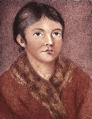
Demasduit was a Beothuk woman, one of the last of her people on Newfoundland.
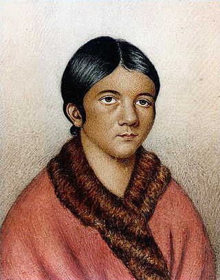
Shanawdithit, also noted as Shawnadithit, Shawnawdithit, Nancy April and Nancy Shanawdithit, was the last known living member of the Beothuk people, who inhabited Newfoundland, Canada. Remembered for her contributions to the historical understanding of Beothuk culture, including drawings depicting interactions with European settlers, Shanawdithit died of tuberculosis in St. John's, Newfoundland on June 6, 1829.

Twillingate is a town of 2,121 people located on the Twillingate Islands ("Toulinquet") in Notre Dame Bay, off the north eastern shore of the island of Newfoundland in the province of Newfoundland and Labrador, Canada. The town is about 100 kilometres (62 mi) north of Lewisporte and Gander.
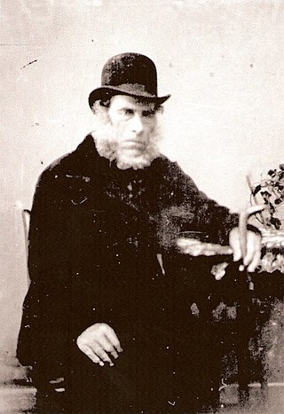
William Epps Cormack was a Scottish explorer, philanthropist, agriculturalist and author, born St. John's, Newfoundland. Cormack was the first person of European descent to journey across the interior of the island. His account of his travels was first published in Britain in 1824. Interested in studying and trying to preserve Native culture, he founded the Beothick Institution in 1827.
The Maritime Archaic is a North American cultural complex of the Late Archaic along the coast of Newfoundland, the Canadian Maritimes and northern New England. The Maritime Archaic began in approximately 7000 BC and lasted until approximately 3500 BC, corresponding with the arrival of the Paleo-Eskimo groups who may have outcompeted the Maritime Archaic for resources. The culture consisted of sea-mammal hunters in the subarctic who used wooden boats. Maritime Archaic sites have been found as far south as Maine and as far north as Labrador. Their settlements included longhouses, and boat-topped temporary or seasonal houses. They engaged in long-distance trade, as shown by white chert from northern Labrador being found as far south as Maine.
Tilting is a community on the eastern end of Fogo Island off the northeast coast of Newfoundland. It was incorporated as a town before becoming part of the Town of Fogo Island through an amalgamation in 2011. The community has been designated as a National Historic Site of Canada, and has also been designated as a Registered Heritage District by the Heritage Foundation of Newfoundland and Labrador.

Boyd's Cove, also known as Boyd's Harbour, is a local service district and designated place in the Canadian province of Newfoundland and Labrador that is near Lewisporte. There is an interpretive centre dedicated to the earlier indigenous Beothuk settlement at this location.

Tilt Cove is a town located southeast of Baie Verte on Notre Dame Bay and was founded in 1813. With an official population of 5 at the 2021 census, Tilt Cove is known as "Canada's smallest town." A source of gold, copper, and zinc ores, Tilt Cove was the site of the first mine in Newfoundland. The Tilt Cove mine opened in 1864 and "was soon employing several hundred men at good wages". Postal service was established in 1869.

Campbellton is a small lumbering and fishing community located on the island of Newfoundland at Indian Arm, Notre Dame Bay. The community was originally named Indian Arm due to a Beothuk village located on the nearby Indian Arm River. It was renamed to Campbellton in honor of the sawmill manager John Campbell.
The Exploits Valley is a valley in the province of Newfoundland and Labrador in the central part of the island of Newfoundland.

Route 340, also known as Road to the Isles, is a road in the Canadian province of Newfoundland and Labrador passing through the towns of Lewisporte, Summerford and Twillingate, all in The Isles of Notre Dame region of the province.

Birchy Bay is a small community found in Notre Dame Bay in the province of Newfoundland and Labrador, Canada.

The Bay of Exploits is a large bay in the northeast of Newfoundland. It extends from the mouth of the Exploits River and opens on to Notre Dame Bay to the north. It is approximately 1,000 square kilometers in size and contains over 30 islands of which New World Island is the largest.

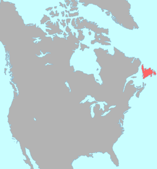
Newfoundland is a large island situated off the eastern coast of the North American mainland and the most populous part of the Canadian province of Newfoundland and Labrador. The island contains 29 percent of the province's land area. The island is separated from the Labrador Peninsula by the Strait of Belle Isle and from Cape Breton Island by the Cabot Strait. It blocks the mouth of the Saint Lawrence River, creating the Gulf of Saint Lawrence, the world's largest estuary. Newfoundland's nearest neighbour is the French overseas collectivity of Saint Pierre and Miquelon.
Winter House Cove was a fishing village on the eastern coast of Seal Bay, within the much larger Notre Dame Bay, Newfoundland, Canada.