Sierra Vista Municipal Airport, a joint-use civil-military airport which shares facilities with Libby Army Airfield, is located on Fort Huachuca in Sierra Vista, a city and U.S. Army installation in Cochise County, Arizona, United States. The airport has three runways and one helipad. It is mostly used for military aviation for the surrounding military base.

Montgomery Regional Airport is a civil-military airport seven miles southwest of Montgomery, the capital of Alabama. Owned by the Montgomery Airport Authority, it is used for general aviation and military aviation, and sees three airlines.

Chandler Municipal Airport is in Maricopa County, Arizona 3 miles southeast of Chandler, which owns it. The National Plan of Integrated Airport Systems for 2011–2015 categorized it as a general aviation reliever airport.

Olympia Regional Airport is a public use airport located four nautical miles (7 km) south of the central business district of Olympia, a city in Thurston County and the capital of the U.S. state of Washington. It is owned by the Port of Olympia. It is about one mile (1.6 km) east of Interstate 5, actually within the boundaries of the city of Tumwater which is south of and adjacent to Olympia. The airport was identified in the Washington State Department of Transportation Long Term Aviation Study as a field that could potentially serve to relieve Seattle-Tacoma International Airport of increasing congestion.

Beaumont Municipal Airport is seven miles west of downtown Beaumont, in Jefferson County, Texas. The National Plan of Integrated Airport Systems for 2017–2021 categorized it as a general aviation facility.

Scholes International Airport at Galveston is a city-owned, public-use airport located three nautical miles (6 km) southwest of the central business district of Galveston, a city in Galveston County, Texas, United States. The airport is included in the National Plan of Integrated Airport Systems for 2011–2015, which categorized it as a reliever airport.

Ryan Airfield, also known as Ryan Field, is a city-owned, public-use airport located 12 miles southwest of the central business district of Tucson, a city in Pima County, Arizona, United States. It is included in the National Plan of Integrated Airport Systems for 2011–2015, which categorized it as a reliever airport. It is mostly used for general aviation but also serves a significant amount of law enforcement and military helicopter activity. Approximately 50% of Ryan's traffic is training-related.

Cairns Army Airfield is a military airport forming a part of Fort Rucker, in Dale County, Alabama, USA and is owned by the United States Army. The airfield is south of the town of Daleville, which sits between it and the main post.
Safford Regional Airport is in Graham County, Arizona 3 miles east of Safford, which owns it. The FAA's National Plan of Integrated Airport Systems for 2009–2013 categorizes it as a general aviation facility. It is the only paved airport in Graham County.

Lakeland Linder International Airport is a public airport five miles southwest of Lakeland, in Polk County, Florida. The Federal Aviation Administration (FAA) National Plan of Integrated Airport Systems for 2017–2021 categorized it as a national reliever facility for Tampa International Airport. The airport has a Class 1 Federal Aviation Regulation (FAR) Part 139 operating certificate allowing passenger airline flights. Annually, around March–April, the airport hosts the Sun 'n Fun International Fly-In and Expo, a six-day fly-in, airshow and aviation convention. It is the second largest such event in the United States after the Experimental Aircraft Association's (EAA) annual "AirVenture" event each summer at Wittman Regional Airport (OSH) in Oshkosh, Wisconsin. During the week of Sun 'n Fun, Lakeland Linder International Airport becomes the world's busiest airport with 60,000+ aircraft movements. In 2017 the airport had 129,504 aircraft operations, averaging 355 per day: 97% general aviation, 2% military, 1% air taxi, and <1% airline. In August 2018, 248 were aircraft based at the airport: 161 single-engine, 35 multi-engine, 42 jet, 9 helicopter, and 1 glider.

Grayling Army Airfield is a public/military use airport located one nautical mile (1.85 km) northwest of the central business district of Grayling, in Crawford County, Michigan, United States. It is owned by United States Army. The airfield is located 7 miles (11 km) northeast of the main cantonment area of Camp Grayling. It is included in the Federal Aviation Administration (FAA) National Plan of Integrated Airport Systems for 2017–2021, in which it is categorized as a general aviation facility.

Treasure Coast International Airport is a public airport located three miles (5 km) northwest of the central business district of Fort Pierce, a city in St. Lucie County, Florida, United States. It is owned by the St. Lucie Board of County Commissioners.

Chicago/Aurora Municipal Airport is a public airport opened in April 1966, located in the village of Sugar Grove, Illinois, United States, 8 miles (13 km) west of the city of Aurora, both in Kane County. The airport is owned and operated by the City of Aurora. It is 50 miles (80 km) west of Chicago and is designated as a reliever airport for Chicago's O'Hare and Midway airports.
Cecil Airport is a public joint civil-military airport and spaceport located in Jacksonville, Florida. The airport is owned by the Jacksonville Aviation Authority and services military aircraft, corporate aircraft, general aviation, and air cargo. The Florida Army National Guard's primary Army Aviation Support Facility and the U.S. Coast Guard's Helicopter Interdiction Tactical Squadron (HITRON) are also located here, the former operating CH-47 Chinook, UH-60 Blackhawk, UH-72 Lakota and C-12 Huron aircraft, while the latter operates the MH-65C Dolphin helicopter.
Grand Prairie Municipal Airport is a city-owned public-use airport located four miles (6 km) southwest of the central business district of Grand Prairie, a city largely in Dallas County, Texas, United States.
Hannibal Regional Airport is a public use airport in Marion County, Missouri, United States. It is located four nautical miles (7 km) northwest of the central business district of Hannibal, Missouri, and is owned by the City of Hannibal. The airport is used for general aviation with no commercial airlines.
Campbell Army Airfield is a military airport at Fort Campbell, which is located near Hopkinsville, a city in Christian County, Kentucky, United States. Previously Campbell Air Force Base, a U.S. Air Force installation from 1947 to 1959, this U.S. Army airfield has two asphalt paved runways: 5/23 is 11,826 by 200 feet and 18/36 is 4,500 by 150 feet. The airfield currently houses UH-60, CH-47, AH-64, and OH-58 helicopters of the 101st Combat Aviation Brigade and MH-60, MH-47, and MH-6 helicopters of the 160th SOAR. It is also home to elements of the 159th Combat Aviation Brigade. Before 2004, all the 101st Airborne Division's Chinooks were in 7th Battalion, 101st Aviation Regiment, and the specialized hangar for those aircraft was built on CAAF. With the division of those aircraft between the two brigades, a Chinook hangar does not yet exist on the 159th's new home on Saber Army Heliport at the opposite end of post.
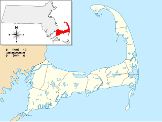
Camp Edwards Heliport is a private use heliport located at Camp Edwards, a U.S. Army facility in Barnstable County, Massachusetts, United States. The airport is located three nautical miles (6 km) north of the central business district of Bourne, Massachusetts. It is owned by the Massachusetts Army National Guard.
Middlebury State Airport is a public use airport in Addison County, Vermont, United States. It is owned by the State of Vermont and is located three nautical miles (5.56 km) southeast of the central business district of the Town of Middlebury.

DeSoto Heliport is a city-owned public heliport in DeSoto, Dallas County, Texas, United States, located approximately 3 nautical miles (5.6 km) north of the central business district. The heliport has no IATA or ICAO designation.