
Old World Wisconsin is an open-air museum located near Eagle, in Waukesha County, Wisconsin, United States. It depicts housing and the daily life of settlers in 19th-century Wisconsin, with separate areas representing the traditions of different ethnic groups who settled in the state. Costumed interpreters portray the occupations and chores of typical settlers of the time.

St. Vrain Creek is a tributary of the South Platte River, approximately 32.2 miles (51.8 km) long, in north central Colorado in the United States. It drains part of the foothills north of Boulder and the Colorado Piedmont area in the vicinity of Longmont.

Bent's Old Fort is an 1833 fort located in Otero County in southeastern Colorado, United States. A company owned by Charles Bent and William Bent and Ceran St. Vrain built the fort to trade with Southern Cheyenne and Arapaho Plains Indians and trappers for buffalo robes. For much of its 16-year history, the fort was the only major white American permanent settlement on the Santa Fe Trail between Missouri and the Mexican settlements. It was destroyed under mysterious circumstances in 1849.

Ceran St. Vrain, born Ceran de Hault de Lassus de St. Vrain, was the American son of a French aristocrat who immigrated to the United States in the late 18th century; his mother was from St. Louis, where he was born. To gain the ability to trade, in 1831 he became a naturalized Mexican citizen in what is now the state of New Mexico. He formed a partnership with American traders William, George and Charles Bent; together they established the trading post of Bent's Fort. It was the only privately held fort in the West.

This is a list of sites in Minnesota which are included in the National Register of Historic Places. There are more than 1,600 properties and historic districts listed on the NRHP; each of Minnesota's 87 counties has at least 2 listings. Twenty-two sites are also National Historic Landmarks.

Silver Creek High School is a comprehensive public high school located in Longmont, Colorado, United States. It is part of the St. Vrain Valley School District. Silver Creek hosts Universal High School, an independent learning program, and the Silver Creek Leadership Academy.

This is a list of the National Register of Historic Places listings in Dakota County, Minnesota. It is intended to be a complete list of the properties and districts on the National Register of Historic Places in Dakota County, Minnesota, United States. Dakota County is located in the southeastern part of the U.S. state of Minnesota, bounded on the northeast side by the Upper Mississippi River and on the northwest by the Minnesota River. The locations of National Register properties and districts for which the latitude and longitude coordinates are included below, may be seen in an online map.

This is a list of the National Register of Historic Places listings in Ozaukee County, Wisconsin. It is intended to provide a comprehensive listing of entries in the National Register of Historic Places that are located in Ozaukee County, Wisconsin. The locations of National Register properties for which the latitude and longitude coordinates are included below may be seen in a map.

This is a list of the National Register of Historic Places listings in Dodge County, Wisconsin. It is intended to provide a comprehensive listing of entries in the National Register of Historic Places that are located in Dodge County, Wisconsin. The locations of National Register properties for which the latitude and longitude coordinates are included below may be seen in a map.

This is a list of the National Register of Historic Places listings in Carver County, Minnesota. It is intended to be a complete list of the properties and districts on the National Register of Historic Places in Carver County, Minnesota, United States. The locations of National Register properties and districts for which the latitude and longitude coordinates are included below, may be seen in an online map.

This is a list of the National Register of Historic Places listings in Stearns County, Minnesota. It is intended to be a complete list of the properties and districts on the National Register of Historic Places in Stearns County, Minnesota, United States. The locations of National Register properties and districts for which the latitude and longitude coordinates are included below, may be seen in an online map.

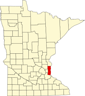
This is a list of the National Register of Historic Places listings in Blue Earth County, Minnesota. It is intended to be a complete list of the properties and districts on the National Register of Historic Places in Blue Earth County, Minnesota, United States. The locations of National Register properties and districts for which the latitude and longitude coordinates are included below, may be seen in an online map.
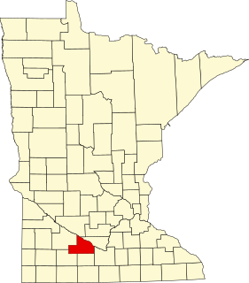
This is a list of the National Register of Historic Places listings in Brown County, Minnesota. It is intended to be a complete list of the properties and districts on the National Register of Historic Places in Brown County, Minnesota, United States. The locations of National Register properties and districts for which the latitude and longitude coordinates are included below, may be seen in an online map.
This is a list of the National Register of Historic Places listings in Washington County, Minnesota. It is intended to be a complete list of the properties and districts on the National Register of Historic Places in Washington County, Minnesota, United States. The locations of National Register properties and districts for which the latitude and longitude coordinates are included below, may be seen in an online map.

This is a list of the National Register of Historic Places listings in Kandiyohi County, Minnesota. It is intended to be a complete list of the properties and districts on the National Register of Historic Places in Kandiyohi County, Minnesota, United States. The locations of National Register properties and districts for which the latitude and longitude coordinates are included below, may be seen in an online map.

This is a list of the National Register of Historic Places listings in Isanti County, Minnesota. It is intended to be a complete list of the properties and districts on the National Register of Historic Places in Isanti County, Minnesota, United States. The locations of National Register properties and districts for which the latitude and longitude coordinates are included below, may be seen in an online map.

The St. Vrain's Mill of Mora, New Mexico is a three-story, stone-constructed gristmill built around 1864 by Ceran St. Vrain. It has also been known as El Molino de Piedra. The building was added to the National Register of Historic Places in 1973.


