Santa Rosa is a city in and the county seat of Sonoma County, in California's Wine Country. Its estimated 2016 population was 175,155. Santa Rosa is the largest city in California's Redwood Empire, Wine Country and the North Bay; the fifth most populous city in the San Francisco Bay Area after San Jose, San Francisco, Oakland, and Fremont; and the 28th most populous city in California.

Santa Rosa is a city in and the county seat of Guadalupe County, New Mexico, United States. The population was 2,848 at the 2010 census. It lies between Albuquerque and Tucumcari, situated on the Pecos River at the intersection of Interstate 40, U.S. Route 54, and U.S. Route 84. The city is located west of, but not within, the Llano Estacado or "staked plains" of eastern New Mexico and west Texas.
Argentina is provided with a vast territory and a huge variety of climates and microclimates ranging from tundra and polar in the south to the tropical climate in the north, through a vast expanse of temperate climate and natural wonders like the Aconcagua, the highest mountain in the world outside the Himalayas, the widest river and estuary of the planet, the huge and very mighty Iguazú Falls, some of the flattest and wide meadows-plains of planet Earth, culture, customs and gastronomies famous internationally, a higher degree of development, good quality of life and people and relatively well prepared infrastructure make this country one of the most visited of America.

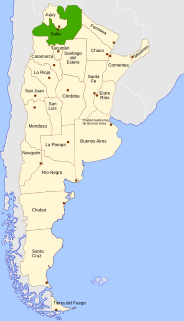
Jujuy is a province of Argentina, located in the extreme northwest of the country, at the borders with Chile and Bolivia. The only neighboring Argentine province is Salta to the east and south.

Santiago del Estero, also known simply as Santiago, is a province in the north of Argentina. Neighbouring provinces, clockwise from the north, are Salta, Chaco, Santa Fe, Córdoba, Catamarca and Tucumán.

Santa Rosa de Copán is the departmental capital of the Honduran department of Copán. It is approximately 1,150 metres (3,773 ft) above mean sea level.

The Laguna de Santa Rosa is a 22-mile-long (35 km) wetland complex that drains a 254-square-mile (660 km2) watershed encompassing most of the Santa Rosa Plain in Sonoma County, California, United States.

Kinal is a major pre-Columbian Maya archaeological site in the Petén Department of the modern-day Petén Department of northern Guatemala. The major occupational phase for the site dates from the Late Classic period of Mesoamerican chronology, with evidence for a substantial and expansionary building program dating from the first half of the 8th century AD. Kinal was discovered in the 1960s by archaeologist Ian Graham while he was carrying out an archaeological survey of the region, although no excavations were undertaken at the site at that time.

Cachi is a small city in Salta Province Argentina. It is the capital of the Cachi Department.
The city & municipality of Tenango del Valle and its seat, Tenango de Arista, are located in the southern portion of the Valley of Toluca in Mexico State, about 72 km southwest of Mexico City and 25 km south of Toluca. While the seat is officially named Tenango de Arista, it is more commonly referred to as Tenango del Valle, as this was the original name of the town. Tenango del Valle is best known as the site of the Teotenango archeological site, which was a walled city inhabited from about 900 C.E. to 1550 C.E.

The Garden of Ninfa is a landscape garden in the territory of Cisterna di Latina, in the province of Latina, central Italy. The park has an area of 105 hectares, and is an Italian natural monument. The landscape garden within the park comprises 8 hectares and contains medieval ruins, several oaks, cypresses and poplars, grassy meadows, a wide range of exotic plants from various parts of the world, numerous watercourses and a large variety of rambling roses growing over the stone walls of the ruins. The site is run by the Italian foundation Fondazione Roffredo Caetani. It is open to the public at set times from April to November. Nearby towns include Norma and Sermoneta. Ninfa has been described as "the most romantic garden in the world".

Santa Rosa Valley is a rural unincorporated community, named after the eponymous valley in which it lies, located in Ventura County, California, United States. For statistical purposes, the United States Census Bureau has defined Santa Rosa Valley as a census-designated place (CDP). The census definition of the area may not precisely correspond to local understanding of the area with the same name. The 2010 United States census reported Santa Rosa Valley's population was 3,334. Santa Rosa Valley sits at an elevation of 433 feet (132 m).

Rosario de Lerma is a department located in Salta Province, Argentina. Its main settlements are Rosario de Lerma and Campo Quijano.

The Salta–Antofagasta railway, also named Huaytiquina, is a non-electrified single track railway line that links Argentina and Chile passing through the Andes. It is a 1,000 mmmetre gauge railway with a total length of 941 km, connecting the city of Salta (Argentina) to the one of Antofagasta (Chile), on the Pacific Ocean, passing through the Puna de Atacama and Atacama Desert.

Santa Rosa de Lima was an early 18th-century Spanish settlement in the Rio Chama valley, near the present-day town of Abiquiu in Rio Arriba County, New Mexico. By the 1730s Spanish settlers were moving into the Chama River valley, and by 1744 at least 20 families were living in the present-day Abiquiú area, where they founded the Plaza de Santa Rosa de Lima. The church was built around 1744, and was in use until the 1930s. Repeated raids by Utes and Comanches caused the settlement to be abandoned in 1747. In 1750, the Spanish founded a new settlement at the present site of Abiquiú, about a mile from Santa Rosa de Lima.
Maria Ygnacia Lopez de Carrillo was the original grantee of Rancho Cabeza de Santa Rosa, the land on which Santa Rosa, California would later be founded. She was also the mother of the woman after whom Benicia, California was named and the grandmother of Romualdo Pacheco, the 12th governor of California.

Colegio de Santa Rosa is a tertiary school in Manila, Philippines. It was established on August 30, 1750 as the Beaterio y Casa de Segunda Enseñanza by Mother Paula de la Santissima Trinidad to educate the indias, or native Filipinas. It acquired its present name on 1774 and is known for several other names including Colegio de Madre Paula and Beaterio y Casa de Enseñanza.