Ahrens, KwaZulu-Natal

Last updated

Ahrens is a railway stop in KwaZulu-Natal, South Africa, 16 km west of Greytown, en route to Kranskop.

KwaZulu-Natal Province of South Africa

KwaZulu-Natal is a province of South Africa that was created in 1994 when the Zulu bantustan of KwaZulu and Natal Province were merged. It is located in the southeast of the country, enjoying a long shoreline beside the Indian Ocean and sharing borders with three other provinces and the countries of Mozambique, Eswatini and Lesotho. Its capital is Pietermaritzburg and its largest city is Durban. It is the 2nd most populous province in South Africa, with slightly fewer residents than Gauteng.

South Africa Republic in the southernmost part of Africa

South Africa, officially the Republic of South Africa (RSA), is the southernmost country in Africa. It is bounded to the south by 2,798 kilometres (1,739 mi) of coastline of Southern Africa stretching along the South Atlantic and Indian Oceans; to the north by the neighbouring countries of Namibia, Botswana, and Zimbabwe; and to the east and northeast by Mozambique and Eswatini (Swaziland); and it surrounds the enclaved country of Lesotho. South Africa is the largest country in Southern Africa and the 25th-largest country in the world by land area and, with over 57 million people, is the world's 24th-most populous nation. It is the southernmost country on the mainland of the Old World or the Eastern Hemisphere. About 80 percent of South Africans are of Sub-Saharan African ancestry, divided among a variety of ethnic groups speaking different African languages, nine of which have official status. The remaining population consists of Africa's largest communities of European (White), Asian (Indian), and multiracial (Coloured) ancestry.

Greytown, KwaZulu-Natal Place in KwaZulu-Natal, South Africa

Greytown is a town situated on the banks of a tributary of the Umvoti River in a richly fertile timber-producing area of KwaZulu-Natal, South Africa.

The railway stop is named after Wilhelm Ahrens, from 1880 to 1906 headmaster of the German school at Hermannsburg, 4 km northeast from here. [1]

German language West Germanic language

German is a West Germanic language that is mainly spoken in Central Europe. It is the most widely spoken and official or co-official language in Germany, Austria, Switzerland, South Tyrol (Italy), the German-speaking Community of Belgium, and Liechtenstein. It is also one of the three official languages of Luxembourg and a co-official language in the Opole Voivodeship in Poland. The languages which are most similar to German are the other members of the West Germanic language branch: Afrikaans, Dutch, English, the Frisian languages, Low German/Low Saxon, Luxembourgish, and Yiddish. There are also strong similarities in vocabulary with Danish, Norwegian and Swedish, although those belong to the North Germanic group. German is the second most widely spoken Germanic language, after English.

Hermannsburg, KwaZulu-Natal Place in KwaZulu-Natal, South Africa

Hermannsburg is a small hamlet located in the Province of KwaZulu-Natal in South Africa. It is home to the Hermannsburg School.

Related Research Articles

Transport in Botswana

Transportation in Botswana is provided by internal and extensive network of railways, highways, ferry services and air routes that criss-cross the country.

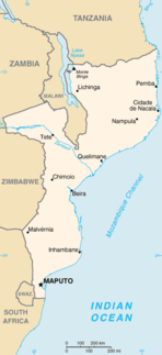
Transport in Mozambique

Modes of transport in Mozambique include rail, road, water, and air. There are rail links serving principal cities and connecting the country with Malawi, Zimbabwe and South Africa. There are over 30,000km of roads, but much of the network is unpaved.

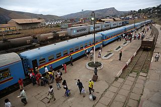
Narrow-gauge railway railway with a gauge (distance between rails) less than that of a standard gauge railway

A narrow-gauge railway is a railway with a track gauge narrower than standard 1,435 mm. Most narrow-gauge railways are between 600 mm and 1,067 mm.

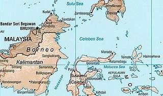
Celebes Sea A marginal sea of the Pacific Ocean between the Sulu Archipelago, Mindanao Island, the Sangihe Islands, Sulawesi and Kalimantan

The Celebes Sea of the western Pacific Ocean is bordered on the north by the Sulu Archipelago and Sulu Sea and Mindanao Island of the Philippines, on the east by the Sangihe Islands chain, on the south by Sulawesi's Minahassa Peninsula, and on the west by Kalimantan in Indonesia. It extends 420 miles (675 km) north-south by 520 mi (840 km) east-west and has a total surface area of 110,000 square miles (280,000 km2), to a maximum depth of 20,300 feet (6,200 m). The sea opens southwest through the Makassar Strait into the Java Sea.

Hakone Tozan Line railway line in Kanagawa prefecture, Japan

The Hakone Tozan Line is a mountain railway in Japan operated by the Hakone Tozan Railway. This company belongs to the Odakyu Group, and also owns the Hakone Tozan Cable Car.

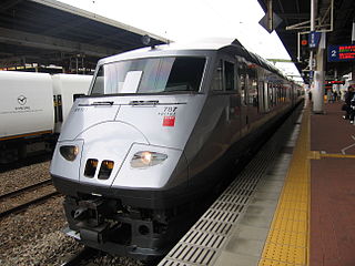
Kagoshima Main Line railway line in Japan

The Kagoshima Main Line is a major railway line operated by the Kyushu Railway Company between Mojikō in Kitakyushu, and Kagoshima Station in Kagoshima City, at the southern end of Kyushu. Until March 13, 2004, it extended 393 km between its two termini; however, with the opening of the Kyushu Shinkansen on March 13, the section between Yatsushiro and Sendai was transferred to the third-sector Hisatsu Orange Railway Company. The line is an important line in Kyushu, connecting Fukuoka to many other major cities. It is the main line through the Fukuoka urban district, and as such many long-distance express trains from all parts of Kyushu use the section between Kokura Station (Kitakyushu) and Tosu Station, where the Nagasaki Main Line meets the Kagoshima Main Line.

3 ft 6 in gauge railways railways with tracks 1067 mm (3′ 6″) apart

Railways with a track gauge of 3 ft 6 in / 1,067 mm were first constructed as horse-drawn wagonways. From the mid-nineteenth century, the 3 ft 6 in gauge became widespread in the British Empire, and was adopted as a standard in Japan and Taiwan.

West Nicholson human settlement

West Nicholson or Tshabezi is a village in the province of Matabeleland South, Zimbabwe. It is located about halfway between Zimbabwe's second largest city, Bulawayo, and the border town to South Africa, Beitbridge, along the main road and rail link to South Africa.

Matadi–Kinshasa Railway

The Matadi–Kinshasa Railway is a railway line in Bas-Congo Province between the port of Matadi and Kinshasa, the capital of Democratic Republic of the Congo.

Botswana Railways national railway operator of Botswana

Botswana Railways (BR) is the national railway of Botswana.

Rail transport in the Democratic Republic of the Congo

Rail transport in the Democratic Republic of the Congo is provided by the Congo Railroad Company and the Office National des Transports (Congo) (ONATRA) and the Office of the Uele Railways.

Mozambique Ports and Railways

Portos e Caminhos de Ferro de Moçambique is the parastatal authority that oversees the railway system of Mozambique and its connected ports.

Kidatu Place in Morogoro Region, Tanzania

Kidatu is a town in central Tanzania, located in Kilombero District, Morogoro Region. The local population is about 3300. The primary economic activity is the large Illovo sugar cane plantation and factory which produces 130,000 tons of sugar per year.

Waterton, New Zealand human settlement in New Zealand

Waterton is a former town in the Canterbury region of New Zealand's South Island. It is still officially recognised as a locality.

HOn3​12 gauge represents the modelling of 3 ft 6 in gauge railways in HO scale, resulting in a model track gauge of 12 mm. Trains are operated using direct current or Digital Command Control over realistic-looking two-rail track.

Little Nymboida River, a mostly perennial stream of the Clarence River catchment, is located in the Northern Rivers and Northern Tablelands districts of New South Wales, Australia.

GE U26C locomotive class

The GE U26C diesel locomotive model was introduced by GE Transportation Systems in 1971. All examples of this model are six axle units, and have the wheel arrangement C-C or Co'Co'.

Rail transport in South Sudan

Rail transport in South Sudan does not have an extensive rail system and current rail infrastructure, which was constructed between 1959–1962, and what has been left over from the previous Sudan government is in a serious state of disrepair. It consists of a 248 kilometers (154 mi) narrow-gauge, single-track line that connect Babonosa with the city of Wau in South Sudan. The line was left in poor condition after the Second Sudanese Civil War after several parts of it were mined; the line was fully rehabilitated with United Nations funds.

Numerous industrial narrow-gauge lines were built for peat extraction, clay extraction for brickworks and construction sites. The dominant gauge for industrial lines was 700 mm, contrary to the 600 mm gauge used in neighbouring countries.

Abbabis

Abbabis is a disused railway station southwest of Karibib in the Erongo Region of western Namibia on the 600 mm dismantled narrow gauge Swakopmund–Windhoek railway line established in 1900. When this line was converted to 1,067 mm from 1910 onwards, it lo longer passed Abbabis.

References

  1. Raper, Peter Edmund. 2004. New Dictionary of South African Place Names. Johannesburg & Cape Town: Jonathan Ball Publishers.

Coordinates: 29°04′S30°45′E / 29.067°S 30.750°E / -29.067; 30.750

Geographic coordinate system Coordinate system

A geographic coordinate system is a coordinate system that enables every location on Earth to be specified by a set of numbers, letters or symbols. The coordinates are often chosen such that one of the numbers represents a vertical position and two or three of the numbers represent a horizontal position; alternatively, a geographic position may be expressed in a combined three-dimensional Cartesian vector. A common choice of coordinates is latitude, longitude and elevation. To specify a location on a plane requires a map projection.