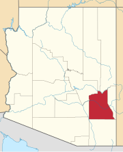
Artesia is a populated place situated in Graham County, Arizona. It has an estimated elevation of 3,271 feet (997 m) above sea level.

Ashurst is a populated place situated in Graham County, Arizona, and appears on the Eden U.S. Geological Survey Map. It has an estimated elevation of 2,739 feet (835 m) above sea level.

Buena Vista is a populated place situated in Graham County, Arizona. It has an estimated elevation of 3,041 feet (927 m) above sea level.

Cork is a populated place situated in Graham County, Arizona. It has an estimated elevation of 2,762 feet (842 m) above sea level.

Chaney Place is a populated place situated in Graham County, Arizona. It has an estimated elevation of 3,455 feet (1,053 m) above sea level.

Emery is a populated place situated in Graham County, Arizona. It has an estimated elevation of 2,680 feet (820 m) above sea level.

Glenbar is a populated place situated in Graham County, Arizona. It has an estimated elevation of 2,802 feet (854 m) above sea level.

Graham is a populated place situated in Graham County, Arizona. It has an estimated elevation of 2,887 feet (880 m) above sea level.

Hollywood is a populated place situated in Graham County, Arizona. It has an estimated elevation of 2,920 feet (890 m) above sea level.

Indian Hot Springs, also known as Holladay Hot Springs, is a populated place situated in Graham County, Arizona. It has an estimated elevation of 2,792 feet (851 m) above sea level.

Kimball is a populated place situated in Graham County, Arizona. It has an estimated elevation of 2,881 feet (878 m) above sea level.

Little Franks is a populated place situated in Graham County, Arizona. It has an estimated elevation of 3,989 feet (1,216 m) above sea level.

Lone Star is a populated place situated in Graham County, Arizona. It has an estimated elevation of 2,953 feet (900 m) above sea level. Eight miles north of Solomonville, the community was named after the nearby mine and mountain.

Natches, also spelled Naches, is a populated place situated in Graham County, Arizona. It has an estimated elevation of 2,559 feet (780 m) above sea level.

Point of Pines is a populated place situated in Graham County, Arizona. It has an estimated elevation of 5,922 feet (1,805 m) above sea level.

Sanchez is a populated place situated in Graham County, Arizona. It has an estimated elevation of 3,061 feet (933 m) above sea level.

Santa Maria is a populated place situated in Maricopa County, Arizona. It has an estimated elevation of 1,020 feet (310 m) above sea level. It is one of two populated places with this name in Maricopa County, the other being a neighborhood in the City of Glendale.

Tanque is a populated place situated in Graham County, Arizona. It has an estimated elevation of 3,251 feet (991 m) above sea level.

Turkey Flat is a populated place situated in Graham County, Arizona. It has an estimated elevation of 7,529 feet (2,295 m) above sea level.

Whitlock Cienega is a populated place situated in Graham County, Arizona. It has an estimated elevation of 3,501 feet (1,067 m) above sea level.


