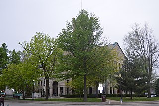
Moniteau County is a county located in the U.S. state of Missouri. As of the 2010 census, the population was 15,607. Its county seat is California. The county was organized February 14, 1845 and named for the Moniteau Creek. 'Moniteau' is a French spelling of Manitou, Algonquian for the Great Spirit.

Union County is a county located in the U.S. state of Illinois. According to the 2010 United States Census, it had a population of 17,808. Its county seat is Jonesboro. It is located in the southern portion of Illinois known locally as "Little Egypt".

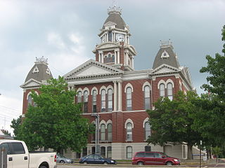
Moultrie County is a county in the U.S. state of Illinois. According to the 2010 United States Census, its population was 14,846. Its county seat is Sullivan. The name is pronounced as in "mole tree", unlike the pronunciation of its namesake, the South Carolinian Revolutionary War hero William Moultrie.

Macon County is a county located in the U.S. state of Illinois. According to the 2010 United States Census, it had a population of 110,768. Its county seat is Decatur.

Fayette County is a county located in the U.S. state of Illinois. As of the 2010 census, the population was 22,140. Its county seat is Vandalia. Ramsey Lake State Recreation Area is located in the northwest part of this county.
Edwards County is a county located in the U.S. state of Illinois. As of the 2010 census, the population was 6,721. Its county seat is Albion. It is located in the southern portion known locally as "Little Egypt".
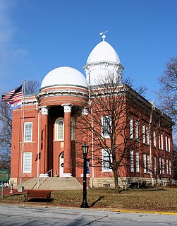
Christian County is a county located in the U.S. state of Illinois. As of the 2010 census, the population was 34,800. Its county seat is Taylorville.
Clarksburg is a census-designated place and an unincorporated area in northern Montgomery County, Maryland, United States. It is located at the northern end of the Interstate 270 technology corridor, about four miles north of Germantown, Maryland. As of 2016, Clarksburg has an estimated population of 20,441.

Clarksburg is a town in Berkshire County, Massachusetts, United States. It is part of the Pittsfield, Massachusetts Metropolitan Statistical Area. The population was 1,702 at the 2010 census.

Shelby Charter Township, officially the Charter Township of Shelby, is a charter township and census-designated place located in Macomb County in the U.S. state of Michigan. The township, an affluent northern suburb of Detroit, is located roughly 15 miles north of the city. As of the 2000 census, the township had a total population of 65,159. The 2010 Census places the population at 73,804. Shelby Charter Township is one of the fastest growing communities in Metro Detroit.

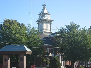
Clarksburg is a city in and the county seat of Harrison County, West Virginia, United States, in the north-central region of the state. The population of the city was 16,578 at the 2010 census. It is the principal city of the Clarksburg, WV Micropolitan Statistical Area, which had a population of 94,221 in 2014. Clarksburg was named National Small City of the Year in 2011 by the National League of Cities.

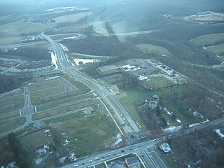
North Central West Virginia Airport is a joint-use public and military airport located one nautical mile (2 km) northeast of the central business district of Bridgeport, a city in Harrison County, West Virginia, United States. While located in Bridgeport, the airport is primarily associated with Clarksburg, West Virginia. It is owned and operated by the Benedum Airport Authority, serving Harrison and Marion County, and was formerly known as Benedum Airport and Harrison-Marion Regional Airport. The airport is served by two commercial airlines with some scheduled passenger service subsidized by the Essential Air Service program.

Shelby County Airport is a public use airport located four nautical miles (7 km) southeast of the central business district of Alabaster, a city in Shelby County, Alabama, United States. It is owned by the Shelby County Commission. The airport is situated in the city of Calera, Alabama.

The 15th Congressional District of Illinois is located in eastern and southeastern Illinois. Republican John Shimkus represents the district.

Lakewood is an unincorporated community in Lakewood Township, Shelby County, Illinois, United States. Lakewood is located on County Highway 12, 8 miles (13 km) southwest of Shelbyville. Lakewood had a post office, which opened on July 26, 1872, and closed on November 2, 2002.

Marshville is an unincorporated community in Harrison County, West Virginia, United States. Marshville is located along Tenmile Creek at the junction of County Routes 5 and 7/2, 7 miles (11 km) west-northwest of Clarksburg.
Maken is an unincorporated community in Harrison County, West Virginia, United States. Maken is located at the junction of U.S. Route 50 and County Route 31 7.5 miles (12.1 km) west of Clarksburg.
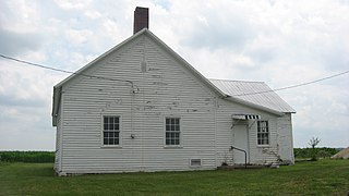
Breckenridge is an unincorporated community in Walker Township, Hancock County, Illinois, United States. Breckenridge is 5.5 miles (8.9 km) west of West Point.