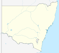
The Snowy Mountains, known informally as "The Snowies", is an IBRA subregion in southern New South Wales, Australia, and is the tallest mountain range in mainland Australia, being part of the continent's Great Dividing Range cordillera system. It makes up the northeastern half of the Australian Alps and contains Australia's five tallest peaks, all of which are above 2,100 m (6,890 ft), including the tallest Mount Kosciuszko, which reaches to a height of 2,228 m (7,310 ft) above sea level. The offshore Tasmanian highlands makes up the only other major alpine region present in the whole of Australia.
The Kosciuszko National Park is a 6,900-square-kilometre (2,700 sq mi) national park and contains mainland Australia's highest peak, Mount Kosciuszko, for which it is named, and Cabramurra, the highest town in Australia. Its borders contain a mix of rugged mountains and wilderness, characterised by an alpine climate, which makes it popular with recreational skiers and bushwalkers.

Mount Kosciuszko, previously spelled Mount Kosciusko, is mainland Australia's tallest mountain, at 2,228 metres (7,310 ft) above sea level. It is located on the Main Range of the Snowy Mountains in Kosciuszko National Park, part of the Australian Alps National Parks and Reserves, in New South Wales, Australia, and is located west of Crackenback and close to Jindabyne, near the border with Victoria.

The Tin Mine Falls is a cascade waterfall located in the remote Pilot Wilderness Area within the Kosciuszko National Park in the Snowy Mountains region of New South Wales, Australia. Described from top to bottom, the falls consist of non-segmented tiered cascades over bedrock with a few smaller plunges, followed by a single large plunge into a pool. The falls are recessed into a punchbowl feature making it impossible to view the entire waterfall from a single location on the ground.

The Australian Alps is a mountain range in southeast Australia. It comprises an interim Australian bioregion, and is the highest mountain range in Australia. The range straddles the borders of eastern Victoria, southeastern New South Wales, and the Australian Capital Territory. It contains Australia's only peaks exceeding 2,000 m (6,600 ft) in elevation, and is the only bioregion on the Australian mainland in which deep snow falls annually. The range comprises an area of 1,232,981 ha.

Charlotte Pass is a snow resort and village in the Snowy Mountains of New South Wales, Australia. The pass is in the Kosciuszko National Park where the Kosciuszko Road crosses Kangaroo Ridge. Charlotte Pass is the closest village to Mount Kosciuszko, the tallest mountain in Australia.

Perisher Valley, commonly called Perisher, is a valley formed below Mount Perisher, a mountain that is located in the Snowy Mountains of New South Wales, Australia.

Mount Jagungal or sometimes Jagungal, Big Bogong, The Big Bogong Nr., or The Big Bogong Mountain, is a mountain within the Jagungal Wilderness Area of the Kosciuszko National Park in the Snowy Mountains region of New South Wales, Australia.
CSIRO Hut, also known as the Rabbiters Hut, is an Australian alpine hut in the Kosciuszko National Park.
Daveys Hut is an Australian alpine hut in the Kosciuszko National Park.
Geehi Hut is an alpine hut located in New South Wales, Australia. Geehi Hut is often named Nankervis Hut after Ken Nankervis and his brother built the hut for grazing and fishing in 1952. Originally at the site there were several buildings including a shed, toilet, laundry and the main house. However, in recent years the shed and laundry have been removed.
The Valentine Falls is a waterfall on the Valentine Creek in the Snowy Mountains region of New South Wales, Australia.

A wilderness hut, bothy, backcountry hut, or backcountry shelter is a free, primitive mountain hut for temporary accommodation, usually located in wilderness areas, national parks and along backpacking and hiking routes. They are found in many parts of the world, such as Finland, Sweden, Norway, northern Russia, the Alps, the Pyrenees, Scotland, Australia, New Zealand, Canada, and the United States. Huts are basic and unmanned, without running water.
The Gungarlin River, a perennial river of the Snowy River catchment, is located in the Snowy Mountains region of New South Wales, Australia.

The Kosciuszko Huts Association was formed in Canberra, Australia in 1971 with the purpose of saving the mountain heritage huts in the Kosciuszko National Park. In addition to the physical maintenance of huts, the KHA preserves the history of the huts.

Mount Gingera is a mountain with an elevation of 1,857 metres (6,093 ft) AHD located within the Brindabella Range on the border between the Australian Capital Territory and New South Wales in Australia. The summit of the mountain is located within the ACT, and is the second highest peak in the territory.

Skiing in Australia takes place in the Australian Alps in the states of New South Wales, Victoria and the Australian Capital Territory as well as in the mountains of the island state Tasmania, during the southern hemisphere winter.

Gungartan is a mountain located in the Snowy Mountains region of New South Wales, Australia.

Skiing in New South Wales takes place in the high country of the Snowy Mountains of New South Wales during the Southern Hemisphere winter.
Mount Wellington is a mountain located to the north-east of Licola in Victoria, Australia. It is on the border of the Alpine National Park and Avon Wilderness Park. The Avon River rises on its south-eastern slopes.


