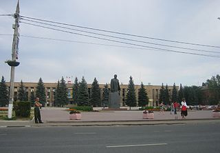
Domodedovsky District

Last updated

Coordinates: 55°26′N37°45′E / 55.433°N 37.750°E / 55.433; 37.750

Geographic coordinate system Coordinate system

A geographic coordinate system is a coordinate system that enables every location on Earth to be specified by a set of numbers, letters or symbols. The coordinates are often chosen such that one of the numbers represents a vertical position and two or three of the numbers represent a horizontal position; alternatively, a geographic position may be expressed in a combined three-dimensional Cartesian vector. A common choice of coordinates is latitude, longitude and elevation. To specify a location on a plane requires a map projection.

Domodedovsky District in Moscow Oblast (2010) Location of Domodedovo Region (Moscow Oblast).svg
Domodedovsky District in Moscow Oblast (2010)

Domodedovsky District (Russian : Домоде́довский райо́н) was an administrative district (raion) of Moscow Oblast, Russia, which was municipally incorporated as Domodedovo Urban Okrug. Its administrative center was the town of Domodedovo. District's population: 135,405(2010 Census); [1] 124,572(2002 Census); [2] 68,538(1989 Census). [3] The population of Domodedovo accounted for 71.0% of the district's total population. [1]

Russian language East Slavic language

Russian is an East Slavic language, which is official in the Russian Federation, Belarus, Kazakhstan and Kyrgyzstan, as well as being widely used throughout Eastern Europe, the Baltic states, the Caucasus and Central Asia. It was the de facto language of the Soviet Union until its dissolution on 25 December 1991. Although, nowadays, nearly three decades after the breakup of the Soviet Union, Russian is used in official capacity or in public life in all the post-Soviet nation-states, as well as in Israel and Mongolia, the rise of state-specific varieties of this language tends to be strongly denied in Russia, in line with the Russian World ideology.

A raion is a type of administrative unit of several post-Soviet states. The term is from the French "rayon", which is both a type of a subnational entity and a division of a city, and is commonly translated in English as "district".

Moscow Oblast First-level administrative division of Russia

Moscow Oblast, or Podmoskovye, is a federal subject of Russia. With a population of 7,095,120 living in an area of 44,300 square kilometers (17,100 sq mi), it is one of the most densely populated regions in the country and is the second most populous federal subject. The oblast has no official administrative center; its public authorities are located in Moscow and across other locations in the oblast.

History

The district was established on April 29, 1969, when its territory was split from Podolsky District. [4] It was abolished on April 1, 2011, with its territory re-organized as the Domodedovo Town Under Oblast Jurisdiction; [5] the municipal status as the urban okrug was unaffected.

Podolsky District District in Moscow Oblast, Russia

Podolsky District is an administrative and municipal district (raion), one of the thirty-six in Moscow Oblast, Russia. It is located in the southwest of the oblast just south of the federal city of Moscow. The area of the district is 281.45 square kilometers (108.67 sq mi). Its administrative center is the city of Podolsk. Population: 82,488 ; 78,076 (2002 Census); 103,925 (1989 Census).

Domodedovo (town) Town in Moscow Oblast, Russia

Domodedovo is a town in Moscow Oblast, Russia, located 37 kilometers (23 mi) south of Moscow. Population: 96,145 (2010 Census); 54,080 (2002 Census); 55,294 (1989 Census). The increase of population is due to the merger of three neighboring inhabited localities into the town in 2004.

City of federal subject significance is an umbrella term used to refer to a type of an administrative division of a federal subject of Russia which is equal in status to a district but is organized around a large city; occasionally with surrounding rural territories.

Related Research Articles

Pavlovo-Posadsky District District in Moscow Oblast, Russia

Pavlovo-Posadsky District is an administrative and municipal district (raion), one of the thirty-six in Moscow Oblast, Russia. It is located in the east of the oblast. The area of the district is 566.34 square kilometers (218.67 sq mi). Its administrative center is the town of Pavlovsky Posad. Population: 83,520 ; 102,311 (2002 Census); 40,173 (1989 Census). The population of Pavlovsky Posad accounts for 76.3% of the district's total population.
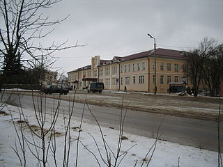
Taldom Town in Moscow Oblast, Russia

Taldom is a town and the administrative center of Taldomsky District in Moscow Oblast, Russia, located 110 kilometers (68 mi) north of Moscow, on a suburban railway connecting Moscow to Savyolovo. Population: 13,819 (2010 Census); 13,334 (2002 Census); 14,410 (1989 Census).

Lytkarino Town in Moscow Oblast, Russia

Lytkarino is a town in Moscow Oblast, Russia, located on the left bank of the Moskva River 6 kilometers (3.7 mi) southeast of Moscow(from MKAD). Population: 55,237 (2010 Census); 50,798 (2002 Census); 50,968 (1989 Census).
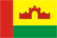
Krasnoarmeysk, Moscow Oblast Town in Moscow Oblast, Russia

Krasnoarmeysk is a town in Moscow Oblast, Russia, on the Vorya River 51 kilometers (32 mi) northeast of Moscow. Population: 26,294 (2010 Census); 26,051 (2002 Census); 27,460 (1989 Census).

Kotelniki Town in Moscow Oblast, Russia

Kotelniki is a town of Moscow Oblast, Russia, located 22 kilometers (14 mi) southeast of the center of Moscow. Population: 32,338 (2010 Census); 17,747 (2002 Census); 17,456 (1989 Census).

Chekhovsky District District in Moscow Oblast, Russia

Chekhovsky District is an administrative and municipal district (raion), one of the thirty-six in Moscow Oblast, Russia. It is located in the south of the oblast. The area of the district is 865.85 square kilometers (334.31 sq mi). Its administrative center is the town of Chekhov. Population: 115,301 (2010 Census); 109,668 ; 39,448 (1989 Census). The population of Chekhov accounts for 52.7% of the district's total population.

Istrinsky District District in Moscow Oblast, Russia

Istrinsky District is an administrative and municipal district (raion), one of the thirty-six in Moscow Oblast, Russia. It is located in the western central part of the oblast. The area of the district is 1,268.97 square kilometers (489.95 sq mi). Its administrative center is the town of Istra. Population: 119,641 (2010 Census); 115,753 ; 90,572 (1989 Census). The population of Istra accounts for 29.3% of the district's total population.

Kashirsky District, Moscow Oblast District in Moscow Oblast, Russia

Kashirsky District is an administrative and municipal district (raion), one of the thirty-six in Moscow Oblast, Russia. It is located in the south of the oblast. The area of the district is 646.09 square kilometers (249.46 sq mi). Its administrative center is the town of Kashira. Population: 70,269 (2010 Census); 70,774 ; 35,300 (1989 Census). The population of Kashira accounts for 59.6% of the district's total population.

Klinsky District District in Moscow Oblast, Russia

Klinsky District is an administrative and municipal district (raion), one of the thirty-six in Moscow Oblast, Russia. It is located in the northwest of the oblast and borders with Tver Oblast in the north, Lotoshinsky District in the northwest, Volokolamsky District in the west, Istrinsky District in the south, Solnechnogorsky District in the southeast, and with Dmitrovsky District in the east. The area of the district is 2,019.62 square kilometers (779.78 sq mi). Its administrative center is the town of Klin. Population: 127,779 (2010 Census); 127,938 ; 48,658 (1989 Census). The population of Klin accounts for 63.1% of the district's total population.

Lukhovitsky District District in Moscow Oblast, Russia

Lukhovitsky District is an administrative and municipal district (raion), one of the thirty-six in Moscow Oblast, Russia. It is located in the southeast of the oblast. The area of the district is 1,340.52 square kilometers (517.58 sq mi). Its administrative center is the town of Lukhovitsy. Population: 58,802 ; 63,235 (2002 Census); 65,534 (1989 Census). The population of Lukhovitsy accounts for 50.8% of the district's total population.

Noginsky District District in Moscow Oblast, Russia

Noginsky District is an administrative and municipal district (raion), one of the thirty-six in Moscow Oblast, Russia. It is located in the east of the oblast. The area of the district is 893.90 square kilometers (345.14 sq mi). Its administrative center is the town of Noginsk. As of the 2010 Census, the total population of the district was 203,609, with the population of Noginsk accounting for 49.1% of that number.

Ozyorsky District, Moscow Oblast District in Moscow Oblast, Russia

Ozyorsky District was an administrative and municipal district (raion) in Moscow Oblast, Russia. It was located in the south of the oblast. The area of the district was 549.06 square kilometers (211.99 sq mi). Its administrative center was the town of Ozyory. Population: 35,752 ; 35,623 (2002 Census); 11,783 (1989 Census). The population of Ozyory accounted for 72.2% of the district's total population.

Ruzsky District District in Moscow Oblast, Russia

Ruzsky District is an administrative and municipal district (raion), one of the thirty-six in Moscow Oblast, Russia. It is located in the west of the oblast. The area of the district is 1,567.56 square kilometers (605.24 sq mi). Its administrative center is the town of Ruza. Population: 61,673 ; 63,685 (2002 Census); 67,533 (1989 Census). The population of Ruza accounts for 21.9% of the district's total population.

Taldomsky District District in Moscow Oblast, Russia

Taldomsky District is an administrative and municipal district (raion), one of the thirty-six in Moscow Oblast, Russia. It is located in the north of the oblast and borders with Tver Oblast in the north, Vladimir Oblast in the northeast, and with Dmitrovsky and Sergiyevo-Posadsky Districts in the south and west. The area of the district is 1,340.52 square kilometers (517.58 sq mi). Its administrative center is the town of Taldom. Population: 48,553 ; 46,302 (2002 Census); 52,619 (1989 Census). The population of Taldom accounts for 28.5% of the district's total population.

Voskresensky District, Moscow Oblast District in Moscow Oblast, Russia

Voskresensky District is an administrative and municipal district (raion), one of the thirty-six in Moscow Oblast, Russia. It is located in the east of the oblast. The area of the district is 812.480 square kilometers (313.700 sq mi). Its administrative center is the town of Voskresensk. Population: 153,600 ; 152,761 (2002 Census); 77,573 (1989 Census). The population of Voskresensk accounts for 59.5% of the district's total population.

Zaraysky District District in Moscow Oblast, Russia

Zaraysky District is an administrative and municipal district (raion), one of the thirty-six in Moscow Oblast, Russia. It is located in the southeast of the oblast. The area of the district is 967.68 square kilometers (373.62 sq mi). Its administrative center is the town of Zaraysk. Population: 41,912 ; 41,974 (2002 Census); 18,104 (1989 Census). The population of Zaraysk accounts for 58.8% of the district's total population.

Ivanteyevka, Moscow Oblast Town in Moscow Oblast, Russia

Ivanteyevka is a town in Moscow Oblast, Russia, located on the Ucha River 20 kilometers (12 mi) northeast of Moscow. Population: 58,626 (2010 Census); 51,454 (2002 Census); 53,140 (1989 Census).

Andreyevka, Solnechnogorsky District, Moscow Oblast Work settlement in Moscow Oblast, Russia

Andreyevka is an urban locality in Solnechnogorsky District of Moscow Oblast, Russia. Population: 10,008 (2010 Census); 8,465 (2002 Census);

Ashukino Work settlement in Moscow Oblast, Russia

Ashukino is an urban locality in Pushkinsky District of Moscow Oblast, Russia. Population: 9,942 (2010 Census); 6,362 (2002 Census); 4,585 (1989 Census).

References

  1. 1 2 Russian Federal State Statistics Service (2011). "Всероссийская перепись населения 2010 года. Том 1" [2010 All-Russian Population Census, vol. 1]. Всероссийская перепись населения 2010 года (2010 All-Russia Population Census) (in Russian). Federal State Statistics Service . Retrieved June 29, 2012.
  2. Russian Federal State Statistics Service (May 21, 2004). "Численность населения России, субъектов Российской Федерации в составе федеральных округов, районов, городских поселений, сельских населённых пунктов – районных центров и сельских населённых пунктов с населением 3 тысячи и более человек" [Population of Russia, Its Federal Districts, Federal Subjects, Districts, Urban Localities, Rural Localities—Administrative Centers, and Rural Localities with Population of Over 3,000](XLS). Всероссийская перепись населения 2002 года [All-Russia Population Census of 2002] (in Russian). Retrieved August 9, 2014.
  3. Demoscope Weekly (1989). "Всесоюзная перепись населения 1989 г. Численность наличного населения союзных и автономных республик, автономных областей и округов, краёв, областей, районов, городских поселений и сёл-райцентров" [All Union Population Census of 1989: Present Population of Union and Autonomous Republics, Autonomous Oblasts and Okrugs, Krais, Oblasts, Districts, Urban Settlements, and Villages Serving as District Administrative Centers]. Всесоюзная перепись населения 1989 года [All-Union Population Census of 1989] (in Russian). Институт демографии Национального исследовательского университета: Высшая школа экономики [Institute of Demography at the National Research University: Higher School of Economics]. Retrieved August 9, 2014.
  4. Московский областной Совет депутатов трудящихся. Решение №365 от 29 апреля 1969 г. «Об образовании Домодедовского и Озёрского районов Московской области». (Moscow Oblast Soviet of the Workers' Deputies. Decision #365 of April 29, 1969 On the Formation of Domodedovsky and Ozyorsky Districts of Moscow Oblast. ).
  5. Московская областная Дума. Закон №88/2010-ОЗ от 9 июля 2010 г. «О внесении изменений в Закон Московской области "Об административно-территориальном устройстве Московской области"», в ред. Закона №177/2010-ОЗ от 24 декабря 2010 г «О внесении изменений в Закон Московской области " внесении изменений в Закон Московской области "Об административно-территориальном устройстве Московской области"». Вступил в силу на следующий день после официального опубликования, за исключением пункта 3 статьи 1, который вступает в силу с 1 января 2011 г. и абзаца сорок пятого этого пункта, который вступает в силу с 1 апреля 2011 г.. (Moscow Oblast Duma. Law #88/2010-OZ of July 9, 2010 On Amending the Law of Moscow Oblast "On the Administrative-Territorial Structure of Moscow Oblast", as amended by the Law #177/2010-OZ of December 24, 2010 On Amending the Law of Moscow Oblast "On Amending the Law of Moscow Oblast "On the Administrative-Territorial Structure of Moscow Oblast". Effective as of the day following the official publication, with the exception of item 3 of Article 1, which takes effect on January 1, 2011, and paragraph forty-five of that item, which takes effect on April 1, 2011.).