
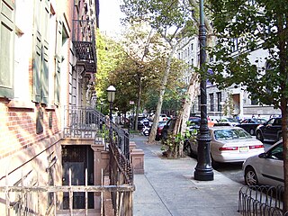
NoHo, short for North of Houston Street, is a primarily residential neighborhood in Lower Manhattan in the New York City borough of Manhattan. It is bounded by Mercer Street to the west and the Bowery to the east, and from East 9th Street in the north to East Houston Street in the south.
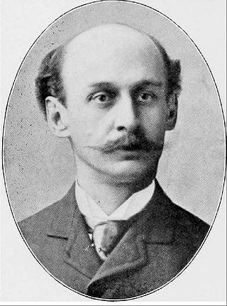
Henry Janeway Hardenbergh FAIA was an American architect, best known for his hotels and apartment buildings, and as a "master of a new building form — the skyscraper."

Lexington Avenue, often colloquially abbreviated as "Lex", is an avenue on the East Side of Manhattan in New York City. The avenue carries southbound one-way traffic from East 131st Street to Gramercy Park at East 21st Street. Along its 5.5-mile (8.9-kilometer), 110-block route, Lexington Avenue runs through Harlem, Carnegie Hill, the Upper East Side, Midtown, and Murray Hill to a point of origin that is centered on Gramercy Park. South of Gramercy Park, the axis continues as Irving Place from 20th Street to East 14th Street.

Gramercy Park is the name of both a small, fenced-in private park and the surrounding neighborhood that is referred to also as Gramercy, in Manhattan in New York City.

The Robb House, located at 23 Park Avenue on the corner of East 35th Street in the Murray Hill neighborhood of Manhattan, New York City is a townhouse built in 1888-92 and designed in the Italian Renaissance revival style by McKim, Mead & White, with Stanford White as the partner-in-charge.

Stuyvesant Square is the name of both a park and its surrounding neighborhood in the New York City borough of Manhattan. The park is located between 15th Street, 17th Street, Rutherford Place, and Nathan D. Perlman Place. Second Avenue divides the park into two halves, east and west, and each half is surrounded by the original cast-iron fence.

George Frederick Pelham was an American architect and the son of George Brown Pelham, who was also an architect.

The Kitchen, Montross & Wilcox Store at 85 Leonard Street between Broadway and Church Street in the TriBeCa neighborhood of Manhattan, New York City was built in 1861 in the Italianate style for a company which dealt in dry goods. The cast iron for the building's facade came from James Bogardus's ironworks, one of the few surviving buildings for which that is the case. The building's columns are referred to as "sperm-candle style" from their resemblance to candles made from spermaceti.
The design [of the building] combines classically-inspired elements with the non-classical emphasis on lightness, openness, and verticality which characterizes cast-iron architecture.

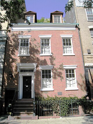
The Samuel J. Tilden House is a historic townhouse pair at 14-15 Gramercy Park South in Manhattan, New York City. Built in 1845, it was the home of Samuel J. Tilden (1814–1886), former governor of New York, a fierce opponent of the Tweed Ring and Tammany Hall, and the losing presidential candidate in the disputed 1876 election. Tilden lived in the brownstone from 1860 until his death in 1886. From 1881 to 1884, Calvert Vaux combined it with the row house next door, also built in 1845, to make the building that now stands, which has been described as "the height of Victorian Gothic in residential architecture" with Italian Renaissance style elements. Since 1906 it has been the headquarters of the National Arts Club, a private arts club.

Robert Henderson Robertson was an American architect who designed numerous houses, institutional and commercial buildings, and churches.

Stone Street is a short street in the Financial District of Manhattan in New York City. It runs in two sections between Whitehall Street in the west and Hanover Square in the east. The street originally ran as one continuous roadway from Whitehall Street to Hanover Square, but the section between Broad Street and Coenties Alley was eliminated in 1980 to make way for the Goldman Sachs building at 85 Broad Street. The one-block-long western section between Whitehall and Broad Streets carries vehicular traffic, while the two-block-long eastern section between Coenties Alley and Hanover Square is a pedestrian zone.
St. Mark's Historic District is a historic district located in the East Village neighborhood of Manhattan, New York City. The district was designated a city landmark by the New York City Landmarks Preservation Commission in 1969, and it was extended in 1984 to include two more buildings on East 10th Street. It was listed on the National Register of Historic Places in 1974 and was expanded in 1985. The boundaries of the NRHP district and its expansion are now coterminous with those of the LPC.

The East 73rd Street Historic District is a block of that street on the Upper East Side of the New York City borough of Manhattan, on the south side of the street between Lexington and Third Avenues. It is a neighborhood of small rowhouses built from the mid-19th to early 20th centuries.

The Madison Square North Historic District is in Manhattan, New York City, and was created on June 26, 2001 by the city's Landmarks Preservation Commission.

The W New York Union Square is a 270-room, 21-story boutique hotel operated by W Hotels at the northeast corner of Park Avenue South and 17th Street, across from Union Square in Manhattan, New York. Originally known as the Germania Life Insurance Company Building, it was designed by Albert D'Oench and Joseph W. Yost and built in 1911 in the Beaux-Arts style.

The Jumel Terrace Historic District is a small New York City and national historic district located in the Washington Heights neighborhood of Manhattan, New York City. It consists of 50 residential rowhouses built between 1890 and 1902, and one apartment building constructed in 1909, as the heirs of Eliza Jumel sold off the land of the former Roger Morris estate. The buildings are primarily wood or brick rowhouses in the Queen Anne, Romanesque and Neo-Renaissance styles. Also located in the district, but separately landmarked, is the Morris-Jumel Mansion, dated to about 1765.

The Charlton–King–Vandam Historic District is a small historic district in Lower Manhattan, New York City. Designated by the New York City Landmarks Preservation Commission (NYCLPC) in 1966, the district contains "the city's largest concentration of row houses in the Federal style, as well as a significant concentration of Greek Revival houses." It is sometimes included as part of the South Village or Hudson Square, though it is historically distinct from both neighborhoods.

The East 10th Street Historic District is a small historic district located in the Alphabet City area of the East Village neighborhood of Manhattan, New York City. It includes all 26 buildings, numbered 293 to 345, on East 10th Street between Avenue A and Avenue B, across from Tompkins Square Park. The district was designated by the New York City Landmarks Preservation Commission on January 17, 2012.

The Treadwell Farm Historic District is a small historic district located on parts of East 61st and East 62nd Street between Second and Third Avenues, in the Upper East Side neighborhood of the borough of Manhattan in New York City.
Charles Street is a street in the West Village neighborhood of Manhattan in New York City. It runs east to west from Greenwich Avenue to West Street. The street was named after Charles Christopher Amos, who owned the parcel the street passed through. Amos is also the namesake of Christopher Street, two blocks to the south, and the former Amos Street, which is now West 10th Street. Charles Lane is a one-block alley located between Charles and Perry Streets and Washington and West Streets. From 1866 to 1936, the section of Charles Street between Bleecker Street and West 4th Street was called Van Ness Place after a farm, owned by the Van Ness family, which had occupied the square bounded by Bleecker, West 4th, Charles and Perry Streets until 1865.

