Related Research Articles

Valdez–Cordova Census Area was a census area located in the state of Alaska, United States. As of the 2010 census, the population was 9,636. It was part of the Unorganized Borough and therefore has no borough seat. On January 2, 2019, it was abolished and replaced by the Chugach Census Area and the Copper River Census Area.
Naukati Bay is a census-designated place (CDP) in the Prince of Wales-Hyder Census Area of the Unorganized Borough of the U.S. state of Alaska. The population was 113 at the 2010 census, down from 135 in 2000.

Chenega is a census-designated place (CDP) on Evans Island in the Chugach Census Area in the U.S. state of Alaska. Located in Prince William Sound, the CDP consists of the Chugach Alutiiq village of Chenega Bay, which was established only after the Good Friday earthquake destroyed the original community on Chenega Island to the north. As of the 2010 census, the population of the CDP was 76, largely Alaska Natives. As of 2021, the population of Chenega is 49. Chenega Bay is in the Chugach School District and has one school, Chenega Bay Community School, serving approximately 16 students from preschool through high school.

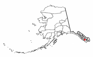
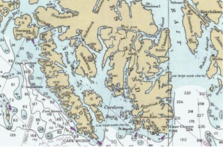
Cordova is a city in Chugach Census Area, Alaska, United States. It lies near the mouth of the Copper River, at the head of Orca Inlet on the east side of Prince William Sound. The population was 2,239 at the 2010 census, down from 2,454 in 2000. Cordova was named Puerto Cordova by Spanish explorer Salvador Fidalgo in 1790. No roads connect Cordova to other Alaskan communities, so a plane or ferry is required to travel there. In the Exxon Valdez oil spill of March 1989, an oil tanker ran aground northwest of Cordova, heavily damaging ecology and fishing. It was cleaned up shortly after, but there are lingering effects, such as a lowered population of some birds.

Valdez is a city in the Chugach Census Area in the U.S. state of Alaska. According to the 2010 US Census, the population of the city is 3,976, down from 4,036 in 2000. The city was named in 1790 after the Spanish Navy Minister Antonio Valdés y Fernández Bazán. A former Gold Rush town, it is located at the head of a fjord on the eastern side of Prince William Sound. The port did not flourish until after the road link to Fairbanks was constructed in 1899. It suffered catastrophic damage during the 1964 Alaska earthquake, and is located near the site of the disastrous 1989 Exxon Valdez oil tanker spill. Today, it is one of the most important ports in Alaska, a commercial fishing port as well as a freight terminal.

Prince William Sound is a sound of the Gulf of Alaska on the south coast of the U.S. state of Alaska. It is located on the east side of the Kenai Peninsula. Its largest port is Valdez, at the southern terminus of the Trans-Alaska Pipeline System. Other settlements on the sound, which contains numerous small islands, include Cordova and Whittier plus the Alaska native villages of Chenega and Tatitlek.
The Alaska Marine Highway (AMH) or the Alaska Marine Highway System (AMHS) is a ferry service operated by the U.S. state of Alaska. It has its headquarters in Ketchikan, Alaska.

MV Aurora is a feeder vessel for the Alaska Marine Highway System, built in Sturgeon Bay, Wisconsin in 1977 by Peterson Shipbuilders and commissioned by the Alaska Marine Highway System the same year.
Chenega Island is an island in Prince William Sound in the U.S. state of Alaska. It is the traditional home to the community of Chenega, though much of its population eventually migrated to Chenega Bay on nearby Evans Island after the 1964 Good Friday earthquake and accompanying tsunami. Chenega Island and its surrounding habitat were also heavily impacted by the 1989 Exxon Valdez oil spill. The island has a land area of 57.084 km2 and, after the mass emigration, was unpopulated as of the 2000 census.

Montague Island (Sugpiaq: Suklluurniilnguq) lies in the Gulf of Alaska at the entrance to Prince William Sound, Alaska. The island has a land area of 790.88 km2, making it the 26th largest island in the United States. As of the 2000 census, Montague did not have a permanent resident population, making it at that time the largest uninhabited island in the United States. Since then, the 2010 abandonment of the United States Coast Guard station on Attu Island in the Aleutian Islands, which at 892.8 km2 is larger than Montague Island, causes Attu to claim that title. Montague Island was named by Captain James Cook in honor of John Montagu, 4th Earl of Sandwich, one of his greatest supporters.

Hinchinbrook Island is an island in the Gulf of Alaska lying at the entrance to Prince William Sound in the state of Alaska, United States. The island has a land area of 171.98 sq mi (445.438 km²), making it the 37th largest island in the United States. There was a population of five permanent residents as of the 2000 census.

Kosciusko Island is an island in the Alexander Archipelago of southeastern Alaska, United States. It lies near the northwest corner of Prince of Wales Island, just across the El Capitan Passage from the larger island.
Warren Island is an island in the Alexander Archipelago of southeastern Alaska, United States. It lies on the Pacific coast just southwest of the community of Edna Bay. Directly west is Coronation Island and directly north is Kuiu Island. Warren Island has a land area of 47.191 km2 and no permanent resident population. The entire island has been designated as the Warren Island Wilderness, a part of Tongass National Forest.
Hawkins Island is an island in the northern part of the Gulf of Alaska in the state of Alaska, United States. It lies just west of the city of Cordova, between that city and the further offshore Hinchinbrook Island. Prince William Sound lies to the north side of the island, while Orca Inlet and the main body of the Gulf of Alaska lie to its south. Hawkins Island has a land area of 176.388 km2 and a population of four persons was reported as of the 2000 census.
Long Island is an island in the Alexander Archipelago of southeastern Alaska, United States. It lies across the Kaigani Strait from the southern portion of Dall Island and west of the southern part of Prince of Wales Island. Directly to its north is Sukkwan Island. Long Island forms part of the western boundary of Cordova Bay, and has a land area of 116.136 km2 and was unpopulated at the 2000 census.
Knight Island is an island in western Prince William Sound of the Gulf of Alaska in the U.S. state of Alaska.
Esther Island is an island in the northwestern part of Prince William Sound on the south-central coast of the state of Alaska in the United States. It has a land area of 127.336 km2 and a resident population of 31 persons as of the 2000 census. The island is the site of the South Esther Island State Marine Park, a part of the Alaska State Parks system. The island is only accessible by floatplane or boat and has no permanent settlements other than the Wally Noerenberg Hatchery, one of the world's largest salmon hatcheries, owned and operated by the Prince William Sound Aquaculture Corporation (PWSAC). The hatchery raises three different species of salmon and is located within the state marine park.
Culross Island is an island near the western end of Prince William Sound of the Gulf of Alaska in Alaska, United States. It lies just off the northeast corner of the Kenai Peninsula, separated from it by the Culross Passage. The island has a land area of 74.709 km2 and had no population at the 2000 census.
Latouche Island is an island in the southern part of Alaska, United States. It lies in the Gulf of Alaska between Montague Island to the east and Evans Island to the northwest. Latouche Island has a land area of 60.627 km2 and had no resident population at the 2000 census.
Chugach Census Area is a census area located in the state of Alaska, United States. It is part of the Unorganized Borough and therefore has no borough seat. On January 2, 2019, it was split from the Valdez–Cordova Census Area, along with neighboring Copper River Census Area.
References
- Evans Island: Blocks 1054 thru 1056, Census Tract 3, Valdez-Cordova Census Area, Alaska United States Census Bureau
Coordinates: 60°03′19″N148°05′19″W / 60.05528°N 148.08861°W
| | This article about a location in the Chugach Census Area, Alaska is a stub. You can help Wikipedia by expanding it. |