
The Potomac River is a major river in the Mid-Atlantic region of the United States that flows from the Potomac Highlands in West Virginia to the Chesapeake Bay in Maryland. It is 405 miles (652 km) long, with a drainage area of 14,700 square miles (38,000 km2), and is the fourth-largest river along the East Coast of the United States and the 21st-largest in the United States. More than 5 million people live within its watershed.
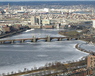
The Charles River, sometimes called the River Charles or simply the Charles, is an 80-mile-long (129 km) river in eastern Massachusetts. It flows northeast from Hopkinton to Boston along a highly meandering route, that doubles back on itself several times and travels through 23 cities and towns before reaching the Atlantic Ocean. The indigenous Massachusett named it Quinobequin, meaning "meandering" or "meandering still water".

The Anacostia River is a river in the Mid Atlantic region of the United States. It flows from Prince George's County in Maryland into Washington, D.C., where it joins with the Washington Channel and ultimately empties into the Potomac River at Buzzard Point. It is about 8.7 miles (14.0 km) long. The name "Anacostia" derives from the area's early history as Nacotchtank, a settlement of Necostan or Anacostan Native Americans on the banks of the Anacostia River.

The Palisades, or simply Palisades, is a neighborhood in Washington, D.C., along the Potomac River, running roughly from the edge of the Georgetown University campus to the D.C.-Maryland boundary.

The Chesapeake and Ohio Canal National Historical Park is located in the District of Columbia and the state of Maryland. The park was established in 1961 as a National Monument by President Dwight D. Eisenhower to preserve the neglected remains of the Chesapeake and Ohio Canal and many of its original structures.
The Potomac Heritage Trail, also known as the Potomac Heritage National Scenic Trail or the PHT, is a designated National Scenic Trail corridor spanning parts of the mid-Atlantic region of the United States that will connect various trails and historic sites in Virginia, Maryland, Pennsylvania, and the District of Columbia. The trail network includes 710 miles (1,140 km) of existing and planned sections, tracing the natural, historical, and cultural features of the Potomac River corridor, the upper Ohio River watershed in Pennsylvania and western Maryland, and a portion of the Rappahannock River watershed in Virginia. The trail is managed by the National Park Service and is one of three National Trails that are official NPS units.

Rock Creek is a tributary of the Potomac River, in the United States, that empties into the Atlantic Ocean via the Chesapeake Bay. The 32.6-mile (52.5 km) creek drains about 76.5 square miles (198 km2). Its final quarter-mile is affected by tides.

The Patowmack Canal, sometimes called the Potomac Canal, is a series of five inoperative canals located in Maryland and Virginia, United States, that was designed to bypass rapids in the Potomac River upstream of the present Washington, D.C., area. The most well known of them is the Great Falls skirting canal, whose remains are managed by the National Park Service since it is within Great Falls Park, an integral part of the George Washington Memorial Parkway.

The American shad is a species of anadromous clupeid fish naturally distributed on the North American coast of the North Atlantic, from Newfoundland to Florida, and as an introduced species on the North Pacific coast. The American shad is not closely related to the other North American shads. Rather, it seems to form a lineage that diverged from a common ancestor of the European taxa before these diversified.

Great Falls Park is a small National Park Service (NPS) site in Virginia, United States. Situated on 800 acres (3.2 km2) along the banks of the Potomac River in northern Fairfax County, the park is a disconnected but integral part of the George Washington Memorial Parkway. The Great Falls of the Potomac River are near the northern boundary of the park, as are the remains of the Patowmack Canal, the first canal in the United States that used locks to raise and lower boats.

Seneca Creek is a 5.8-mile-long (9.3 km) stream in Montgomery County, Maryland, USA, roughly 16 miles (26 km) northwest of Washington, D.C. It drains into the Potomac River.
Pope's Creek is a 5.3-mile-long (8.5 km) tidal tributary of the Potomac River in Westmoreland County, Virginia. The George Washington Birthplace National Monument lies along the north side of Popes Creek. Popes Creek landing is located at 38°11′29″N76°54′16″W.

Difficult Run is a 15.9-mile-long (25.6 km) tributary stream of the Potomac River in Northern Virginia in the United States. The area has had many historical uses dating back to the early 1800s. Today, the area is used recreationally by visitors interested in the watershed's variety of options including hiking, biking, fishing, boating, climbing, and bird watching. The wildlife at Difficult Run is vast as 163 different species can be seen depending on the season. There are 41 different soil types found on the trail and alongside the stream. The stream is part of the greater 57.7- square-mile Drainage basin, or watershed, located in the north-central portion of Fairfax County and drains directly to the Potomac River.
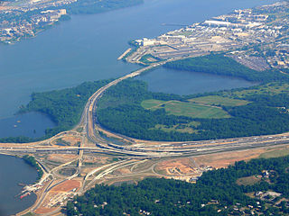
Oxon Creek is a stream on the Potomac River which feeds a cove that straddles the border between Washington, D.C., and Prince George's County, Maryland just north of Interstate 495 at Woodrow Wilson Bridge. Oxon Creek heads at the confluence of Oxon Run and Barnaby Run, sometimes referred to as Winkle Doodle Run. It starts just inside the boundary of D.C. and then runs 1.5 miles (2.4 km) to the south and west into Maryland to empty into the Potomac at Goose Island across from the city of Alexandria, Virginia. Before reaching the Potomac, the creek widens to form Oxon Cove which is partially in Maryland and partially in Washington, D.C. The creek is almost entirely within Oxon Cove National Park, except for the first few feet in D.C. and a portion of the cove on the southside of the Blue Plains Advanced Wastewater Treatment Plant.
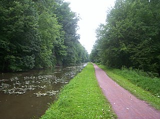
Delaware Canal State Park is a 830-acre (336 ha) Pennsylvania state park in Bucks and Northampton Counties in Pennsylvania. The main attraction of the park is the Delaware Canal which runs parallel to the Delaware River between Easton and Bristol.

William Randolph Hearst Memorial State Beach is located near the historic town of San Simeon along California State Route 1, in San Luis Obispo County, California, United States. It is named for newspaper magnate William Randolph Hearst (1863–1951), whose family is closely associated with the area.
Shad is a type of fish, much valued as a sport fish. The male shad is an excellent game fish, showing multiple jumps and an occasional end-over-end; it has been called a "freshwater tarpon". The gravid female does not fight much, but is often kept for the roe. The current world record is listed by the IGFA as 11 pounds 4 ounces (5.1 kg), set at Holyoke Dam, Massachusetts, on 19 May 1986 by Robert A. Thibodo.
Giller is a 19th-century term for a person who fishes using a gillnet, as used in the Chesapeake Bay region from the early 19th to the mid-20th centuries. Gillers worked individually or in groups of two or three men using a small boat from which they set and gathered a gillnet. Gillnets first appeared on the Potomac River in 1838 to fish for American shad, and rapidly became the most popular type of fishing gear in the bay region because they allowed the independent fisherman to work with limited resources, following the fish with his boat and net as they moved from place to place in search of food or to spawn. Gillnet fishing in Chesapeake Bay shad fisheries frequently led to conflict among states bordering the bay, with Pennsylvania seiners blaming Maryland gillers for over-harvesting and blocking shad passage upstream into the Susquehanna River, and Maryland gillers blaming Virginia pound-netters for intercepting fish on their northward migration up the bay. Conflicts sometimes erupted into violent confrontations, called "Gillers Wars," during one of which in 1876, a giller in Charles County, Maryland was indicted by the county court for assault with intent to kill the captains of a steamer and a tug. Upon trial he was found not guilty, but his case evidences the extent of the trouble between gillnetters and other bay users that led to involvement by state authorities in regulating fishing and settling disputes involving gillers.
Piney Run Park is a nature park in Sykesville, located in Carroll County, Maryland. It is Carroll County's oldest developed park and hosts thousands of visitors annually. The park encompasses 550 acres of fields, forest and open spaces, features over 15 miles of hiking trails, a 300-acre lake and many sports and recreational facilities. Prior to being a park, this land was a private farm.
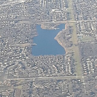
Lake Arlington is a human-made, 50-acre (20 ha) detention lake in the Chicago suburb of Arlington Heights, Illinois. The lake's average depth is between 5 and 7 feet.

