James Birdseye McPherson was a career United States Army officer who served as a general in the Union Army during the American Civil War. McPherson was on the General's staff of Henry Halleck and later, of Ulysses S. Grant and was with Grant at the Battle of Shiloh. He was killed at the Battle of Atlanta, facing the army of his old West Point classmate John Bell Hood, who paid a warm tribute to his character. He was the second highest ranking Union officer killed in action during the war.
Fort Larned National Historic Site preserves Fort Larned which operated from 1859 to 1878. It is approximately 5.5 miles (8.9 km) west of Larned, Kansas, United States.
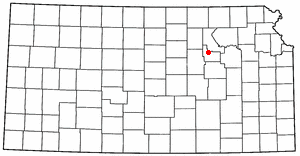
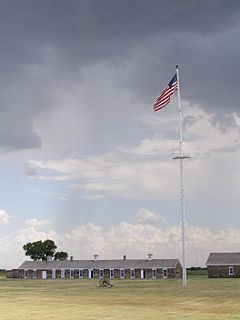
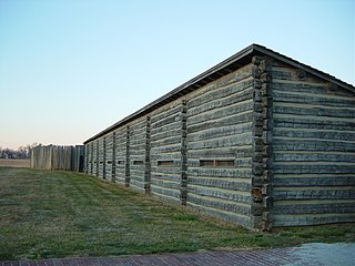
Fort Scott National Historic Site is a historical area under the control of the United States National Park Service in Bourbon County, Kansas, United States. Named after General Winfield Scott, who achieved renown during the Mexican–American War, during the middle of the 19th century the fort served as a military base for US Army action in what was the edge of settlement in 1850. For the next quarter century, it was used as a supply base and to provide security in turbulent areas during the opening of the West to settlement, a period which included Bleeding Kansas and the American Civil War.

Fort Caspar was a military post of the United States Army in present-day Wyoming, named after 2nd Lieutenant Caspar Collins, a U.S. Army officer who was killed in the 1865 Battle of the Platte Bridge Station against the Lakota and Cheyenne. Founded in 1859 along the banks of the North Platte River as a trading post and toll bridge on the Oregon Trail, the post was later taken over by the Army and named Platte Bridge Station to protect emigrants and the telegraph line against raids from Lakota and Cheyenne in the ongoing wars between those nations and the United States. The site of the fort, near the intersection of 13th Street and Wyoming Boulevard in Casper, Wyoming, is listed in the National Register of Historic Places and is now owned and operated by the City of Casper as the Fort Caspar Museum and Historic Site.
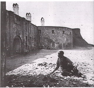
Castle Pinckney was a small masonry fortification constructed by the United States government by 1810, in the harbor of Charleston, South Carolina. It was used very briefly as a prisoner-of-war camp and artillery position during the American Civil War. It was named to the National Register of Historic Places in 1970.
Fort Atkinson was the first United States Army post to be established west of the Missouri River in the unorganized region of the Louisiana Purchase of the United States. Located just east of present-day Fort Calhoun, Nebraska, the fort was erected in 1819 and abandoned in 1827. The site is now known as Fort Atkinson State Historical Park and is a National Historic Landmark. A replica fort was constructed by the state at the site during the 1980s–1990s.

Fort Reno also known as Fort Connor or Old Fort Reno, was a wooden Fort established on August 15, 1865 by the United States Army in Dakota Territory in present-day Johnson County, Wyoming. The fort was built to protect travelers on the Bozeman Trail from Native American tribes.
The Department of the Missouri was a command echelon of the United States Army in the 19th century and a sub division of the Military Division of the Missouri that functioned through the Indian Wars.

Fort Omaha, originally known as Sherman Barracks and then Omaha Barracks, is an Indian War-era United States Army supply installation. Located at 5730 North 30th Street, with the entrance at North 30th and Fort Streets in modern-day North Omaha, Nebraska, the facility is primarily occupied by Metropolitan Community College. A Navy Operational Support Center and Marine Corps Reserve unit, along with an Army Reserve unit occupy the periphery of the 82.5 acres (33.4 ha) fort. The government deeded all but four parcels of the land to the community college in 1974.
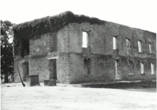
Fort Washita is the former United States military post and National Historic Landmark located in Durant, Oklahoma on SH 199. Established in 1842 by General Zachary Taylor to protect citizens of the Choctaw and Chickasaw Nations from the Plains Indians it was later abandoned by Federal forces at the beginning of the American Civil War. Confederate troops held the post until the end of the war when they burned the remaining structures. It was never reoccupied by the United States military. After years in private hands the Oklahoma Historical Society bought the fort grounds in 1962 and restored the site. Today the Fort Washita Historic Site and Museum is a tourist attraction and hosts several events throughout the year.

The present-day state of Nebraska was still a territory of the United States during the American Civil War. It did not achieve statehood until March 1867, two years after the war ended. Nevertheless, Nebraska contributed significantly to the Union war effort.
Fort Baxter, also known as Fort Blair, was a small US Army post located in the southeast corner of Kansas near present-day Baxter Springs. This area was known as the Cherokee Strip. It was one of a few Kansas forts attacked by Confederate forces during the American Civil War. At one point the Confederate government claimed authority over the Neutral Lands. Both Union and Confederate troops operated in the area, as did guerrilla forces and militias prevalent in the Kansas-Missouri border area.
Kansas has always been home to many forts and military posts.
Fort Belmont, in southern Woodson County, Kansas, was built about 1860 near the town of Belmont. It was to protect the settlers there from attacks by Border Ruffians and Indians. The fort consisted of three or four officer cabins, a redoubt about a quarter of a mile to the north and a parade ground a mile to the east.
Fort Row, located on the south bank of the Verdigris River and east of the present town of Coyville, Kansas, was built in the fall of 1861, probably in October. It was built by the local mounted militia for their use. However, the fort became associated with one of the worst human tragedies of the Civil War.
The Military Division of the Missouri was an administrative formation of the United States Army that functioned through the end of the American Civil War and the Indian Wars that continued after its conclusion. It was created by the War Department on February 3, 1865, at the direction of General Ulysses S. Grant to bring all the military departments west of the Mississippi River under a single commander.
Iola, Kansas, was founded in 1859 and soon after a two-story stone building was built on the southwest corner of Jefferson and Madison streets. Davis Parsons, one of the first town settlers, built this building, which was to serve as a rallying point and defense headquarters in the event the town was threatened by Bushwhackers or Indians. The area's Indians proved reasonably peaceful and no Bushwhackers threatened the area. The stone building was not truly fortified until the Civil War began.
Fort Lane, on the crest of Mount Oread, then southwest of Lawrence, Kansas, was built by the residents of Lawrence in 1856 to serve as a lookout post to observe groups of men desiring to attack Lawrence. Lawrence was a free-state community built by northerners. From 1854 to 1861, when Kansas became a state, at times the area around Lawrence was a battleground for settlers who had come from both the northern and southern states. From this location, one could see for many miles in all directions.
Leander T. "Lee" Herron was a Corporal in the United States Army who received the Medal of Honor for heroism near Fort Dodge, Kansas on September 2, 1868.