| Site of Special Scientific Interest | |
 Cows on Warden Hill | |
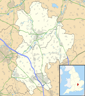
| Area of Search | Bedfordshire |
|---|---|
| Grid reference | TL092265 |
| Interest | Biological |
| Area | 47.0 hectares |
| Notification | 1986 |
| Location map | Magic Map |
Galley and Warden Hills is a 47 hectare biological Site of Special Scientific Interest in Warden Hill, a suburb of Luton in Bedfordshire. The local planning authority is Central Bedfordshire Council, and it was notified in 1986 under Section 28 of the Wildlife and Countryside Act 1981. [1] [2] It is also a Local Nature Reserve. [3] [4]

A Site of Special Scientific Interest (SSSI) in Great Britain or an Area of Special Scientific Interest (ASSI) in the Isle of Man and Northern Ireland is a conservation designation denoting a protected area in the United Kingdom and Isle of Man. SSSI/ASSIs are the basic building block of site-based nature conservation legislation and most other legal nature/geological conservation designations in the United Kingdom are based upon them, including national nature reserves, Ramsar sites, Special Protection Areas, and Special Areas of Conservation. The acronym "SSSI" is often pronounced "triple-S I".
Warden Hill is a suburb of Luton in Bedfordshire, England. It is roughly bounded by the edge of Luton to the north, Enderby Road, the A6 and Weybourne Drive to the south, Birdsfoot Lane, Grasmere Road, Icknield Way, and the A6 to the west, and the hills to the east.

Luton is a large town, borough and unitary authority area of Bedfordshire, England. The town is situated on the River Lea in the south east of the island of Great Britain. It is located about 30 miles (50 km) northwest of London. Earliest settlements in the Luton area can be traced back over 250,000 years, but the town's foundation dates to the sixth century as a Saxon outpost on the River Lea, from which Luton derives its name. Luton is recorded in the Domesday Book as Loitone and Lintone and one of the largest churches in Bedfordshire, St Mary's Church, was built in 1121. There are local museums which explore Luton's history in Wardown Park and Stockwood Park.
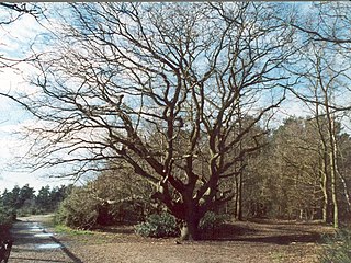
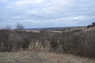
The site is chalk grassland with areas of dense scrub, and it has many plants which are rare nationally and locally. [1] It has a wide variety of wild flowers and more than twenty species of butterflies. Near the top of Galley Hill there are two Bronze Age barrows, one of which was used for public executions in the Middle Ages. [3]

The Bronze Age is a historical period characterized by the use of bronze, and in some areas proto-writing, and other early features of urban civilization. The Bronze Age is the second principal period of the three-age Stone-Bronze-Iron system, as proposed in modern times by Christian Jürgensen Thomsen, for classifying and studying ancient societies.

In the history of Europe, the Middle Ages lasted from the 5th to the 15th century. It began with the fall of the Western Roman Empire and merged into the Renaissance and the Age of Discovery. The Middle Ages is the middle period of the three traditional divisions of Western history: classical antiquity, the medieval period, and the modern period. The medieval period is itself subdivided into the Early, High, and Late Middle Ages.
The Icknield Way Path passes through the hills on its 110-mile course from Ivinghoe Beacon in Buckinghamshire to Knettishall Heath in Suffolk.
The Icknield Way Path or Icknield Way Trail is a long distance footpath in East Anglia, England. The ancient Icknield Way itself is unique among long-distance trails because it can claim to be ‘the oldest road in Britain’. It consists of prehistoric pathways, ancient when the Romans came; the route is dotted with archaeological remains. It survives today in splendid tracks and green lanes along the ‘chalk spine’ of southern England.
Ivinghoe Beacon is a prominent hill and landmark in the Chiltern Hills, standing 233 m (757 ft) above sea level. It is situated close to the village of Ivinghoe in Buckinghamshire, the Ashridge Estate, and the villages of Aldbury and Little Gaddesden in Hertfordshire and is managed and owned by the National Trust. Ivinghoe Beacon is part of the Ivinghoe Hills Site of Special Scientific Interest. It lies between the towns of Dunstable in Bedfordshire, and Berkhamsted and Tring in Hertfordshire. It is the starting point of the Icknield Way to the east, and the Ridgeway long-distance path to the west.
Knettishall Heath is a 91.7 hectare biological Site of Special Scientific Interest west of Knettishall in Suffolk. A larger area of 176 hectares is the Knettishall Heath nature reserve, which is managed by the Suffolk Wildlife Trust.
There is access from Warden Hill Road. [3]