
The National Geospatial-Intelligence Agency (NGA) is a combat support agency within the United States Department of Defense whose primary mission is collecting, analyzing, and distributing geospatial intelligence (GEOINT) in support of national security. Initially known as the National Imagery and Mapping Agency (NIMA) from 1996 to 2003, it is a member of the United States Intelligence Community.

Geomatics is defined in the ISO/TC 211 series of standards as the "discipline concerned with the collection, distribution, storage, analysis, processing, presentation of geographic data or geographic information". Under another definition, it consists of products, services and tools involved in the collection, integration and management of geographic (geospatial) data. It is also known as geomatic(s) engineering. Surveying engineering was the widely used name for geomatic(s) engineering in the past.
Keyhole Markup Language (KML) is an XML notation for expressing geographic annotation and visualization within two-dimensional maps and three-dimensional Earth browsers. KML was developed for use with Google Earth, which was originally named Keyhole Earth Viewer. It was created by Keyhole, Inc, which was acquired by Google in 2004. KML became an international standard of the Open Geospatial Consortium in 2008. Google Earth was the first program able to view and graphically edit KML files, but other projects such as Marble have added KML support.
A Web Map Service (WMS) is a standard protocol developed by the Open Geospatial Consortium in 1999 for serving georeferenced map images over the Internet. These images are typically produced by a map server from data provided by a GIS database.
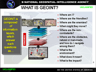
In the United States, geospatial intelligence (GEOINT) is intelligence about the human activity on earth derived from the exploitation and analysis of imagery, signals, or signatures with geospatial information. GEOINT describes, assesses, and visually depicts physical features and geographically referenced activities on the Earth. GEOINT, as defined in US Code, consists of imagery, imagery intelligence (IMINT) and geospatial information.Geospatial data and information include hydrospatial data and information. Hydrospatial is all about the blue of our blue planet and its contiguous zones
The Australian Geospatial-Intelligence Organisation (AGO) is an Australian government intelligence agency that is part of the Department of Defence responsible for the collection, analysis, and distribution of geospatial intelligence (GEOINT) in support of Australia's defence and national interests. The AGO is one of six agencies that form the Australian Intelligence Community.
A spatial database is a general-purpose database that has been enhanced to include spatial data that represents objects defined in a geometric space, along with tools for querying and analyzing such data. Most spatial databases allow the representation of simple geometric objects such as points, lines and polygons. Some spatial databases handle more complex structures such as 3D objects, topological coverages, linear networks, and triangulated irregular networks (TINs). While typical databases have developed to manage various numeric and character types of data, such databases require additional functionality to process spatial data types efficiently, and developers have often added geometry or feature data types. The Open Geospatial Consortium (OGC) developed the Simple Features specification and sets standards for adding spatial functionality to database systems. The SQL/MM Spatial ISO/IEC standard is a part the SQL/MM multimedia standard and extends the Simple Features standard with data types that support circular interpolations. Almost all current relational and object-relational database management systems now have spatial extensions, and some GIS software vendors have developed their own spatial extensions to database management systems.
GeoRSS is a specification for encoding location as part of a Web feed. (Web feeds are used to describe feeds of content, such as news articles, Audio blogs, video blogs and text blog entries. These web feeds are rendered by programs such as aggregators and web browsers.) The name "GeoRSS" is derived from RSS, the most known Web feed and syndication format.
Geospatial metadata is a type of metadata applicable to geographic data and information. geospatial metadata include hydrospatial metadata. Hydrospatial is all about the blue of our blue planet and its contiguous zones. Such objects may be stored in a geographic information system (GIS) or may simply be documents, data-sets, images or other objects, services, or related items that exist in some other native environment but whose features may be appropriate to describe in a (geographic) metadata catalog.

The Chartered Institution of Civil Engineering Surveyors or CICES is a professional association in the field of civil engineering surveying. CICES is recognised as a leading chartered professional body for civil engineering surveyors. CICES members consist mainly of commercial managers and geospatial engineers working and studying within civil engineering surveying. The institution began in 1969 as the Association of Surveyors in Civil Engineering and became a registered educational charity in 1992.
Hydrographics may refer to:
GeoSPARQL is a standard for representation and querying of geospatial linked data for the Semantic Web from the Open Geospatial Consortium (OGC). The definition of a small ontology based on well-understood OGC standards is intended to provide a standardized exchange basis for geospatial RDF data which can support both qualitative and quantitative spatial reasoning and querying with the SPARQL database query language.

Geospatial Information Agency is the national mapping agency of Indonesia. BIG was formerly named National Coordinator for Survey and Mapping Agency. This national agency is responsible for Indonesian geospatial information per one map policy implementation. In 2010, Susilo Bambang Yudhoyono stated that Indonesia should have a single referenced map, so there would not be any differences in spatial data for country development.
The Geospatial Information Regulation Bill, 2016 was introduced in Parliament of India in 2016.
Geographic data and information is defined in the ISO/TC 211 series of standards as data and information having an implicit or explicit association with a location relative to Earth.
This page is based on this
Wikipedia article Text is available under the
CC BY-SA 4.0 license; additional terms may apply.
Images, videos and audio are available under their respective licenses.