
The Lincoln Hills extend along the Mississippi River in Missouri, starting about 40 miles (64 km) northwest of St. Louis and extending to Hannibal. They are located roughly between Highway 61 and Highway 79 in Lincoln, Pike, Ralls and Marion counties. The Lincoln Hills, locally referred to as 'knobs', may have partially escaped the most recent glaciation as nunataks during the Pleistocene. In geology and biology, they more resemble the rugged and forested hills of the Ozarks than the rolling plains of northern Missouri. The limestone bedrock has formed bluffs, glades, caves, springs, and sinkholes. Exposed rocks range in age from Ordovician to Missisippian.

Mount Baker Wilderness is a 119,989-acre (48,558 ha) wilderness area within the Mount Baker-Snoqualmie National Forest in the western Cascade Range of northern Washington state. Its eastern border is shared with the boundary of the Stephen Mather Wilderness and North Cascades National Park for a distance of 40 miles. The wilderness extends from State Route 20 north to the Canada–US border. On the west, it is bounded by the foothills of the Puget Sound lowlands.
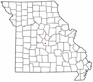
Ulman is an unincorporated community in southern Miller County, Missouri, United States. It is located on Missouri Route C, approximately three miles southwest of Missouri Route 17 and about five miles south of Tuscumbia and the Osage River.

The North River is an 82-mile-long (132 km) river in northeastern Missouri, the United States. It rises in Knox County at 40°03′30″N92°15′26″W and flows southeast and east through Shelby and Marion counties, emptying into the Mississippi River at 39°51′21″N91°26′41″W between West Quincy and Hannibal.
Kelley Branch is a stream in northern Boone County in the U.S. state of Missouri. It is a tributary of Silver Fork.
Dixie is an unincorporated community in southwestern Callaway County, in the U.S. state of Missouri. The community is located at the intersection of Missouri Routes BB and PP. It is on a ridge between Middle River to the east and Hillers Creek to the west. Jefferson City on the Missouri River lies 12 miles to the southwest.
Moniteau Creek is a stream in Cooper, Moniteau and Cole counties in central Missouri. It is a tributary of the Missouri River. The stream headwaters are in western Moniteau County just west of Tipton. The stream flows north into Cooper County then turns east and flows through the southeastern part of the county and re-enters Moniteau County. The stream continues meandering east passing under Missouri Route 87 south of Jamestown and enters the Missouri River floodplain in the Marion Bottoms Conservation Area between Sandy Hook to the north and Marion to the south. The confluence with the Missouri River floodplain lies in the northern tip of Cole County.
Otter Creek is a stream in Cooper and Morgan Counties in the U.S. state of Missouri. It is a tributary of the Lamine River.
Corkery is an extinct town in Dallas and Laclede counties, in the U.S. state of Missouri. The GNIS classifies it as a populated place. The community area is located on a ridge surrounded on three sides by an entrenched meander of the Niangua River which is about 300 feet below the ridgetop. The location is only accessible by road from Laclede County.
Hurricane Creek is a stream in northern Howard County in the U.S. state of Missouri. It is a tributary of the Missouri River which it enters just south of Glasgow.
Salt River Township is an inactive township in Knox County, in the U.S. state of Missouri.
Spring Hollow Creek is a stream in Dallas and Laclede counties in the U.S. state of Missouri. It is a tributary of the Niangua River.
Chariton Township is an inactive township in Macon County, in the U.S. state of Missouri.
Middle Fork Township is an inactive township in Macon County, in the U.S. state of Missouri.
The Maries River is a tributary of the Osage River in Pulaski, Maries, and Osage counties in the U.S. state of Missouri.
Luna is an extinct town in Ozark County, in the U.S. state of Missouri. The GNIS classifies it as a populated place. The community is on a ridge between Bryant Creek to the east and Pine Creek to the west and is located on Missouri Route FF. Zanoni, on Missouri Route 181, lies approximately two miles to the northwest. The community church is one and one-half miles west on Caney Creek and Missouri Route AA. The Pine Creek confluence with Bryant Creek is one and one-quarter miles to the south, at the north end of Norfork Lake.
Oak Mound is an unincorporated community in eastern Ozark County, in the Ozarks of south-central Missouri, United States. The community was located on Bond Ridge and the Oak Mound Cemetery lies adjacent to the south side of Missouri Route KK. The North Fork of the White River lies just over one mile west of the site.
Salt River Township is an inactive township in Randolph County, in the U.S. state of Missouri.
Salt River Township is an inactive township in Shelby County, in the U.S. state of Missouri.
Hester is an unincorporated community in northern Marion County, in the U.S. state of Missouri.
This page is based on this
Wikipedia article Text is available under the
CC BY-SA 4.0 license; additional terms may apply.
Images, videos and audio are available under their respective licenses.