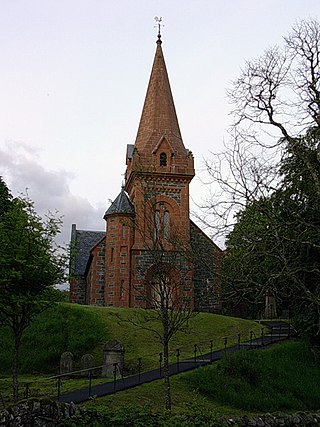
A fortified tower stood on a hill overlooking the village for hundreds of years, although little remains of it now, its site being marked with a cairn built from stones from the original tower; this was probably one of a series of so-called Peel towers, small fortified keeps built along the Scottish Borders, intended as watch towers where signal fires could be lit to warn of approaching danger. A line of these towers was built in the 1430s across the Tweed valley from Berwick to its source (a few miles from Hawkshaw) as a response to the dangers of invasion from the English Borders. Hawkshaw was one of over two dozen of these in Peeblesshire alone.
Roman artefacts have also been found in the vicinity, pre-dating the tower and indicating continuity of habitation in the area for some hundreds of years.
The cairn plays host to a gathering of Porteous family members from all over the world every five years. The September 2005 gathering attracted seventy family members from five continents, and a short religious service was followed by the laying of a wreath at the cairn, in memory of all fallen Porteous servicemen and women.
Peel towers are small fortified keeps or tower houses, built along the English and Scottish borders in the Scottish Marches and North of England, mainly between the mid-14th century and about 1600. They were free-standing with defence being a prime consideration of their design, although "confirmation of status and prestige" also played a role. They also functioned as watch towers, where signal fires could be lit by the garrison to warn of approaching danger.
The Porteous family is a Scottish Borders armigerous family.
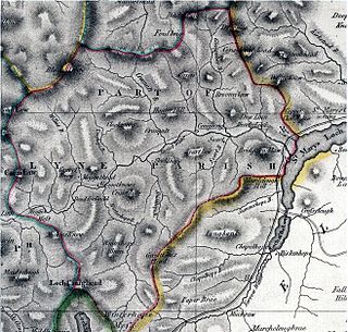
Peeblesshire, the County of Peebles or Tweeddale is a historic county of Scotland. Its county town is Peebles, and it borders Midlothian to the north, Selkirkshire to the east, Dumfriesshire to the south, and Lanarkshire to the west.
Tweedsmuir is a village and civil parish in Tweeddale, the Scottish Borders Council district, southeastern Scotland.
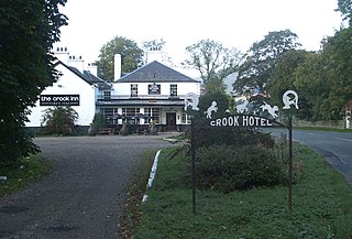
The Crook Inn is an inn in the Scottish Borders, near the village of Tweedsmuir on the A701 road between Broughton and Moffat. It is one of many claimants to be the oldest inn in Scotland. It was licensed in 1604. Robert Burns wrote "Willie Wastle's Wife" there. It has served as a coaching inn, a Post Office and source of employment. In the early 20th century a halt was built on the Talla Railway to serve it. The inn attracted much passing trade from the labourers who were building the Talla Reservoir, which the railway was built to serve.
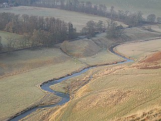
The Lyne Water is a tributary of the River Tweed that rises in the Pentland Hills of southern Scotland at Baddinsgill Reservoir. It runs through West Linton and Romannobridge, passes Flemington and Lyne Station and enters the Tweed west of Peebles. It floods regularly in winter and occasionally in summer. There is free fishing above Flemington Bridge, and below Flemington fishing in the river is administered by the Peebles fishing authority.
Oliver Castle was a medieval tower house, located in upper Tweedsdale in the Scottish Borders. The site of the hillfort known as Oliver Castle is to the north of the village of Tweedsmuir, although the site of the tower house is less certain. Mentioned in a document of c.1200, it was originally part of the line of peel towers along the Tweed Valley. It was replaced in the seventeenth century by a house, which was itself replaced in the late 18th century by the present Oliver House. For most of its existence the property has been owned by members of the Tweedie family.
Polmood is a small settlement in southern Scotland near Tweedsmuir in the Scottish Borders, in the valley of the River Tweed.
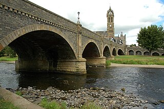
The Tweed Bridge is a stone-built road bridge of five spans over the River Tweed in Peebles, in the Scottish Borders.
Smailholm is a small village in the historic county of Roxburghshire in south-east Scotland. It is at grid reference NT648364 and straddles the B6397 Gordon to Kelso road. The village is almost equidistant from both, standing 6 miles (10 km) northwest of the abbey town of Kelso. Since local government reorganisation in Scotland in the early 1970s, Smailholm has been part of the Scottish Borders Council.
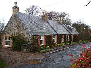
Lyne is a small village and civil parish in the Scottish Borders area of Scotland, 4 miles (6.4 km) west of the market town of Peebles; it lies off the A72, in the old county of Peeblesshire and has an area of about 4 square miles (10 km2).
Camptown is a small settlement on the A68, in the Scottish Borders area of Scotland, 5m (8 km) south of Jedburgh, and the same distance south to Carter Bar. The village lies on the course of the Jed Water, and the remains of a peel tower are close by at Edgerston.
Horsburgh Castle, also known as Horsbrugh Castle or Horsbrugh Tower, is a ruined tower house castle by the River Tweed, on the A72 road from Peebles to Galashiels, near Glentress in the Scottish Borders area of Scotland. The ruins date from the 16th century and was built by the Horsburghs.
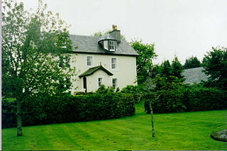
Dawyck House is a historic house at Dawyck, in the parish of Drumelzier in the former Peeblesshire, in the Scottish Borders area of Scotland. The alternative name is 'Dalwick House'. Canmore ID 49816.
Menzion, sometimes Minzion is a small settlement in southern Scotland near Tweedsmuir in the Scottish Borders, in the valley of the River Tweed.
Darnhall Mains is a farm and settlement off the A703, near Eddleston and the Eddleston Water in the Scottish Borders area of Scotland, in the former Peeblesshire.
Broughton, Glenholm and Kilbucho is a parish in Peeblesshire in the Scottish Borders, 11 miles south-west of Peebles, lying in the upper part of the valley of the River Tweed in the Southern Uplands. It is a union of three former parishes of bearing these names and the united parish is bound by Kirkurd on the north, Stobo on the east, Drumelzier on the south-east, Culter and Biggar, South Lanarkshire on the west and by Skirling in the north-west. For 4½ miles the eastern border of the parish follows the northward flowing Tweed. It is 9½ miles long north-to-south and 3½ miles wide. The only village is Broughton.
Megget is a former chapelry or parish containing the valley of Megget Water, now forming the westernmost part of the parish of Yarrow, Selkirkshire in the Scottish Borders area of Scotland. The centre of the valley is 19 miles west of Selkirk.
Skirling is a parish, community council area and village in Peeblesshire in the Scottish Borders situated 2+1⁄2 miles east of Biggar in Lanarkshire. Biggar Water, a tributary the River Tweed forms the southern boundary of the parish with the parish of Broughton, Glenholm and Kilbucho. It is also bounded by that parish on the east, namely the Broughton part of it. On the north it is bounded by the parish Kirkurd in Peeblesshire. Spittal Burn forms most of its western boundary with Lanarkshire.
This page is based on this Wikipedia article Text is available under the CC BY-SA 4.0 license; additional terms may apply. Images, videos and audio are available under their respective licenses.