Kings Mills is a census-designated place in the southwestern corner of Deerfield Township, Warren County, Ohio, United States, on the western shore of the Little Miami River. Located along I-71 twenty miles northeast of Cincinnati, it is less than a mile east of Mason, two miles southwest of South Lebanon, two and one-half miles north of Fosters, and two miles west of Hopkinsville.

Zoar is an unincorporated community in northern Hamilton Township, Warren County, Ohio, United States. It is located on the 3C Highway about one mile east of Hopkinsville and three miles west of Morrow in Virginia Military District Military Survey 1546.

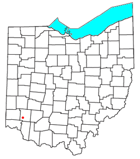
Bethany is an unincorporated community in southeastern Liberty Township, Butler County, Ohio, United States, located in the southwestern part of Ohio. It lies about three miles south of Monroe.
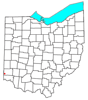
Okeana, originally known as Tariff, is an unincorporated community in central Morgan Township, Butler County, Ohio, United States. It is located on Dry Fork Creek, a tributary of the Great Miami River, on State Route 126 about three miles northwest of Shandon in sections 21 and 26 of R1ET3N of the Congress Lands. It is a mile north of Alert, a mile east of Macedonia, and ten miles southwest of Hamilton. The bulk of addresses served by the Okeana post office are in the Ross Local School District, but parts of the region are in the Southwest Local School District.

Saint Marys Township is one of the fourteen townships of Auglaize County, Ohio, United States. The 2010 census found 11,015 people in the township.

Houston is an unincorporated community in northern Loramie Township, Shelby County, Ohio, United States. It has a post office and a grain elevator.

Bridgetown is a census-designated place (CDP) in Green Township, Hamilton County, Ohio, United States. The population was 14,407 at the 2010 census. In earlier censuses it was listed as the Bridgetown North CDP.

Galloway is an unincorporated community west of the city of Columbus in southern Prairie Township, Franklin County, Ohio, United States. The 43119 ZIP Code, however covers a significant portion of rural and suburban western Franklin County, as well as parts of western Columbus, and locals might use the name Galloway to refer to any location in the area roughly bounded by I-70, Galloway Rd, Alkire Rd, and Big Darby Creek; such a location is seldom in the community of Galloway proper. The Galloway Post Office is located within the city of Columbus about two miles north of the actual community of Galloway, which lies at the intersection of Galloway Road and Sullivant Avenue.
Jefferson Township High School is a public high school located near Dayton, Ohio. It is the only high school in the Jefferson Township Local Schools district. Their nickname is the Broncos.
Lakota High School was a high school in the Lakota School District in Butler County, Ohio; it encompasses both West Chester Township and Liberty Township. The Thunderbird was the Lakota mascot, drawing on the Native American name, T-Birds being a common nickname.

Mathers Mill, alternately called Mathers Mills or Mather's Mills, is an unincorporated community in Warren County, Ohio, United States. It is approximately 5 miles east of Lebanon, and 2 miles south of Oregonia in eastern Turtlecreek Township. The area is served by the Oregonia post office, and Lebanon phone exchange and school district. Wilmington Road crosses the Little Miami River and intersects Corwin Road in this area. The bridge is known as the Mathers Mill bridge and the steep hill up out of the valley is sometimes referred to as Mathers Mill Hill.

Pyrmont is an unincorporated community in northwestern Perry Township, Montgomery County, Ohio, United States. It lies at the intersection of Sulphur Springs and Providence Roads with the Brookville-Pyrmont Pike. Located in the far west of the county, it lies several miles from the city of Dayton; the nearest city is Brookville, 3 miles to the northeast. Pyrmont is a part of the Brookville Local School District. Pyrmont was a busy town before interstate 70 was established near Brookville. Pyrmont was on the Stage Coach Wagon route. Then Interstate 70 was formed.
Brookville Local Schools is a public school district in Brookville, Ohio, United States. Brookville Local School District is known for its outstanding schooling. It serves in Perry Township, Ohio, Clay Township Ohio, and Brookville, Ohio. The mascot of Brookville Local Schools is the Blue Devil.

Randolph Township is one of four townships in Ohio County, Indiana, United States. As of the 2010 census, its population was 4,383 and it contained 2,033 housing units.

Jackson Township is one of twenty townships in Allen County, Indiana, United States. As of the 2010 census, its population was 504.

Monroe Township is one of twenty townships in Allen County, Indiana, United States. At the 2010 census, the population was 1,927.

Mack is a census-designated place (CDP) in Green and Miami townships, Hamilton County, Ohio, United States. The population was 11,585 at the 2010 census. At prior censuses, the community was listed as two separate CDPs, Mack North and Mack South.

Colerain Heights is an unincorporated community in Colerain Township, Hamilton County, Ohio, United States, near Cincinnati. Most of Colerain Heights is contained around the intersection of Colerain Avenue and Springdale Road in Colerain Township. K-12 Students in the small community attend schools in the Northwest Local School District within Colerain and Green Townships. The community contains Northgate Mall, one of Cincinnati's major shopping malls, which contains stores such as Macy's, Sears, Aeropostale, Foot Locker, among other stores.

Delshire is a census-designated place (CDP) in Delhi Township, Hamilton County, Ohio, United States. The population was 3,180 at the 2010 census.
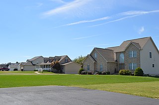
Lake Lakengren is a census-designated place in Preble County, in the U.S. state of Ohio. It is located in Gasper Township, 3 miles southwest of Eaton. The northern portion of Lakengren is served by Eaton Community Schools and the southern portion is served by the Preble Shawnee Local School District. In 2016, this gated community had a population of 3,383, making it the second largest population center in Preble County, after Eaton.
Lakengren is a private community. Lakengren is well known by nearby places as a great fishing spot.