
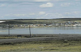
Rankin Inlet is an Inuit hamlet on the Kudlulik Peninsula in Nunavut, Canada. It is the largest hamlet and second-largest settlement in Nunavut, after the territorial capital, Iqaluit. On the northwestern Hudson Bay, between Chesterfield Inlet and Arviat, it is the regional centre for the Kivalliq Region.

The Kivalliq Region is an administrative region of Nunavut, Canada. It consists of the portion of the mainland to the west of Hudson Bay together with Southampton Island and Coats Island. The regional centre is Rankin Inlet. The population was 11,045 in the 2021 Canadian census, an increase of 6.1% from the 2016 Census.

Kitikmeot Region is an administrative region of Nunavut, Canada. It consists of the southern and eastern parts of Victoria Island with the adjacent part of the mainland as far as the Boothia Peninsula, together with King William Island and the southern portion of Prince of Wales Island. The regional centre is Cambridge Bay.
Piita Taqtu Irniq, formerly Peter Irniq, is an Inuk politician in Canada, who served as the second commissioner of Nunavut from April 2000 to April 2005.

The District of Keewatin was a territory of Canada and later an administrative district of the Northwest Territories. It was created in 1876 by the Keewatin Act, and originally it covered a large area west of Hudson Bay. In 1905, it became a part of the Northwest Territories and in 1912, its southern parts were adjoined to the provinces of Manitoba and Ontario, leaving the remainder, now called the Keewatin Region, with a population of a few thousand people. On April 1, 1999, the Keewatin Region was formally dissolved, as Nunavut was created from eastern parts of the Northwest Territories, including all of Keewatin.

The District of Mackenzie was a regional administrative district of Canada's Northwest Territories. The district consisted of the portion of the Northwest Territories directly north of British Columbia, Alberta, and Saskatchewan on Canada's mainland.

Melville Peninsula is a large peninsula in the Canadian Arctic north of Hudson Bay. To the east is Foxe Basin and to the west the Gulf of Boothia. To the north the Fury and Hecla Strait separates it from Baffin Island. To the south Repulse Bay and Frozen Strait separate it from Southampton Island at the north end of Hudson Bay. On the southwest it is connected to the mainland by the Rae Isthmus, named after the Arctic explorer John Rae.

Boothia Peninsula is a large peninsula in Nunavut's northern Canadian Arctic, south of Somerset Island. The northern part, Murchison Promontory, is the northernmost point of mainland Canada.
Baker Lake is a hamlet in the Kivalliq Region, in Nunavut on mainland Canada. Located 320 km (200 mi) inland from Hudson Bay, it is near the nation's geographical centre, and is notable for being Nunavut's sole inland community. The hamlet is located at the mouth of the Thelon River on the shore of Baker Lake. The community was given its English name in 1761 from Captain William Christopher who named it after Sir William Baker, the 11th Governor of the Hudson's Bay Company.

Calm Air International LP. is a full service airline, offering passenger, charter and freight services in northern Manitoba and the Kivalliq Region of Nunavut. It is owned by Exchange Income Corporation with its main base in Winnipeg, Manitoba.

Keewatin Air is an airline that operates from Winnipeg, Manitoba, Canada. The airline was started by Frank Robert May and his wife Judy Saxby in 1971, in the Keewatin Region, then part of the Northwest Territories.

Chesterfield Inlet is a hamlet located on the western shore of Hudson Bay, Kivalliq Region, in Nunavut, Canada, at the mouth of Chesterfield Inlet. Igluligaarjuk is the Inuktitut word for "place with few houses", it is the oldest community in Nunavut. The community is served by air, Chesterfield Inlet Airport, and by an annual supply known as sealift.
Hockey North is the governing body of all ice hockey in the Northwest Territories and Nunavut, Canada.
Nueltin Lake straddles the Manitoba-Nunavut border in Canada. The lake, which has an area of 2,279 km2 (880 sq mi), is predominantly in Nunavut's Kivalliq Region, and on the Manitoba side there is the Nueltin Lake Airport which serves the fishing lodge. The lake is split into two parts by a set of narrows. It is drained by the Thlewiaza River.
The locality Tavani (TA-vuh-nee) was a mining settlement and trading post in the Kivalliq Region of Nunavut, Canada. Sometimes known as Tavane, it is located on western Hudson Bay's Mistake Bay, 31.3 km (19.4 mi) south of the community of Whale Cove and 97 km (60 mi) east of Kaminak Lake.
Qamanirjuaq Lake formerly Kaminuriak Lake, pronunciation: ka-min-YOO-ree-ak; meaning: "huge lake adjoining a river at both ends", is a lake in the Kivalliq Region, Nunavut, Canada. It is the first of several named lakes on the eastward flow of the Ferguson River through the eastern barrenlands. The lake is located about 2 km (1 mi) downstream from Ferguson Lake, and adjacent upstream to Parker Lake South. The Ferguson River passes through a series of rapids before entering the western arm of Qamanirjuaq Lake.
The Pork Peninsula is a cape located in Kivalliq Region, Nunavut, Canada. It is located on Hudson Bay, 30.1 km (18.7 mi) from the Inuit hamlet of Whale Cove, and 43.5 km (27.0 mi) from Rankin Inlet. The peninsula separates Corbett Inlet and Pistol Bay. Igloo Point is the eastern extremity of the peninsula.
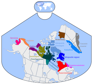
Kivalliq, also known as Kivallirmiutut, Caribou Eskimo, or formerly as Keewatin, is a dialect of Eastern Canadian Inuktitut which is spoken along the northwestern shores of Hudson Bay in Nunavut.
