A cancellation is a postal marking applied on a postage stamp or postal stationery to deface the stamp and prevent its re-use. Cancellations come in a huge variety of designs, shapes, sizes and colors. Modern cancellations commonly include the date and post office location where the stamps were mailed, in addition to lines or bars designed to cover the stamp itself. The term "postal marking" sometimes is used to refer specifically to the part that contains the date and posting location, although the term often is used interchangeably with "cancellation." The portion of a cancellation that is designed to deface the stamp and does not contain writing is also called the "obliteration" or killer. Some stamps are issued pre-cancelled with a printed or stamped cancellation and do not need to have a cancellation added. Cancellations can affect the value of stamps to collectors, positively or negatively. The cancellations of some countries have been extensively studied by philatelists and many stamp collectors and postal history collectors collect cancellations in addition to the stamps themselves.
Barda (Bərdə) is a rayon of Azerbaijan, and its capital city is Barda. There is 1 city and 110 villages in the Rayon, two of which have the same name- Qazaxlar.

Stara Gradiška is a village and a municipality in Slavonia, in the Brod-Posavina County of Croatia. It is located on the left bank of the river Sava, across Gradiška in Bosnia and Herzegovina. The total population is 1,363, distributed in the following settlements:

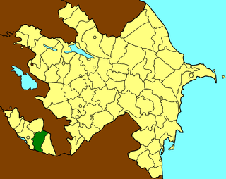
Kangarli is the newest rayon of Azerbaijan, in the Nakhchivan Autonomous Republic. Kangarli district was established in March 19, 2004. The district of Kangarli is located between the districts of Babek and Sharur. The southern part of the district is bordered by Iran, the northern - by Armenia. The landscape of the district is predominantly mountainous; it is located on the Daralayaz Plateau. The area is 704 square km. It was split off from Sharur rayon in March 2004. The administrative center of the rayon is Givrakh. The name Kangarli was originally applied to a Turkic tribe who founded a regional Maku Khanate that ruled the area. On 25 May 2004, President Ilham Aliyev appointed Nazim Cafarov as the executive head of the rayon.

Sumağavaqazma is a village in the Davachi Rayon of Azerbaijan. The village forms part of the municipality of Pirəbədil.
Ghazarahogh is a village in the Kalbajar Rayon of Azerbaijan.
Qazançı, also known as Shahkert, is a village and municipality in the Julfa Rayon of Nakhchivan, Azerbaijan. It is located 43 km in the north from the district center, on the right bank of the Alinjachay River, on the slope of the Zangezur ridge.
Milax is a village and municipality in the Julfa Rayon of Nakhchivan, Azerbaijan. It is located 55 km in the north from the district center, on the right bank of the Alinjachay River, on the slope of the Zangezur ridge. Its population is busy with farming and animal husbandry. There are secondary school, cultural house, kindergarten, library, communication branch, and a medical center in the village. It has a population of 924. The Zoğala settlement and necropolis of the ancient and Middle Ages were discovered in the north-west from the village.
Ərəfsə is a village and municipality in the Julfa Rayon of Nakhchivan, Azerbaijan. It is located 55 km in the north from the district center, on the right bank of the Alinjachay River, on the slope of the Zangezur ridge. Its population is busy with vine-growing, grain-growing and animal husbandry. There are secondary school, cultural house, two libraries, communication branch, and a medical center in the village. It has a population of 940. There exist the Daş Körpü and the Xarabalıq settlement of the Middle Ages in the north-east from the Arafsa village.
Kırna is a village and municipality in the Julfa Rayon of Nakhchivan, Azerbaijan. It is located 30 km in the north from the district center, on the left bank of the Alinjachay River, on the slope of the Zangezur ridge. Its population is busy with vine-growing, farming and animal husbandry. There are secondary school, cultural house, two libraries, kindergarten, communication branch, and a medical center in the village. It has a population of 1,326.
Xanağa is a municipality and village in the Ordubad Rayon of Nakhchivan, Azerbaijan. It is located near the Ordubad-Vanand highway, 14 km in the north-west from the district center, on the left bank of the Araz River. Its population is busy with gardening, farming and animal husbandry. There are secondary school, club, library and a medical center in the village. It has a population of 665. It forms part of the municipality of Vənənd.
Gülüstan is a village and municipality in the Julfa Rayon of Nakhchivan, Azerbaijan. It is located 5 km in the north-west from the district center, on the right bank of the Aras River, on the plain. Its population is busy with farming and animal husbandry. There are secondary school, cultural house, two libraries, communication branch, and a medical center in the village. It has a population of 482.

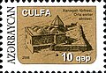
The postage stamps and postal history of Azerbaijan describes the history of postage stamps and postal systems in Azerbaijan, which closely follows the political history of Azerbaijan, from its incorporation to the Russian Empire in 1806, to its briefly obtained independence in 1918, which it lost to the Soviet Union in 1920 and re-acquired it in 1991 after the fall of the Soviet Union.
Sheikh Safi al-Din Khānegāh and Shrine Ensemble is the tomb of Sheikh Safi-ad-din Ardabili located in Ardabil, Iran. In 2010, it was registered on the UNESCO World Heritage List. This monument is situated in the Ali-Ghapu area.

Kiltsi Manor is a knight’s manor in Väike-Maarja Parish, present day Lääne-Viru County, Estonia. It is number 16079 on the Estonian State Register of Cultural Monuments.
Sheykh Babi Yagub Mausoleum – is a mausoleum in Babi village of Fuzuli Rayon of Azerbaijan and was built in 1272.
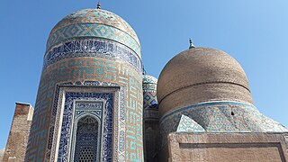
The Tomb of prophet Noah or Noah’s Mausoleum is a mausoleum in the city of Nakhchivan, Azerbaijan. Architecture of the construction is dated from the 8th century.
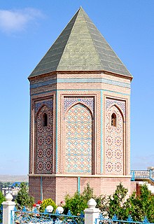
Kirna mausoleum – is a cultic complex in Kırna village of Julfa District, Azerbaijan.

The Mosque of Abu Bakr al-'Aydarus or Aidrus Mosque is a Sufi mosque in Aidrus Street in Crater, Aden, Yemen. One of the principal mosques in Aden, it is named after Abu Bakr al-Aydarus, the wali of Aden.