Related Research Articles

Vinton County is a county located in the U.S. state of Ohio. As of the 2020 census, the population was 12,800, making it the least populous county in the state. Its county seat is McArthur. The county is named for Samuel Finley Vinton, US Representative from Ohio.
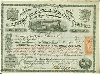
The Marietta and Cincinnati (M&C) was one of five important east-west railroads of southern Ohio; it was later absorbed by the Baltimore and Ohio Railroad (B&O). Its original route ran from Marietta through Vincent, Athens, Hamden, Chillicothe, Greenfield, Blanchester, and Loveland. It had two main branches: Blanchester to Hillsboro, which was originally part of the Hillsboro and Cincinnati Railroad; and Hamden to Portsmouth, Ohio, originally part of the Scioto and Hocking Valley Railroad.

The Great Allegheny Passage (GAP) is a 150-mile (240 km) rail trail between Pittsburgh, Pennsylvania and Cumberland, Maryland. Together with the C&O Canal towpath, the GAP is part of a 335 mi (539 km) route between Pittsburgh and Washington, D.C., that is popular with through hikers and cyclists.

Niles Canyon is a canyon in the San Francisco Bay Area formed by Alameda Creek, known for its heritage railroad and silent movie history. The canyon is largely in an unincorporated area of Alameda County, while the western portion of the canyon lies within the city limits of Fremont and Union City. The stretch of State Route 84 known as Niles Canyon Road traverses the length of the canyon from the Niles district of Fremont to the unincorporated town of Sunol. Two railroads also follow the same route down the canyon from Sunol to Niles: the old Southern Pacific track along the north side, now the Niles Canyon Railway, and the newer Union Pacific track a little to the south. At the west end of the canyon are the ruins of the Vallejo Flour Mill, which dates to 1853.

Anderson Creek is a 23.6-mile-long (38.0 km) tributary of the West Branch Susquehanna River in Clearfield County, Pennsylvania, in the United States.

Moonville is a ghost town in southeastern Brown Township, Vinton County, Ohio, United States. Little remains of this former mining community except a few foundations, a cemetery, and an abandoned railroad tunnel which is the subject of numerous ghost stories.

Transportation in Pittsburgh, Pennsylvania is different than in many other major American cities. A large metropolitan area that is surrounded by rivers and hills, Pittsburgh has an infrastructure system that has been built out over the years to include roads, tunnels, bridges, railroads, inclines, bike paths, and stairways; however, the hills and rivers still form many barriers to transportation within the city.

Buchanan State Forest is a Pennsylvania State Forest in Pennsylvania Bureau of Forestry District #2. The main office is located in McConnellsburg in Fulton County, Pennsylvania, in the United States. The forest also includes tracts in Franklin and Bedford Counties. It is named for James Buchanan of Pennsylvania, the fifteenth President of the United States.

The Hockhocking Adena Bikeway, known colloquially as The Bike Path or more formally as The Athens County Bike Path, is a 21-mile (34 km) long bicycle path in Athens County, Ohio, in the United States. The original section of the path was built on a levee along the Hocking River at Ohio University in Athens, on university land. It was gradually expanded and now crosses university land, city land, and county land. The greater part of the path is a rail trail,. The eastern terminus of the path is near the intersection of East State Street with US-50 on the east side of Athens and its western terminus is in Nelsonville, at the Rocky Brands Factory Outlet at the intersection of Canal Street and Myers Street, one block from the Historic Square Arts District.

The P&W Subdivision is a railroad line owned and operated by CSX Transportation, the Allegheny Valley Railroad (AVR), and the Buffalo and Pittsburgh Railroad (BPRR) in the U.S. state of Pennsylvania. The line runs from Rankin north through Pittsburgh to West Pittsburg along a former Baltimore and Ohio Railroad line, once the Pittsburgh and Western Railroad.

Waterloo Township is one of the fourteen townships of Athens County, Ohio, United States. The 2020 census found 2,352 people in the township.
Ingham is a ghost town in southeastern Brown Township, Vinton County, Ohio and western Waterloo Township, Athens County, Ohio, United States. The town is located east of the more well known ghost town of Moonville in Vinton County and west of Mineral and King’s Station in Athens County
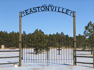
Eastonville was a town in eastern Colorado from c. 1880-1935. It is no longer incorporated. The former town limits now reside in El Paso County, in the Colorado Springs metro area, near Black Forest.

The Moonville Rail-Trail is a sixteen-mile rail-trail in southeast Ohio, located in Vinton and Athens Counties. It is largely embedded in the Zaleski State Forest and passes close to Lake Hope State Park. The trail is named after the Moonville Tunnel through which it passes.

Mineral is an unincorporated community in Athens County, Ohio, United States. Centered on State Route 356, it was established as a coal mining community. It is located on Mud Lick Run, which flows into nearby Hewitt Fork, a tributary of Raccoon Creek. The B&O Railroad once ran through the community, but was abandoned in the 1980s. In recent years, the portion of the old railroad grade going west from the community has become the Moonville Rail-Trail. The King Switch Tunnel on the grade is close to the community. The next larger community is New Marshfield, also unincorporated, to the east in the same township.
The Hocking Valley Scenic Railway is a non-profit, 501c3, volunteer-operated tourist railroad attraction that operates out of Nelsonville, Athens County, Ohio. It is also located near the popular Hocking Hills State Park in nearby Hocking County. It uses former trackage of the Chesapeake & Ohio Railway, which was in turn originally Hocking Valley Railway trackage. The current operation was founded in 1972.
Eaton is a ghost town in Wood County, West Virginia, United States. It sat along the path of the Baltimore and Ohio Railroad. Passenger service along the line stopped completely in the fall of 1981. Eaton's long abandoned train station burned in the mid 1980s. All rail service on the line was discontinued in 1988. The railroad tracks were removed in the 1990s and turned into part of the North Bend Rail Trail.
Bankersmith is a ghost town in Kendall County, Texas, United States. The town was founded in 1913. It lies approximately halfway between Fredericksburg and Comfort, near the border of Gillespie County.

Twin Arrows is a ghost town located in the central part of Arizona on U.S. Route 66 (US 66) in Coconino County between the city of Flagstaff and the town of Winslow.
References
- ↑ U.S. Geological Survey Geographic Names Information System: King's Station, Ohio
- ↑ Ohio Ghost Town Exploration https://ohioghosttowns.org/athens-county/ Archived 2018-01-18 at the Wayback Machine
- ↑ Off the beaten path: King Tunnel-Vinton County CVB https://vintoncountytravel.com/off-the-beaten-path-king-tunnel/