
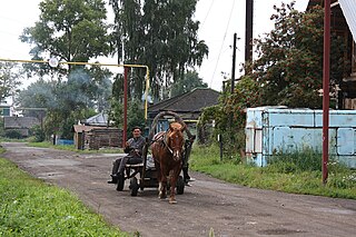
Barabinsky District is an administrative and municipal district (raion), one of the thirty in Novosibirsk Oblast, Russia. It is located in the western central part of the oblast. The area of the district is 5,400 square kilometers (2,100 sq mi). Its administrative center is the town of Barabinsk. Population: 14,169 ; 17,126 (2002 Census); 18,279 (1989 Census).
Bolotninsky District is an administrative and municipal district (raion), one of the thirty in Novosibirsk Oblast, Russia. It is located in the northeast of the oblast. The area of the district is 3,400 square kilometers (1,300 sq mi). Its administrative center is the town of Bolotnoye. Population: 29,365 ; 32,348 (2002 Census); 36,236 (1989 Census). The population of Bolotnoye accounts for 56.4% of the district's total population.

Chanovsky District is an administrative and municipal district (raion), one of the thirty in Novosibirsk Oblast, Russia. It is located in the west of the oblast. The area of the district is 5,515 square kilometers (2,129 sq mi). Its administrative center is the urban locality of Chany. Population: 25,523 ; 29,391 (2002 Census); 34,199 (1989 Census). The population of Chany accounts for 33.2% of the district's total population.
Chistoozyorny District is an administrative and municipal district (raion), one of the thirty in Novosibirsk Oblast, Russia. It is located in the southwest of the oblast. The area of the district is 5,690 square kilometers (2,200 sq mi). Its administrative center is the urban locality of Chistoozyornoye. Population: 19,603 ; 22,444 (2002 Census); 24,126 (1989 Census). The population of Chistoozyornoye accounts for 32.8% of the district's total population.

Dovolensky District is an administrative and municipal district (raion), one of the thirty in Novosibirsk Oblast, Russia. It is located in the south of the oblast. The area of the district is 4,400 square kilometers (1,700 sq mi). Its administrative center is the rural locality of Dovolnoye. Population: 17,405 ; 20,664 (2002 Census); 22,506 (1989 Census). The population of Dovolnoye accounts for 38.9% of the district's total population.

Iskitimsky District is an administrative and municipal district (raion), one of the thirty in Novosibirsk Oblast, Russia. It is located in the east of the oblast. The area of the district is 4,384 square kilometers (1,693 sq mi). Its administrative center is the town of Iskitim. Population: 62,816 ; 66,420 (2002 Census); 67,733 (1989 Census).
Karasuksky District is an administrative and municipal district (raion), one of the thirty in Novosibirsk Oblast, Russia. It is located in the southwest of the oblast. The area of the district is 4,321 square kilometers (1,668 sq mi). Its administrative center is the town of Karasuk. Population: 46,262 ; 48,548 (2002 Census); 50,374 (1989 Census). The population of Karasuk accounts for 61.8% of the district's total population.
Kochenyovsky District is an administrative and municipal district (raion), one of the thirty in Novosibirsk Oblast, Russia. It is located in the eastern central part of the oblast. The area of the district is 5,072 square kilometers (1,958 sq mi). Its administrative center is the urban locality of Kochenyovo. Population: 43,850 ; 46,378 (2002 Census); 46,148 (1989 Census). The population of Kochenyovo accounts for 37.3% of the district's total population.
Kolyvansky District is an administrative and municipal district (raion), one of the thirty in Novosibirsk Oblast, Russia. It is located in the northeast of the oblast. The area of the district is 10,573 square kilometers (4,082 sq mi). Its administrative center is the urban locality of Kolyvan. Population: 24,049 ; 25,737 (2002 Census); 28,292 (1989 Census). The population of Kolyvan accounts for 49.2% of the district's total population.
Kuybyshevsky District is an administrative and municipal district (raion), one of the thirty in Novosibirsk Oblast, Russia. It is located in the center of the oblast. The area of the district is 8,823.3 square kilometers (3,406.7 sq mi). Its administrative center is the town of Kuybyshev. Population: 15,466 ; 19,386 (2002 Census); 21,758 (1989 Census).

Novosibirsky District is an administrative and municipal district (raion), one of the thirty in Novosibirsk Oblast, Russia. It is located in the east of the oblast. The area of the district is 2,900 square kilometers (1,100 sq mi). Its administrative center is the city of Novosibirsk. Population: 127,891 ; 113,047 (2002 Census); 130,300 (1989 Census).

Ordynsky District is an administrative and municipal district (raion), one of the thirty in Novosibirsk Oblast, Russia. It is located in the southeast of the oblast. The area of the district is 4,748 square kilometers (1,833 sq mi). Its administrative center is the urban locality of Ordynskoye. Population: 36,708 ; 39,209 (2002 Census); 38,231 (1989 Census). The population of Ordynskoye accounts for 27.9% of the district's total population.
Severny District is an administrative and municipal district (raion), one of the thirty in Novosibirsk Oblast, Russia. It is located in the northwest of the oblast. The area of the district is 15,548 square kilometers (6,003 sq mi). Its administrative center is the rural locality of Severnoye. Population: 10,687 ; 11,835 (2002 Census); 12,923 (1989 Census). The population of Severnoye accounts for 49.7% of the district's total population.
Suzunsky District is an administrative and municipal district (raion), one of the thirty in Novosibirsk Oblast, Russia. It is located in the southeast of the oblast. The area of the district is 4,746 square kilometers (1,832 sq mi). Its administrative center is the urban locality of Suzun. Population: 32,592 ; 34,917 (2002 Census); 35,677 (1989 Census). The population of Suzun accounts for 47.1% of the district's total population.

Tatarsky District is an administrative and municipal district (raion), one of the thirty in Novosibirsk Oblast, Russia. It is located in the west of the oblast. The area of the district is 4,870 square kilometers (1,880 sq mi). Its administrative center is the town of Tatarsk. Population: 15,875 ; 19,297 (2002 Census); 20,718 (1989 Census).

Ubinsky District is an administrative and municipal district (raion), one of the thirty in Novosibirsk Oblast, Russia. It is located in the center of the oblast. The area of the district is 13,760 square kilometers (5,310 sq mi). Its administrative center is the rural locality of Ubinskoye. Population: 16,297 ; 19,300 (2002 Census); 21,107 (1989 Census). The population of Ubinskoye accounts for 35.8% of the district's total population. The district's name comes from Lake Ubinskoye, which is mostly located inside the district.
Vengerovsky District is an administrative and municipal district (raion), one of the thirty in Novosibirsk Oblast, Russia. It is located in the west of the oblast. The area of the district is 6,382.71 square kilometers (2,464.38 sq mi). Its administrative center is the rural locality of Vengerovo. As of the 2010 Census, the total population of the district was 20,446, with the population of Vengerovo accounting for 34.4% of that number.

Ob is a town in Novosibirsk Oblast, Russia, located 17 kilometers (11 mi) west of Novosibirsk, the administrative center of the oblast. Population: 25,382 (2010 Census); 24,473 (2002 Census); 25,014 (1989 Census).
Linyovo is an urban-type settlement in Iskitimsky District, Novosibirsk Oblast, Russia. Population: 20,707 (2010 Census); 21,816 (2002 Census); 22,310 (1989 Census).

Kochenyovo is an urban-type settlement and the administrative center of Kochenyovsky District, Novosibirsk Oblast, Russia. Population: 16,374 (2010 Census); 16,510 (2002 Census); 15,048 (1989 Census).


