Loma Grande, Texas

Last updated
Amaya, Texas
CDP
Coordinates: 28°43′20″N99°49′58″W / 28.72222°N 99.83278°W / 28.72222; -99.83278
Country United States
State Texas
County Zavala
Area
  Total 0.1 sq mi (0.3 km2)
  Land 0.1 sq mi (0.3 km2)
  Water 0.0 sq mi (0 km2)
Population (2010)
  Total 107
  Density 1,100/sq mi (410/km2)
Time zone Central (CST) (UTC-6)
  Summer (DST) CDT (UTC-5)
Zip Code 78839
FIPS code 4843458

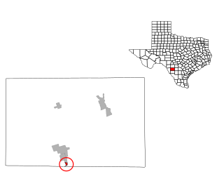
Loma Grande is a census-designated place (CDP) in Zavala County, Texas, United States. This was a new CDP formed from parts of the former Las Colonias CDP prior to the 2010 census with a population of 107. [1]

A census-designated place (CDP) is a concentration of population defined by the United States Census Bureau for statistical purposes only. CDPs have been used in each decennial census since 1980 as the counterparts of incorporated places, such as self-governing cities, towns, and villages, for the purposes of gathering and correlating statistical data. CDPs are populated areas that generally include one officially designated but currently unincorporated small community, for which the CDP is named, plus surrounding inhabited countryside of varying dimensions and, occasionally, other, smaller unincorporated communities as well. CDPs include small rural communities, colonias located along the U.S. border with Mexico, and unincorporated resort and retirement communities and their environs.

Zavala County, Texas County in the United States

Zavala County is a county located in the U.S. state of Texas. As of the 2010 census, the population was 11,677. Its county seat is Crystal City. The county was created in 1858 and later organized in 1884. Zavala is named for Lorenzo de Zavala, Mexican politician, signer of the Texas Declaration of Independence, and first vice president of the Republic of Texas.

Texas State of the United States of America

Texas is the second largest state in the United States by both area and population. Geographically located in the South Central region of the country, Texas shares borders with the U.S. states of Louisiana to the east, Arkansas to the northeast, Oklahoma to the north, New Mexico to the west, and the Mexican states of Chihuahua, Coahuila, Nuevo León, and Tamaulipas to the southwest, while the Gulf of Mexico is to the southeast.

Geography

Loma Grande is located at 28°43′20″N99°49′58″W / 28.72222°N 99.83278°W / 28.72222; -99.83278 (28.722077, -99.832709). The CDP has a total area of 0.1 square miles (0.26 km2), all land. [2]

Related Research Articles

Del Sol-Loma Linda, Texas former CDP in Texas, United States

Del Sol-Loma Linda is a census-designated place (CDP) in San Patricio County, Texas, United States. The population was 726 at the 2000 census.

Las Lomas, Texas CDP in Texas, United States

Las Lomas is a census-designated place (CDP) in Starr County, Texas, United States. The population was 3,147 at the 2010 census. Las Lomas is one of several colonias in Starr County, within the Rio Grande Valley region. The name is derived from the community's terrain.

Ranchitos Las Lomas is a census-designated place (CDP) in Webb County, Texas, United States. The population was 266 at the 2010 census. Las Lomas means "the hills" in Spanish. The town prides itself as "the place where nothing ever happened."

Morales-Sanchez, Texas CDP in Texas, United States

Morales-Sanchez is a census-designated place (CDP) in Zapata County, Texas, United States. The population was 84 at the 2010 census.

Batesville, Texas CDP in Texas, United States

Batesville is a census-designated place (CDP) in Zavala County, Texas, United States. The population was 1,068 at the 2010 census.

Chula Vista, Zavala County, Texas CDP in Texas, United States

Chula Vista is a census-designated place (CDP) in Zavala County, Texas, United States. The population was 450 at the 2010 census. Prior to the 2010 census, the CDP was known as Chula Vista-River Spur.

Las Colonias, Texas former CDP in Texas, United States

Las Colonias was a census-designated place (CDP) in Zavala County, Texas, United States. The population was 283 at the 2000 census. Prior to the 2010 census, parts of this former CDP were used to create the new Amaya and Loma Grande CDPs.

Bonanza Hills, Texas Census-designated place in Texas, United States

Bonanza Hills is a census-designated place in Webb County, Texas, United States. The population was 37 at the 2010 census. This was a new CDP formed from parts of the Botines CDP and additional area prior to the 2010 census.

Colorado Acres, Texas Census-designated place in Texas, United States

Colorado Acres is a census-designated place in Webb County, Texas, United States. The population was 296 at the 2010 census. This was a new CDP formed from parts of the Ranchitos Las Lomas CDP prior to the 2010 census.

Loma Linda is a census-designated place (CDP) in San Patricio County, Texas, United States. The population was 122 at the 2010 census. Prior to the 2010 census Loma Linda was part of the Del Sol-Loma Linda CDP.

La Loma de Falcon is a census-designated place (CDP) in Starr County, Texas, United States. This was a new CDP for the 2010 census with a population of 95.

Hillside Acres is a census-designated place (CDP) in Webb County, Texas, United States. This was a new CDP formed from parts of the Ranchitos Las Lomas CDP prior to the 2010 census with a population of 30.

Las Haciendas is a census-designated place (CDP) in Webb County, Texas, United States. This was a new CDP formed from parts of the Ranchitos Las Lomas CDP prior to the 2010 census with a population of 7.

Las Pilas is a census-designated place (CDP) in Webb County, Texas, United States. This was a new CDP formed from parts of the Ranchitos Las Lomas CDP prior to the 2010 census with a population of 28.

Los Veteranos I is a census-designated place (CDP) in Webb County, Texas, United States. This was a new CDP formed from parts of the Ranchitos Las Lomas CDP prior to the 2010 census with a population of 24.

Pueblo East is a census-designated place (CDP) in Webb County, Texas, United States. This was a new CDP formed from parts of the Ranchitos Las Lomas CDP prior to the 2010 census. Although a new CDP the population was listed as zero.

Valle Verde is a census-designated place (CDP) in Webb County, Texas, United States. This was a new CDP formed from parts of the Ranchitos Las Lomas CDP prior to the 2010 census. Although a new CDP the population was listed as zero.

Los Lobos is a census-designated place (CDP) in Zapata County, Texas, United States. This was a new CDP for the 2010 census with a population of 9.

Ramireno is a census-designated place (CDP) in Zapata County, Texas, United States. This was a new CDP for the 2010 census with a population of 35.

Amaya is a census-designated place (CDP) in Zavala County, Texas, United States. This was a new CDP formed from parts of the former Las Colonias CDP prior to the 2010 census with a population of 93.

References

  1. "Population and Housing Unit Counts, 2010 Census of Population and Housing" (PDF). Texas: 2010. Retrieved 9 January 2017.
  2. "US Gazetteer Files 2016-Places-Texas". US Census. Retrieved 9 January 2017.