Mount Pisgah is the name of several mountains and places:

Mount Pisgah Academy is a four-year secondary education boarding and day school located in Candler, North Carolina, United States, near Asheville. The academy is named after the Mount Pisgah of biblical reference as well as its proximity to Mount Pisgah in the Blue Ridge Mountains.

Mount Pisgah is a mountain in the Appalachian Mountain Range and part of the Blue Ridge Mountains of North Carolina, United States. The mountain's height is 5,721 feet above sea level, and it sits approximately 15 miles southwest of Asheville, near the crossing of the boundaries of Buncombe, Haywood, Henderson and Transylvania counties. It is located on the border of Buncombe and Haywood counties, close to the point where Henderson and Transylvania meet them, but not actually within the latter two counties. The mountain is easily accessible via a hiking trail from the Blue Ridge Parkway, near the Pisgah Inn.

Pisgah National Forest is a National Forest in the Appalachian Mountains of western North Carolina. It is administered by the United States Forest Service, part of the United States Department of Agriculture. The Pisgah National Forest is completely contained within the state of North Carolina. The forest is managed together with the other three North Carolina National Forests from common headquarters in Asheville, North Carolina. There are local ranger district offices located in Pisgah Forest, Mars Hill, and Nebo.

Mount Snow is a mountain resort and ski area in southern Vermont located in the Green Mountains. It is Vermont's closest big mountain to many Northeast metropolitan areas.
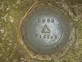
Mount Pisgah is the highest point in Northborough, Massachusetts.

Black Balsam Knob, also known as Black Balsam Bald, is in the Pisgah National Forest southwest of Asheville, North Carolina, near milepost 420 on the Blue Ridge Parkway. It is the second highest mountain in the Great Balsam Mountains. The Great Balsams are within the Blue Ridge Mountains, which are part of the Appalachian Mountains. It is the 23rd highest of the 40 mountains in North Carolina over 6000 feet.
Mt. Pisgah is a peak located in northeastern Pennsylvania's Glaciated Low Plateau region, also known as the Endless Mountains. The mountain peak lies next to a state park named after the mountain, Mt. Pisgah State Park. There is a hiking trail to the summit that has a view of the surrounding countryside, 1,000 feet (305 m) feet below. Stephen Foster lake is also located at the base of the mountain.

Pisgah Mountain or Pisgah Ridge is a long ridgeline 12.5 miles (20.1 km) Tamaqua to Jim Thorpe oriented NNE-to-SSW whose northside valley is followed by U.S. Route 209 from river gap to river gap. The ridge is a succession of peaks exceeding 1,440 feet (438.9 m) looming 300–540 feet above the towns of Lansford, Coaldale, Summit Hill, and Tamaqua in the Panther Creek valley. Near Summit Hill was the 'Sharpe Mountain' (peak), where in 1791 Phillip Ginter is documented as having discovered Anthracite leading to the formation of the Lehigh Coal Mine Company. In 1818 the Lehigh Coal Company took over the mines and the mining camp gradually became a settlement and grew into Summit Hill.
Mount Pisgah is a peak in Carbon County, Pennsylvania situated north-northwest from and looming over the right bank business district in downtown Jim Thorpe.

Grays Mountain is a mountain located in the Catskill Mountains of New York southeast of Bovina Center. Grays Mountain is located south of Mount Pisgah, southwest of Farmers Hill, west-northwest of Fords Hill and north of Dingle Hill.
Fords Hill is a mountain located in the Catskill Mountains of New York southeast of Bovina Center. Fords Hill is located south of Mount Pisgah.
Dingle Hill is a mountain located in the Catskill Mountains of New York southeast of Bovina Center. Dingle Hill is located south of Mount Pisgah, west-northwest of Meekers Hill, and northeast of Perch Lake Mountain.
Mill Mountain is a mountain located in the Catskill Mountains of New York northwest of New Kingston. Mount Pisgah is located south of Mill Mountain and Burnt Hill is located east.
Farmers Hill is a mountain located in the Catskill Mountains of New York east of Andes. Mount Pisgah is located north, and Fords Hill is located south of Farmers Hill.
Mount Pisgah is a mountain located in the Catskill Mountains of New York north of Windham. Steenburg Mountain is located northwest, Richtmyer Peak is located west, and Mount Nebo is located southeast of Mount Pisgah.

Mount Pisgah is a peak in York County, Pennsylvania situated south-southwest of Wrightsville.

Richtmyer Peak is a mountain in Greene County, New York and partly in Schoharie County, New York. It is located in the Catskill Mountains southwest of West Durham. Mount Pisgah is located east, and Richmond Mountain is located southwest of Richtmyer Peak.
Harbor Hill is a mountain in Chenango County, New York. It is located northeast of Greene. Watrous Hill is located south-southwest, Mount Pisgah is located west, and Cohoon Hill is located southeast of Harbor Hill.


