Mount Poroshiri

Last updated
Mount Poroshiri
幌尻岳

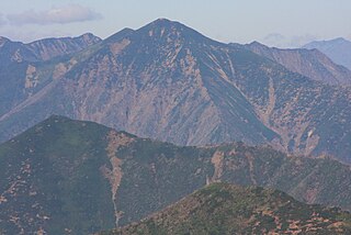
Mt.Poroshiridake from Mt.Tottabetsudake.jpg

A view from Mount Tottabetsu(September 2006)
Highest point
Elevation 2,052.8 m (6,735 ft) [1]
Listing List of mountains and hills of Japan by height
100 Famous Japanese Mountains
Coordinates 42°43′10″N142°40′58″E / 42.71944°N 142.68278°E / 42.71944; 142.68278 Coordinates: 42°43′10″N142°40′58″E / 42.71944°N 142.68278°E / 42.71944; 142.68278 [1]
Naming
Translationbig mountain(Ainu)
Geography
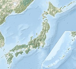
Japan natural location map with side map of the Ryukyu Islands.jpg
Red triangle with thick white border.svg
Mount Poroshiri
Location of Mount Poroshiri in Japan.
Location Hokkaidō, Japan
Parent range Hidaka Mountains
Topo map Geospatial Information Authority (国土地理院,Kokudochiriin) 25000:1 幌尻岳
50000:1 夕張岳
Geology
Mountain type Fold

Mount Poroshiri(幌尻岳,Poroshiri-dake) or sometimes Mount Horoshiri is located in the Hidaka Mountains, Hokkaidō, Japan. Its name was derived from a phonetic kanji transcription of the Ainu words for "great mountain", poro-shiri [2] . It is the highest mountain in the Hidaka range, and is one of the 100 famous mountains in Japan. [3]
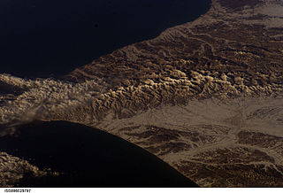
Hidaka Mountains mountain range in Hokkaido, Japan

Hidaka Mountains is a mountain range in southeastern Hokkaido, Japan. It runs 150 km from Mount Sahoro or Karikachi Pass in central Hokkaidō south, running into the sea at Cape Erimo. It consists of folded mountains that range from 1,500 to 2,000 metres in height. Mount Poroshiri is the highest at 2,053 m. The Hidaka Mountains separate the subprefectures of Hidaka and Tokachi. Most of the range lies in the Hidaka-sanmyaku Erimo Quasi-National Park. Since the mountain range lies so far north, the alpine climate zone lies at a lower altitude.

Japan Constitutional monarchy in East Asia

Japan is an island country in East Asia. Located in the Pacific Ocean, it lies off the eastern coast of the Asian continent and stretches from the Sea of Okhotsk in the north to the East China Sea and the Philippine Sea in the south.

<i>Kanji</i> adopted logographic Chinese characters used in the modern Japanese writing system

Kanji are the adopted logographic Chinese characters that are used in the Japanese writing system. They are used alongside the Japanese syllabic scripts hiragana and katakana. The Japanese term kanji for the Chinese characters literally means "Han characters". It is written with the same characters in the Chinese language to refer to the character writing system, hanzi (漢字).
Contents

Climbing route

Nukabira course

The Nukabira course(額平コ-ス) course is a two-day course. [4]

On the first day, drive 35 km from Furenai(振内) to the Rindō Gate(林道ゲート). From the gate it is a 5 km (2 hours) hike to the Shusui Dam(取水ダーム) on the Nukabira River(額平川). From the dam it is another 4 km (3 hours) to the Poroshiri Mountain Cottage(幌尻山荘,poroshiri-dake san-sou). The cottage is maintained by the Biratori Alpine Club and sits 950 m above sea level. [4]

For the second day, the route climbs 1.5 km (2 hours) from the mountain cottage to the Spring of Life(命の泉,inochi no izumi). The route continues another 2.5 km (2 hours) along the field of alpine flowers past the North Cirque (北カール,kita kāru) to the summit. The route then turns north and runs 3 km (2 hours) along the Seven Pond Cirque(七つ沼カール,nanatsu-numa-kāru) to the summit of Mount Tottabetsu (1959m). From there it is a 1 km (30 minute) walk to Mount Naka Tottabetsu. The route then descends 3 km (2 hours) to the Mount Poroshiri Mountain Cottage. [4]

Cirque An amphitheatre-like valley formed by glacial erosion

A cirque is an amphitheatre-like valley formed by glacial erosion. Alternative names for this landform are corrie and cwm. A cirque may also be a similarly shaped landform arising from fluvial erosion.

Mount Tottabetsu mountain in Hokkaido, Japan

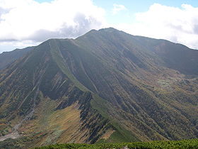
Mount Tottabetsu is located in the Hidaka Mountains, Hokkaidō, Japan.

Niikappu River course

The Niikappu River course starts at Okuniikappu Hatsudensho gate(奥新冠発電所ゲート). From there the trail proceeds to Okuniikappu Dam(奥新冠ダーム), which forms Lake Poroshiri. From the dam the trail goes to a survey cabin along the Poroshiri River and then onto the mountain ridge before ascending to the summit. [5]

Related Research Articles

Mount Rakko mountain in Hokkaido, Japan

Mount Rakko is located in the Hidaka Mountains, Hokkaidō, Japan.

Mount Sahoro mountain in Hokkaido, Japan

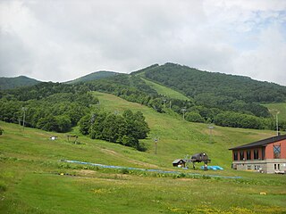
Mount Sahoro is located in the Hidaka Mountains, Hokkaidō, Japan. It is the site of the Sahoro Ski Resort.

Mount Pekerebetsu is located in the Hidaka Mountains, Hokkaidō, Japan. The Nisshō Pass route leads to the peak.

Mount Tokachi (Hidaka) mountain in Hidaka Mountains, Hokkaido, Japan

Mount Tokachi is located in the Hidaka Mountains, Hokkaidō, Japan.

Mount Penkenūshi is located in the Hidaka Mountains, Hokkaidō, Japan. It is the source of the Penkenūshi River.

Mount Memuro is located in the Hidaka Mountains, Hokkaidō, Japan. The western summit of Mount Memuro is named Mount Pankenūshi.

Mount Tsurugi is located in the Hidaka Mountains, Hokkaido, Japan. The Mount Tsurugi Shrine route leads up to the peak.

Mount Fushimi is located in the Hidaka Mountains, Hokkaidō, Japan.

Mount Nukabira is located in the Hidaka Mountains, Hokkaidō, Japan. This peak shares its name with the nearby Nukabira River.

Mount Tokachiporoshiri mountain in Hokkaido, Japan

Mount Tokachiporoshiri is located in the Hidaka Mountains, Hokkaidō, Japan.

Mount Oshiki is located in the Hidaka Mountains, Hokkaidō, Japan.

Mount Petegari mountain in Hokkaido, Japan

Mount Petegari is located in the Hidaka Mountains, Hokkaidō, Japan.

Mount Ponyaoromappu is located in the Hidaka Mountains, Hokkaidō, Japan.

Mount Pisenai mountain in Hokkaido, Japan

Mount Pisenai is located in the Hidaka Mountains, Hokkaidō, Japan.

Mount Rubetsune is located in the Hidaka Mountains, Hokkaidō, Japan.

Mount Shibichari is located in the Hidaka Mountains, Hokkaidō, Japan.

Mount Yoko is located in the Hidaka Mountains, Hokkaidō, Japan. The mountain has three peaks:

Pinneshiri (Hidaka) mountain in Japan

Pinneshiri is a mountain located in the Hidaka Mountains, Hokkaidō, Japan. The mountain is made from ultramafic rock of unknown age.

Mount Tomamu is located in the Hidaka Mountains, Hokkaidō, Japan. It is the site of the Alpha Resort Tomamu, a ski resort.

References

  1. 1 2 Geospatial Information Authority topo map 25000:1 幌尻岳
  2. Mt. Poroshiri | Best Hike Japan
  3. 幌尻岳登山をされる方へ (PDF) (in Japanese). Biratori Town. Retrieved 1 October 2010.
  4. 1 2 3 幌尻岳登山コース概念図とコースタイム (PDF) (in Japanese). Biratori Town. Retrieved 7 October 2010.
  5. Umezawa, Shun; Yasuhiko Sugawara; Jun Nakagawa (1991). 北海道夏山ガイド4日高山脈の山やま (in Japanese). Hokkaidō Shimbunshya. pp. 96–109. ISBN   4-89363-605-7.
Sapporo Designated city in Hokkaido, Japan

Sapporo is the fifth largest city of Japan by population, and the largest city on the northern Japanese island of Hokkaido. It is the capital city of Hokkaido Prefecture and Ishikari Subprefecture. It is an ordinance-designated city.

International Standard Book Number Unique numeric book identifier

The International Standard Book Number (ISBN) is a numeric commercial book identifier which is intended to be unique. Publishers purchase ISBNs from an affiliate of the International ISBN Agency.