Mzimvubu to Keiskamma Water Management Area

Last updated

Mzimvubu to Keiskamma WMA, or Mzimvubu to Keiskamma Water Management Area (coded: 12), includes the following major rivers: the Swane River, Mntafufu River, Mzimvubu River, Mngazi River, Mthatha River, Xora River, Mbashe River, Nqabara River, Gqunube River, Buffalo River, Nahoon River, Groot Kei River and Keiskamma River, [1] and covers the following Dams:

Mzimvubu River river in South Africa

Mzimvubu River or Umzimvubu River is one of the most important rivers in South Africa. It is located in the Eastern Cape Province.

Mthatha River river in South Africa

Mthatha River or Umtata River is a river in the Eastern Cape Province in South Africa. The river flows into the Indian Ocean in an estuary located near Coffee Bay. The Mthatha river flows in a southeastern direction and is approximately 250 km long with a catchment area of 2,600 km². It is named after Mthatha Town (Umtata).

Buffalo River (Eastern Cape) river in South Africa

The Buffalo River is situated in the city of East London on the East Coast of South Africa. It is to the west of the Nahoon River. It is the only navigable river in South Africa. The town of East London was thus established around it.

Contents

Binfield Park Dam is a dam on the Tyhume River, near Alice, Eastern Cape, South Africa. It was established in 1986, and commissioned in 1987.

Tyhume River river in South Africa

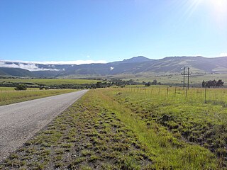
The Tyhume River is a river in Amathole District Municipality in the central part of the Eastern Cape province of South Africa. It springs in the forested mountains of Hogsback, part of the Amatola Mountains, and runs down the Tyhume River Valley and through the eastern verge of the small town of Alice, Eastern Cape, bordering most of the Fort Hare University grounds.

Bridal Drift Dam is a rock-fill type dam on the Buffalo River, near East London, Eastern Cape, South Africa. It was first constructed in 1969 and renovated in 1994. The purpose of the dam is for industrial and domestic use, the reservoir is now the main drinking water supply for Buffalo City.

Boundaries

Primary drainage regions R and S, and also tertiary drainage regions T11 to T13, T20, T31 to T36, T60, T70, T80 and T90.

See also

Water Management Areas (WMAs) are parts of South Africa that are managed by the Water Boards.

Related Research Articles

Great Kei River river in South Africa

The Great Kei River is a river in the Eastern Cape province of South Africa. It is formed by the confluence of the Black Kei River and White Kei River, northeast of Cathcart. It flows for 320 km (199 mi) and ends in the Great Kei Estuary at the Indian Ocean with the small town Kei Mouth on the west bank. Historically the Great Kei River formed the southwestern border of the Transkei region.

Nahoon River river in South Africa

The Nahoon River is situated in the city East London on the East Coast of South Africa. It is to the east of the Buffalo River harbour, and is to the west of Gonubie River. The suburb of Nahoon is on its west bank and Beacon Bay is on the east bank. It flows through an estuary and Africa's southern most mangrove forest into the Indian Ocean. Its mouth is located near Nahoon Reef which is a famous surfing spot and is also known for attacks by Great White Sharks.

Limpopo WMA, or Limpopo Water Management Area(coded: 1), in South Africa includes the following major rivers: the Limpopo River, Matlabas River, Mokolo River, Lephalala River, Mogalakwena River, Sand River and Nzhelele River and covers the following dams.

Luvubu and Letaba WMA, or Levubu and Letaba Water Management Area , includes the following major South African rivers: Mutale River, Luvuvhu River and Letaba River, and cover the following dams:

Crocodile (West) and Marico WMA, or Crocodile (West) and Marico Water Management Area , in South Africa is sub-divided into 6 sub-management areas each corresponding with a (part) river drainage area, and include the following major rivers: the Crocodile River and Marico River, sub divided into an upper Crocodile River sub-management area and a lower Crocodile River sub-management area. The Marico River sub-management area, the upper Molopo River sub-management area, The Elands River sub-management area, and the Apies River / Pienaars River sub-management area.

Upper Orange WMA, or Upper Orange Water Management Area , Includes the following major rivers: the Modder River, Riet River, Caledon River and Orange River, and covers the following Dams:

Lower Orange WMA, or Lower Orange Water Management Area , Includes the following major rivers: the Ongers River, Hartbees River and Orange River, and covers the following Dams:

Fish to Tsitsikama WMA, or Fish to Tsitsikama Water Management Area , in South Africa Includes the following major rivers: the Fish River, Kowie River, Boesmans River, Sundays River, Gamtoos River, Kromme River, Tsitsikamma River and Groot River, and covers the following Dams:

Gouritz WMA, or Gouritz Water Management Area , in South Africa includes the following major rivers: the Gouritz River, Olifants River, Kamanassie River, Gamka River, Buffels River, Touws River, Goukou River and Duiwenhoks River, and covers the following Dams:

Olifants/Doorn WMA, or Olifants/Doorn Water Management Area, Includes the following major rivers: the Olifants River, Doorn River, Krom River, Sand River, and Sout River, and covers the following dams:

Berg WMA, or Berg Water Management Area , Include the following major rivers: the Berg River, Diep River and Steenbras River, and covers the following Dams:

Breede WMA, or Breede Water Management Area , Includes the following major rivers: the Breede River, Riviersonderend River, Sout River, Bot River and Palmiet River, and covers the following Dams:

Komani River river in South Africa

The Komani River, is a river part of the Great Kei River system in the Eastern Cape, South Africa. It is a short river originating north of Queenstown and joining up with the Klaas Smits River, just south of the same town.

White Kei River river in South Africa

The White Kei River or Wit-Kei River is a river in the Eastern Cape, South Africa. It originates north of Queenstown, beginning its course as the Grootvleispruit river and eventually joining the Black Kei River, to form the Great Kei River.

Black Kei River river in South Africa

The Black Kei River, originates southwest of Queenstown, and eventually joins the White Kei River, to become the Great Kei River. Several villages are situated on its banks, including McBride Village, Qabi, Ntabelanga, Thornhill, Loudon, Mitford, Basoto, Baccle's Farm and Tentergate.

Keiskamma River river in South Africa

The Keiskamma River is a river in the Eastern Cape Province in South Africa. The river flows into the Indian Ocean in the Keiskamma Estuary, located by Hamburg Nature Reserve, near Hamburg, midway between East London and Port Alfred. The Keiskamma flows first in a southwestern and then in a southeastern direction after meeting its main tributary, the Tyhume River.

Tsitsa River river in South Africa

The Tsitsa River is a river in the Eastern Cape Province, South Africa. It is a tributary of the Mzimvubu River and belongs to the Mzimvubu to Keiskamma Water Management Area.

References