
Bound Brook is a borough in Somerset County, in the U.S. state of New Jersey, located along the Raritan River. As of the 2020 United States census, the borough's population was 11,988, an increase of 1,586 (+15.2%) from the 2010 census count of 10,402, which in turn reflected an increase of 247 (+2.4%) from the 10,155 counted in the 2000 census,.

South Bound Brook is a borough in Somerset County, in the U.S. state of New Jersey. As of the 2020 United States census, the borough's population was 4,863, an increase of 300 (+6.6%) from the 2010 census count of 4,563, which in turn reflected an increase of 71 (+1.6%) from the 4,492 counted in the 2000 census.

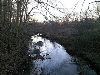
The Raritan River is a major river of New Jersey. Its watershed drains much of the mountainous area of the central part of the state, emptying into the Raritan Bay on the Atlantic Ocean.

The Delaware and Raritan Canal is a canal in central New Jersey, built in the 1830s, that connects the Delaware River to the Raritan River. It was an efficient and reliable means of transportation of freight between Philadelphia and New York City, transporting anthracite coal from eastern Pennsylvania during much of the 19th and early 20th centuries. The canal allowed shippers to cut many miles off the existing route from the Pennsylvania Coal Region down the Delaware, around Cape May, and up the occasionally treacherous Atlantic Ocean coast to New York City.

The Narrows is the tidal strait separating the boroughs of Staten Island and Brooklyn in New York City. It connects the Upper New York Bay and Lower New York Bay and forms the principal channel by which the Hudson River empties into the Atlantic Ocean. It has long been considered to be the maritime "gateway" to New York City and historically has been one of the most important entrances into the harbors of the Port of New York and New Jersey.

Natirar is an estate spanning 491 acres (1.99 km2) in Peapack-Gladstone, Far Hills and Bedminster, in Somerset County, New Jersey, United States. Its name is a reverse spelling of Raritan. The complex was built between 1910 and 1912. In 2003 it was sold by the estate of Hassan II, late King of Morocco, to Somerset County, New Jersey, and is now administered by the Somerset County Park Commission. Approximately 90 acres (360,000 m2) of the estate have been leased to develop that portion of the estate into an exclusive hotel, spa, restaurant complex.

The South Branch Raritan River is a 50-mile-long (80 km) tributary of the Raritan River in New Jersey.

The North Branch Raritan River is a tributary of the Raritan River in central New Jersey.

The South River is a tributary of the Raritan River in central New Jersey in the United States.
Manalapan Brook is a tributary of the South River in Monmouth and Middlesex counties, New Jersey in the United States.

The Millstone River is a 38.6-mile-long (62.1 km) tributary of the Raritan River in central New Jersey in the United States.

The Green Brook Flood Control Project is a flood control project in Somerset County in central New Jersey first proposed in the early 1970s in the wake of two major flooding events: a 1971 flood event and a major 1973 flood which ravaged the Green Brook and Raritan River basins, causing millions in property damage and several deaths in central New Jersey.

The Six Mile Run Reservoir Site, part of the Delaware and Raritan Canal State Park, is located in Franklin Township, Somerset County, New Jersey, United States. It is adjacent to the Delaware and Raritan Canal. It covers 3,037 acres (12.29 km2). The reservoir plan was to flood the Six Mile Run watershed. The Six Mile Run is a tributary of the Millstone River that, with its tributaries, drains a large area in central Franklin Township, Somerset County, New Jersey and western portions of North Brunswick and South Brunswick Townships in Middlesex County, New Jersey. It derives its name, along with other streams, from the distance early surveyors estimated it was from the point where the historic King's Highway left the Raritan River at New Brunswick to the point the roadway crossed the stream. The estimates were not very accurate but the stream names have remained in use ever since.
The Raritan River Greenway is a proposed path in Somerset County, New Jersey that would link Branchburg Township to the East Coast Greenway with the Delaware and Raritan Canal trail in South Bound Brook. Raritan River Greenway is a priority park for Somerset County.

The D&R Canal trail is a recreational trail in the U.S. state of New Jersey. The 77-mile (124 km) trail is made up of three segments that transverse three counties: a canal towpath from New Brunswick to Trenton; a canal towpath/rail trail from Trenton to Bull's Island; and a rail trail from Bull's Island to Frenchtown. The three combined trails together form the largest completed trail in New Jersey. Much of the trail runs along the existing Delaware & Raritan Canal within the Delaware and Raritan Canal State Park.

Van Veghten's Bridge is a bridge spanning the Raritan River in Somerset County, New Jersey, connecting the Finderne section of Bridgewater with Manville. The bridge carries four lanes of Somerset County Route 533 across the river and the flood plain. In Manville the roadway is called North Main Street. In Bridgewater, it becomes Finderne Avenue.

Middle Brook is a tributary of the Raritan River in Somerset County, New Jersey. The stream can be referred to as Rha-weigh-weiros, a Native American name meaning "running from a deep hole", on early maps of the area.

Ten Mile Run is a tributary of the Millstone River, draining an area in southern South Brunswick and southern Franklin Park, New Jersey in the United States.

The Old Stone Arch Bridge is a bridge located in Bound Brook, New Jersey, United States. It is the second-oldest extant bridge in the US, after the Frankford Avenue Bridge over Pennypack Creek in North Philadelphia, Pennsylvania. Built in 1731, it is the oldest bridge in New Jersey. It spans the Green Brook and connects Bound Brook with Middlesex Borough in northern central New Jersey.

Readingsburg, also known as Stone Mill, is an unincorporated community located along the South Branch Raritan River within Clinton Township in Hunterdon County, New Jersey.


