
New Westminster is a city in the Lower Mainland region of British Columbia, Canada, and a member municipality of the Metro Vancouver Regional District. It was founded by Major-General Richard Moody as the capital of the Colony of British Columbia in 1858 and continued in that role until the Mainland and Island colonies were merged in 1866. It was the British Columbia Mainland's largest city from that year until it was passed in population by Vancouver during the first decade of the 20th century.

Belltown is the most densely populated neighborhood in Seattle, Washington, United States, located on the city's downtown waterfront on land that was artificially flattened as part of a regrading project. Formerly a low-rent, semi-industrial arts district, in recent decades it has transformed into a neighborhood of trendy restaurants, boutiques, nightclubs, and residential towers as well as warehouses and art galleries. The area is named after William Nathaniel Bell, on whose land claim the neighborhood was built.

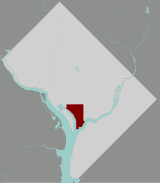
Southwest is the southwestern quadrant of Washington, D.C., the capital of the United States, and is located south of the National Mall and west of South Capitol Street. It is the smallest quadrant of the city, and contains a small number of named neighborhoods and districts, including Bellevue, Southwest Federal Center, the Southwest Waterfront, Buzzard Point, and the military installation known as Joint Base Anacostia–Bolling.

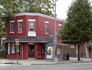
Judiciary Square is a neighborhood in the northwest quadrant of Washington, D.C., the vast majority of which is occupied by various federal and municipal courthouses and office buildings. Judiciary Square is located roughly between Pennsylvania Avenue to the south, H Street to the north, 6th Street to the west, and 3rd Street to the east. The center of the neighborhood is an actual plaza named Judiciary Square. The Square itself is bounded by 4th Street to the east, 5th Street to the west, D Street and Indiana Avenue to the south, and F Street to the north. The neighborhood is served by the Judiciary Square station on the Red Line of the Washington Metro, in addition to Washington Metropolitan Area Transit Authority bus stops.
For thousands of years the area that is today known as Steveston was home to the Halq’eméylem speaking peoples. Specifically, the area is said to be home to at least two Musqueam villages. One known as qʷeyaʔχʷ was located East of what is today known as Garry Point Park. This community was forced out of their homes due to pressure from the canneries who would replace their homes with fishing camps. The second village, qʷɬeyəm, is believed to have been located North of Moncton Street near Railway Avenue. Today, Musqueam's presence in the history of what is today known as Steveston is heavily underrepresented. As Musqueam Councillor Howard Grant explains, there is "almost nothing with respect to Musqueam people... or First Nations in general." Richmond is currently working to change this as, "recently, city council voted to rebuild the historic First Nations Bunkhouse in Britannia Heritage Shipyards--believed to be the only structure of its kind remaining along B.C.'s coast."

Queen's Park is an area located partly in the City of Westminster and mostly in the London Borough of Brent. Some of the area within Westminster forms a civil parish, the first to be created in London since the right of communities to establish civil parishes was enacted in 2007. The area is located 3.9 miles (6.3 km) north-west of Charing Cross, and centred around a 30 acres (12 ha) park, which opened in 1887 and was named in honour of Queen Victoria. The area gives its name to Queens Park Rangers football club.
Park View is a neighborhood in Washington, D.C., located in Northwest D.C. The neighborhood is primarily residential with its main commercial corridor of shops and restauarants located along Georgia Avenue.

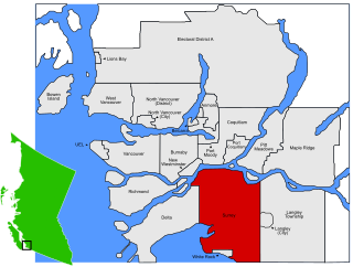
Minoru Park is a park located on the site of a former horse-racing track and airstrip in Richmond, British Columbia.

South Cambie is a neighbourhood in the city of Vancouver, British Columbia, Canada, that is generally considered one of the smallest neighbourhoods in the city, both in size and in population. It is wedged between one of the city's largest parks and the upscale neighbourhood of Shaughnessy, and is known for a large cluster of medical facilities.

The neighborhoods of Milwaukee include a number of areas in southeastern Wisconsin within the state's largest city at nearly 600,000 residents.
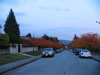
North Burnaby is a general name for a large neighbourhood in the City of Burnaby, British Columbia, that includes a number of smaller ones. It stretches from Boundary Road in the west to Burnaby Mountain with Simon Fraser University in the east and is bounded by Burrard Inlet to the north and the Lougheed Highway to the south. It is a desirable place to live for many local and immigrant families, which is reflected by real-estate prices that keep climbing and have doubled in the last 15 years.
Parkcrest is a hillside neighbourhood in North Burnaby, British Columbia adjacent to Kensington Park which gave it its name. It has a long rectangular shape stretched north to south and is bounded by Springer Avenue to the west and Kensington Avenue to the east. To the north its border runs along Hastings Street, its southern border lies along the Lougheed Highway and Skytrain tracks. Its elevation gradually lowers to the south and ends up in Central Valley, quite low above the level of Burnaby Lake.
The Southwest Waterfront is a neighborhood in Southwest Washington, D.C. The Southwest quadrant is the smallest of Washington's four quadrants, and the Southwest Waterfront is one of only two residential neighborhoods in the quadrant; the other is Bellevue, which, being east of the Anacostia River, is frequently, if mistakenly, regarded as being in Southeast.

Downtown is the central business district of Washington, D.C., located in Northwest D.C. It is the third largest central business district in the United States. The "Traditional Downtown" has been defined as an area roughly between Union Station in the east and 16th Street NW in the west, and between the National Mall on the south and Massachusetts Avenue on the north, including Penn Quarter. However, nowadays, Downtown D.C. usually refers to a larger area, as the DC Office of Planning states:
…most residents, workers, and visitors think of Downtown in a broader sense — including areas as far north as Dupont Circle, as far west as Foggy Bottom, and as far east as Capitol Hill. Only about half of the central city workforce is located within the city’s traditional Downtown.

Ocean Park is a neighbourhood of South Surrey, a region of Surrey, British Columbia.

Grange Park is a neighbourhood in downtown Toronto, Ontario, Canada. It is bounded on the west by Spadina Avenue, on the north by College Street, on the east by University Avenue and on the south by Queen Street West. It is within the 'Kensington-Chinatown' planning neighbourhood of the City of Toronto. Its name is derived from the Grange Park public park. The commercial businesses of Chinatown extend within this neighbourhood.
Sunnyside is a neighbourhood of South Surrey, which in turn is a region of Surrey, British Columbia, Canada.
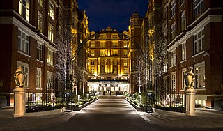
St. Ermin's Hotel is a four-star central London hotel adjacent to St James's Park Underground station, close to Westminster Abbey, Buckingham Palace, and the Houses of Parliament. The Grade II-listed late Victorian building, built as one of the early mansion blocks in the English capital, is thought to be named after an ancient monastery reputed to have occupied the site pre-10th century. Converted to a hotel in 1896–1899, it became during the 1930s, through the Second World War and beyond, a meeting place of the British intelligence services, notably the birthplace of the Special Operations Executive (SOE), and where notorious Cambridge Five double agents Philby and MacLean met their Russian handlers. St Ermin's is now part of Marriott Hotels' Autograph Collection. The hotel is owned by the family of Tei-Fu Chen, founder of Sunrider International.

The Armoury also called The Armouries is a Canadian Forces armoury located at 530 Queens Avenue in New Westminster, British Columbia and it is the oldest active wooden military structure in Canada. It is the home of The Royal Westminster Regiment, an infantry reserve regiment.
The Irving House is a heritage site residing in New Westminster, British Columbia. It is a one and a half storey tall building which is known to be the oldest house in the Lower Mainland that is still completely intact. It is located at the corner of Royal Avenue and Merivale Street in its original location. Today, it is a museum open to the public for those who wish to explore colonial history during the time of pioneer expansion in the Lower Mainland.


