Mercy San Juan Medical Center is a not-for-profit hospital located in Carmichael, California serving the areas of north Sacramento County and south Placer County. It is home to Sacramento's first Comprehensive Stroke Center.

Riverview is an unincorporated community in Yolo County, California. It lies on the west bank of the Sacramento River, on the Sacramento Northern and the Oakland, Antioch and Eastern Railroads 5 miles (8.0 km) south-southwest of West Sacramento, at an elevation of 16 feet.
Hurleton is an unincorporated community in Butte County, California. It is located 7.5 miles (12.1 km) north of Bangor. It lies at an elevation of 1598 feet.
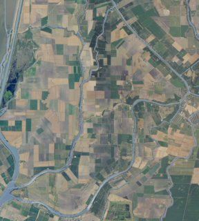
Grand Island is an island lying between Sycamore Slough and the Sacramento River. A post office operated at Grand Island from 1854 to 1919. It is shown, labeled "Taylor Island", on an 1850 survey map of the San Francisco Bay area made by Cadwalader Ringgold and an 1854 map of the area by Henry Lange.

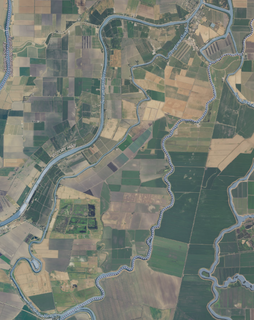
Fremont Weir Wildlife Area is 1,461 acres at the north end of the Yolo Bypass floodway along the Sacramento River in Sutter County and Yolo County. It is 6 miles north-east of the city of Woodland and 15 miles north of Yolo Bypass Wildlife Area and the nearby Sacramento Bypass Wildlife Area. Whenever water in the river exceeds the height of the weir the excess flow runs over the weir and down the Yolo Bypass floodway, thereby reducing the risks of flooding in the city of Sacramento and nearby urban areas along the river.
Norristown, or Hoboken, was an ephemeral California Gold Rush settlement and steamboat landing on the American River in present-day Sacramento County, California.
Krakow is an unincorporated community in Franklin County, in the U.S. state of Missouri. The community is situated on Missouri Route A, between Union to the south and Washington to the north.
Jenningsville is an unincorporated community in Wyoming County, in the U.S. state of Pennsylvania.
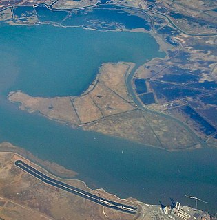
Chipps Island is a small island in Suisun Bay, California. It is part of Solano County. It is also known as Knox Island, Its coordinates are 38°03′19″N121°54′43″W by which name it appears on an 1850 survey map of the San Francisco Bay area made by Cadwalader Ringgold, as well as an 1854 map of the area by Henry Lange.
Dutton Island is a small island in Suisun Bay, California. It is part of Solano County, and included within Reclamation District 2127. Its coordinates are 38°04′54″N121°58′14″W. An 1850 survey map of the San Francisco Bay area made by Cadwalader Ringgold, as well as an 1854 map of the area by Henry Lange, shows an unlabeled island covering some of the area now occupied by Dutton Island.

Wheeler Island is a small island in Suisun Bay, California. It is part of Solano County; parts of it are included in Reclamation Districts 2127 and 2130. Its coordinates are 38°05′06″N121°56′15″W. An 1850 survey map of the San Francisco Bay area made by Cadwalader Ringgold, and an 1854 map by Henry Lange, show islands partially covering some of the current area of Wheeler Island, labeled "Davis Island" and "Warrington Island".

Decker Island is a small island in the San Joaquin River delta, in California. It is part of Solano County. Its coordinates are 38.0904745°N 121.7191214°W.
Tyler Island is a small island in the San Joaquin River delta, part of Sacramento County, California. Its coordinates are 38.1729725°N 121.5474531°W. It is named after 1861 owner W.C. Tyler, and managed by Reclamation Districts 563 and 554.

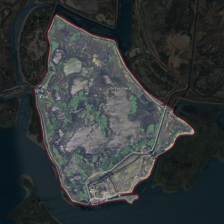
Brannan Island is a small island in the Sacramento–San Joaquin River Delta. It is part of Sacramento County, California, and managed by Reclamation District 2067. Its coordinates are 38°07′19″N121°38′37″W, and the United States Geological Survey measured its elevation as −13 ft (−4.0 m) in 1981. A "Brannan Island", with the same location but a slightly different shape, is labeled on an 1850 survey map of the San Francisco Bay area made by Cadwalader Ringgold as well as an 1854 map of the area by Henry Lange.

Ida Island is a small island in the Sacramento–San Joaquin River Delta. It is part of Sacramento County, California. Its coordinates are 38°10′14″N121°38′12″W, and the United States Geological Survey measured its elevation as 3 ft (0.91 m) in 1981. It appears on a 1978 USGS map of the area.

Long Island is a small island in the Sacramento–San Joaquin River Delta. It is part of Sacramento County, California. Its coordinates are 38°10′01″N121°37′30″W, and the United States Geological Survey measured its elevation as 7 ft (2.1 m) in 1981. It appears on 1978 USGS maps of the area.

The Webb Tract is an island in the Sacramento–San Joaquin River Delta. It is part of Contra Costa County, California, and managed by Reclamation District 2026. Its coordinates are 38°04′47″N121°36′32″W, and the United States Geological Survey measured its elevation as −13 ft (−4.0 m) in 1981.

The Rio Blanco Tract is an island in the Sacramento–San Joaquin River Delta. It is part of San Joaquin County, California, and managed by Reclamation District 2114. Its coordinates are 38°04′46″N121°24′18″W, and the United States Geological Survey measured its elevation as 0 ft (0 m) in 1981. It appears on a 1952 USGS map of the area.

The Hastings Tract is an island in the Sacramento–San Joaquin River Delta. It is part of Solano County, California, and managed by Reclamation District 2060. Its coordinates are 38°16′19″N121°43′45″W, and the United States Geological Survey measured its elevation as 0 ft (0 m) in 1981.

Montezuma Island is an island in Suisun Bay, an embayment of San Francisco Bay, and downstream of the Sacramento–San Joaquin River Delta. It is part of Sacramento County, California, and not managed by any reclamation district. Its coordinates are 38°04′28″N121°50′23″W, and the United States Geological Survey measured its elevation as 7 ft (2.1 m) in 1981. It is labeled "Burnett Island" on an 1850 survey map of the San Francisco Bay area made by Cadwalader Ringgold, and shown (unlabeled) on an 1854 map of the area by Henry Lange.
