
The George Washington and Jefferson National Forests are U.S. National Forests that combine to form one of the largest areas of public land in the Eastern United States. They cover 1.8 million acres (7,300 km2) of land in the Appalachian Mountains of Virginia, West Virginia, and Kentucky. Approximately 1 million acres (4,000 km2) of the forest are remote and undeveloped and 139,461 acres (564 km2) have been designated as wilderness areas, which eliminates future development.
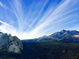
Los Padres National Forest is a United States national forest in southern and central California. Administered by the United States Forest Service, Los Padres includes most of the mountainous land along the California coast from Ventura to Monterey, extending inland. Elevations range from sea level to 8,847 feet (2,697 m).

The Deschutes National Forest is a United States National Forest located in parts of Deschutes, Klamath, Lake, and Jefferson counties in central Oregon. It comprises 1.8 million acres (7,300 km2) along the east side of the Cascade Range. In 1908, the Deschutes National Forest was established from parts of the Blue Mountains, Cascade, and Fremont National Forests. In 1911, parts of the Deschutes National Forest were split off to form the Ochoco and Paulina National Forests, and parts of the Cascade and Oregon National Forests were added to the Deschutes. In 1915, the lands of the Paulina National Forest were rejoined to the Deschutes National Forest. A 1993 Forest Service study estimated that the extent of old growth in the forest was 348,100 acres (140,900 ha). Within the boundaries of the Deschutes National Forest is the Newberry National Volcanic Monument, containing cinder cones, lava flows, and lava tubes. The Deschutes National Forest as a whole contains in excess of 250 known caves. The forest also contains five wilderness areas, six National Wild and Scenic Rivers, the Oregon Cascade Recreation Area, and the Metolius Conservation Area. Forest headquarters are located in Bend, Oregon. There are local ranger district offices in Bend, Crescent, and Sisters.

The natural environment of Virginia encompasses the physical geography and biology of the U.S. state of Virginia. Virginia has a total area of 42,774.2 square miles (110,784.67 km2), including 3,180.13 square miles (8,236.5 km2) of water, making it the 35th-largest state by area. Forests cover 65% of the state, wetlands and water cover 6% of the land in the state, while 5% of the state is a mixture of commercial, residential, and transitional.

Mount Hood National Recreation Area is a 34,550-acre (13,980 ha) protected area within Mount Hood National Forest in Oregon, USA. Established on March 30, 2009 by the Omnibus Public Land Management Act of 2009, the National Recreation Area is managed by the U.S. Forest Service. It comprises three non-contiguous units, none of which include Mount Hood itself, which is within the Mount Hood Wilderness. The Mount Hood Unit lies to the southeast of Mount Hood. The Fifteenmile Unit lies directly to the east of the mountain south of Oregon Route 35, and the Shellrock Unit is to the northeast of the mountain, paralleling Route 35.
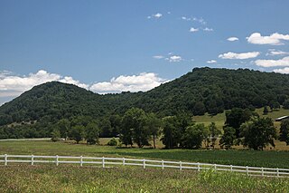
Bear Creek National Scenic Area is a federally designated National Scenic Area in Smyth County, Virginia, USA. The 5,503-acre (2,227 ha) scenic area is administered by the U.S. Forest Service as part of Jefferson National Forest. Mountains and ridges within the scenic area include Walker Mountain to the north and Brushy Mountain to the south, with the headwaters of Bear Creek in the valley between the ridges. Four miles of the Appalachian Trail run through the scenic area.

Brush Mountain East Wilderness is a U.S. wilderness area in the Eastern Divide Ranger District of the George Washington and Jefferson National Forests. It was designated as wilderness area in 2009 by Omnibus Public Land Management Act of 2009.
The Little Dry Run Wilderness is an area in the Mount Rogers National Recreation Area protected by the Eastern Wilderness Act of Congress to maintain its present, natural condition. As part of the wilderness system, it is intended to preserve a variety of natural life forms and contribute to a diversity of plant and animal gene pools. Over half of the ecosystems in the United States exist within designated wilderness.

The Raccoon Branch Wilderness is an area in the Mount Rogers National Recreation Area protected by the Eastern Wilderness Act of Congress to maintain its present, natural condition. As part of the wilderness system, it is intended to preserve a variety of natural life forms and contribute to a diversity of plant and animal gene pools. Over half of the ecosystems in the United States exist within designated wilderness.
The Little Wilson Creek Wilderness is an area in the Mount Rogers National Recreation Area protected by the Eastern Wilderness Act of Congress to maintain its present, natural condition. As part of the wilderness system, it is intended to preserve a variety of natural life forms and contribute to a diversity of plant and animal gene pools. Over half of the ecosystems in the United States exist within designated wilderness.

The Lewis Fork Wilderness is an area in the Mount Rogers National Recreation Area protected by the Eastern Wilderness Act of Congress to maintain its present, natural condition. As part of the wilderness system, it is intended to preserve a variety of natural life forms and contribute to a diversity of plant and animal gene pools. Over half of the ecosystems in the United States exist within designated wilderness.
Devil's Den-Ewing Mountain is a wildland in the George Washington and Jefferson National Forests of western Virginia that has been recognized by the Wilderness Society as a special place worthy of protection from logging and road construction. The Wilderness Society has designated the area as a “Mountain Treasure”.
Horse Heaven is a wildland in the George Washington and Jefferson National Forests of western Virginia that has been recognized by the Wilderness Society as a special place worthy of protection from logging and road construction. The Wilderness Society has designated the area as a “Mountain Treasure”.
Shaw Gap is a wildland in the George Washington and Jefferson National Forests of western Virginia that has been recognized by the Wilderness Society as a special place worthy of protection from logging and road construction. The Wilderness Society has designated the area as a “Mountain Treasure”.

Mount Rogers Crest Zone is a wildland in the George Washington and Jefferson National Forests of western Virginia that has been recognized by the Wilderness Society as a special place worthy of protection from logging and road construction. The Wilderness Society has designated the area as a “Mountain Treasure”.
Whitetop Laurel is a wildland in the George Washington and Jefferson National Forests of western Virginia that has been recognized by the Wilderness Society as a special place worthy of protection from logging and road construction. The Wilderness Society has designated the area as a “Mountain Treasure”.
Rogers Ridge, a wildland in the George Washington and Jefferson National Forests of western Virginia and the Cherokee National Forest of eastern Tennessee, has been recognized by the Wilderness Society as a special place worthy of protection from logging and road construction. The Wilderness Society has designated the area as a “Mountain Treasure”.

The Mount Rogers Cluster is a region recognized by The Wilderness Society for its unique high elevation mountains, vistas, trout streams and wildlife habitat. The heart of the region is Mount Rogers, the highest mountain in Virginia. The area extends over the Mount Rogers National Recreation Area and into part of the Cherokee National Forest.


