Slurry | |
|---|---|
 Slurry  Slurry | |
| Coordinates: 25°49′00″S25°51′00″E / 25.816667°S 25.85°E Coordinates: 25°49′00″S25°51′00″E / 25.816667°S 25.85°E | |
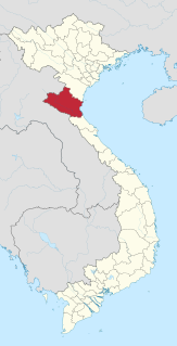
| Country | South Africa |
| Province | North West |
| District | Ngaka Modiri Molema |
| Municipality | Mahikeng |
| Area | |
| • Total | 33.21 km2 (12.82 sq mi) |
| Population (2011) [1] | |
| • Total | 587 |
| • Density | 18/km2 (46/sq mi) |
| Racial makeup (2011) | |
| • Black African | 70.3% |
| • Coloured | 3.8% |
| • Indian/Asian | 6.3% |
| • White | 19.6% |
| First languages (2011) | |
| • Tswana | 55.2% |
| • Afrikaans | 22.3% |
| • English | 9.2% |
| • Zulu | 6.3% |
| • Other | 7.0% |
| Time zone | UTC+2 (SAST) |
| PO box | 2895 |
| Area code | 018 |
Slurry is a settlement in Ngaka Modiri Molema District Municipality in the North West province of South Africa.

Ngaka Modiri Molema District Municipality is one of the four districts of North West province in South Africa. Its capital is Mahikeng, which is also the capital of the province.

North West is a province of South Africa. Its capital is Mahikeng. Klerksdorp is the largest city in the province. The province is located to the west of the major population centre of Gauteng.

South Africa, officially the Republic of South Africa (RSA), is the southernmost country in Africa. It is bounded to the south by 2,798 kilometres (1,739 mi) of coastline of Southern Africa stretching along the South Atlantic and Indian Oceans; to the north by the neighbouring countries of Namibia, Botswana, and Zimbabwe; and to the east and northeast by Mozambique and Eswatini (Swaziland); and it surrounds the enclaved country of Lesotho. South Africa is the largest country in Southern Africa and the 25th-largest country in the world by land area and, with over 57 million people, is the world's 24th-most populous nation. It is the southernmost country on the mainland of the Old World or the Eastern Hemisphere. About 80 percent of South Africans are of Sub-Saharan African ancestry, divided among a variety of ethnic groups speaking different African languages, nine of which have official status. The remaining population consists of Africa's largest communities of European (White), Asian (Indian), and multiracial (Coloured) ancestry.
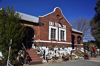
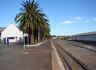
Slurry is a village with a large cement factory, 22 km north-east of Mafikeng and 15 km south-west of Ottoshoop. It was named after the mixture of limestone and other components in the manufacture of cement. [2]

Ottoshoop is one of the small towns in the Mahikeng Local Municipality in the North West Province of South Africa, situated 20km from the city of Mahikeng on the way to the town of Zeerust. Residents serve the scanty needs of a few locals, underwater divers and railway users. During the town's boom years from 1879 to 1880, Ottoshoop was, however, the commercial capital of South Africa. This spirit of the town still lives on in today's commercial capital of Africa – Johannesburg. Before the Europeans' arrival in mid-1800, the area was populated by the baRalong tribe, who built extensive walls to steer game into traps.