
Lincoln County is a county located in the U.S. state of Montana. As of the 2010 United States Census, the population was 19,687. Its county seat is Libby. The county was founded in 1909 and named for President Abraham Lincoln. The county lies on Montana's north border and thus shares the US-Canadian border with the Canadian province of British Columbia.

Flathead County is in the U.S. state of Montana. At the 2010 United States Census, its population was 90,928, making it the state's fourth most populous county. Its county seat is Kalispell. Its numerical designation is 7. Its northern border is on the state's north border, making it contiguous with the Canada–US border, facing British Columbia.
Columbia Falls is a city along the Flathead River in Flathead County, Montana, United States. The population was 4,710 at the 2010 census. Columbia Falls has been ranked as one of the best and safest places to live in Montana.

Whitefish is a town in Flathead County, Montana, United States. According to the census of 2019, there were 7,714 people in the town.

The Spirit of the American Doughboy is a pressed copper sculpture by E. M. Viquesney, designed to honor the veterans and casualties of World War I. Mass-produced during the 1920s and 1930s for communities throughout the United States, the statue's design was the most popular of its kind, spawning a wave of collectible miniatures and related memorabilia as well as numerous copies by other artists. Its title is often shortened to The Doughboy.

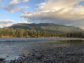
Polebridge is an unincorporated community in Flathead County, Montana, United States, 35 miles (56 km) northwest of Columbia Falls in the northwestern part of the state. This community is named for the log bridge that formerly connected the "inner" North Fork Road in Glacier National Park to the "outer" North Fork Road which leads to Montana Secondary Highway 486, over the North Fork Flathead River. Polebridge lies near the Canada–United States border.

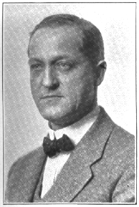
Ernest Moore Viquesney was an American sculptor best known for his popular World War I monument Spirit of the American Doughboy.

The World War I Memorial is a bronze sculpture by Pietro Montana and is located at the intersection of Taunton Avenue, Whelden Avenue, and John Street in East Providence, Rhode Island, United States. The sculpture is modeled on Charles Atlas and depicts a dynamically posed soldier standing on a granite base. Montana's original design was modified by the East Providence Memorial Committee for being "too brutal". Dedicated on July 30, 1927, Major General Charles Pelot Summerall gave an address which highlighted the handicap placed upon the soldiers by a lack of preparedness and "invoked the fighting ideal embodied by Montana's doughboy." The World War I Memorial was added to the National Register of Historic Places in 2001.
John Paulding was an American sculptor best remembered for his World War I memorials. Paulding was born in Darke County, Ohio. He studied sculpture at the Art Institute of Chicago and was to remain in Chicago until his death at an early age in 1935.
The Greenwood Avenue Historic District in Bethel, Connecticut is a historic district representing the commercial and civic center of that town. It was listed on the National Register of Historic Places in 1999 and includes 29 contributing buildings, 5 non-contributing buildings, and the town green, P. T. Barnum Square. It includes the Bethel Public Library, a former railroad station converted into a brewery, and a World War I Doughboy bronze statue sculpted by Ernest Moore Viquesney in P. T. Barnum Square.

Link & Haire was a prolific architectural firm in Montana, formally established on January 1, 1906. It designed a number of buildings that are listed on the National Register of Historic Places.

Fred Fielding Willson, most commonly known as Fred F. Willson, was an architect in Bozeman, Montana who designed many buildings that are listed on the National Register of Historic Places.

The Regional designations of Montana vary widely within the U.S state of Montana. The state is a large geographical area that is split by the Continental Divide, resulting in watersheds draining into the Pacific Ocean, Gulf of Mexico and Hudson's Bay. The state is approximately 545 miles (877 km) east to west along the Canada–United States border and 320 miles (510 km) north to south. The fourth largest state in land area, it has been divided up in official and unofficial ways into a variety of regions. Additionally, Montana is part of a number of larger federal government administrative regions.
Frederick Adolph Brinkman was an American architect based in Kalispell, Montana, and Brinkman and Lenon is a partnership in which he worked. More than a dozen of Brinkman's extant works in and around Kalispell have been listed on the National Register of Historic Places, including the Anderson Style Shop, Charles Boles House, Brice Apartments, City Water Department, Cornelius Hedges Elementary School, Russell School, Linderman School, the Montgomery Ward Store in Kalispell, and the O'Neil Print Shop.

The Lewis and Clark County Hospital Historic District is a historic district in Helena, Lewis and Clark County, Montana. It has also been known as "Cooney Convalescent Home", "Miner's Hospital", "Poor Farm", and "Old Cooney Home". There are seven buildings and a garden on the property; four buildings and the garden are part of the historic district: the hospital, detention hospital, shed, superintendent's residence, and garden. The non-contributing buildings are the modern garage, concrete garage, and ambulance garage.

The Craighead County Courthouse is located at 511 Main Street, in the center of Jonesboro, Arkansas, the county seat of Craighead County. It is a two-story brick structure with limestone trim, built in 1934, and is the city's only significant example of Art Deco architecture. The building has a stepped appearance, with a large central block that has an oversized second story, and is flanked by smaller two-story wings, from which single-story sections project to the front and back. Vertical panels of fluted limestone accentuate corner projections from the main block, a motif repeated near the roof line of that block. The main entrance is recessed in an opening flanked by similarly fluted panels. The courthouse is the fifth of the county to stand on the site. Near the entrance to the courthouse stands a copy of John Paulding's World War I memorial, Over the Top, placed in 1920, and often confused with E. M. Viquesney's "Spirit of the American Doughboy".

St. Richard's Church is a gothic style former Catholic church located in Columbia Falls, Montana, United States.

The Flathead River Bridge otherwise known as the Red Bridge is an abandoned steel truss bridge located at the south end of 4th Ave in Columbia Falls, Montana. The bridge was added to the National Register of Historic Places in 2010.


