This article needs additional citations for verification .(March 2010) |

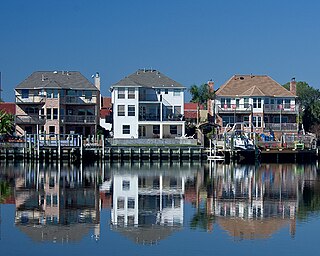
South Belt/Ellington is a neighborhood located around 20 miles southeast of Downtown Houston, Texas.
This article needs additional citations for verification .(March 2010) |
South Belt/Ellington is a neighborhood located around 20 miles southeast of Downtown Houston, Texas.
Before the Spaniards came to America the South Belt area was dominated by the Karankawa natives. Explorers that came into the area feared the Karankawas and viewed them as savages and cannibals. However when settlers first began to settle in the area they were greeted by somewhat neighborly natives.[ citation needed ]
In the 19th and early 20th century the area that is now known as South Belt was mainly used for farming and ranching. By the 1960s however the Ayrshire Development Corp., who had bought the land, began to look into developing the area.[ citation needed ]
In 1963 Ayrshire built five homes and established a water district. A year later he sold the first home to the George West family. The area began to grow and develop quickly until the 1980s when it became known that toxic waste had been dumped in the area by Brio Refining Inc. and was causing a high number of birth defects in children living in the South Bend subdivision. Because of this 677 homes and Arlyne S. Weber Elementary [1] were demolished and the site became the Brio Superfund site.
In the 2000s the area began to flourish again as many new homes and businesses were built in the area including the Clear Brook Landing subdivision which was built near the Superfund Site and a new Weber Elementary which is on Blackhawk Blvd.
South Belt/Ellington is serviced by branches of both the Harris County Public Library (Parker Williams Library [2] ) and Houston Public Library (Bracewell Library). [3]
South Belt is served by both the Pasadena Independent School District and Clear Creek Independent School District.
Pasadena ISD schools:
Residents of Pasadena ISD (and therefore Southbelt/Ellington) are zoned to San Jacinto College. [4]

Galena Park is a city in Harris County, Texas, United States, within the Houston–Sugar Land–Baytown metropolitan area. The population was 10,740 at the 2020 census. The population is predominantly Hispanic.

Jacinto City is a city in Harris County, Texas, United States, east of the intersection of Interstate 10 and the East Loop of Interstate 610. Jacinto City is part of the Houston–Sugar Land–Baytown metropolitan area and is bordered by the cities of Houston and Galena Park. The population was 9,613 at the 2020 census.

La Porte is a city in Harris County, Texas, United States, within the Bay Area of the Houston–Sugar Land–Baytown metropolitan area. As of the 2020 census, the city population was 35,124. La Porte is the fourth-largest incorporated city in Harris County.
Nassau Bay is a city in Harris County, Texas, United States, bordering the outermost southeastern edge of the city of Houston. It is located in the Clear Lake Area near Galveston Bay, directly adjacent to the Lyndon B. Johnson Space Center. The population was 5,347 at the 2020 census.

Pasadena is a city in the U.S. state of Texas, located in Harris County. It is part of the Houston–The Woodlands–Sugar Land metropolitan area. As of the 2020 U.S. census, the city's population was 151,950, making it the twentieth most populous city in Texas and the second most populous in Harris County. The area was founded in 1893 by John H. Burnett of Galveston, who named the area after Pasadena, California, because of the perceived lush vegetation.

Sheldon is an unincorporated community and a census-designated place (CDP) in northeastern Harris County, Texas, United States, located completely inside the extraterritorial jurisdiction of the City of Houston. The Sheldon area is located along Beltway 8 and US Highway 90, approximately twelve miles (19 km) northeast of Downtown Houston.

South Houston is a city in the U.S. state of Texas, within Houston–The Woodlands–Sugar Land metropolitan area and Harris County. The population was 16,153 at the 2020 census. It is bordered by the cities of Houston and Pasadena, and geographically located southeast of Houston.

Pearland is a city in the U.S. state of Texas, located in Brazoria County, with portions extending into Fort Bend and Harris counties. The city of Pearland is a principal city within the Houston–The Woodlands–Sugar Land metropolitan statistical area. At the 2020 U.S. census, the city's population was 125,828, up from a population of 91,252 at the 2010 census. Pearland's population growth rate from 2000 to 2010 was 142 percent, which ranked Pearland as the 15th-fastest-growing city in the U.S. during that time period, compared to other cities with a population of 10,000 or greater in 2000. Pearland is the third-largest city in the Greater Houston area after Houston and Pasadena, Texas.

League City is a city in the U.S. state of Texas, in Galveston County, within the Greater Houston metropolitan area. The population 114,392 at the 2020 census.

Clear Lake City is a master-planned community located in southeast Harris County, Texas, within the Bay Area of Greater Houston. It is the second-largest master-planned community in Houston – behind Kingwood. The majority of the community lies in the corporate limits of Houston, and a small eastern portion within the city limits of Taylor Lake Village.

San Jacinto College is a public community college in the Greater Houston area, with its campuses in Pasadena and Houston, Texas. Established in 1961, San Jacinto College originally consisted of the independent school districts (ISD) of Channelview, Deer Park, Galena Park, La Porte, and Pasadena.
Genoa is an area in Houston, Texas, United States located about 15 miles (24 km) southeast of Downtown Houston; it was formerly a distinct unincorporated area in Harris County.
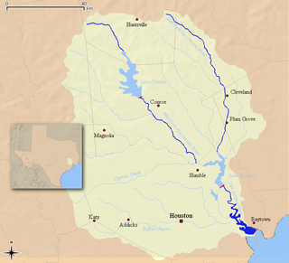
The San Jacinto River flows through southeast Texas. It is named after Saint Hyacinth. In the past, it was home to the Karankawa and Akokisa tribes.
Pasadena High School is the first established high school in Pasadena, Texas, located along Texas State Highway 225. It serves grades 9th through 12 and is part of the Pasadena Independent School District. The principal is Mrs. Laura Gomez. Pasadena High School's mascot is an eagle named "Baldy". The school colors are green and white.
The Memorial area of Houston, Texas is located west of Downtown, northwest of Uptown, and south of Spring Branch. The Memorial Super Neighborhood, as defined by the City of Houston, is bounded by Buffalo Bayou to the south, Barker Reservoir to the west, Westview to the north, and the Memorial Villages, a contiguous group of independent municipalities, to the east.
Pasadena Independent School District is a school district that is based in Pasadena, Texas, United States.
Galena Park Independent School District is a school district based in the Channelview CDP of unincorporated Harris County, Texas, United States.
North Shore is a community in east side of Harris County, Texas with a small portion inside the city of Houston, Texas. The area includes subdivisions such as Songwood, Holiday Forest, Wood Bayou, Cimarron, Home Owned Estates, Woodland Acres, Hidden Forest, Pine Trails, Woodforest, Woodforest North, New Forest, and New Forest West, as well as newer neighborhoods near Highway 90 and Beltway 8 North Sam Houston Parkway.

The Brio Superfund site is a former industrial location in Harris County, Texas, at the intersection of Beamer Road and Dixie Farm Road, about 16 miles southeast of downtown Houston and adjacent to the Dixie Oil Processors Superfund site. It is a federal Superfund site, although it was deleted from the National Priorities List in December 2006. A neighboring residential subdivision called South Bend, now abandoned was located along and north of the northern boundary of Brio North. The former South Bend neighborhood had about 670 homes, an elementary school, and a Little League baseball field. The Brio Superfund site documents are located at the San Jacinto College South Campus Library, which houses Brio Site Repository Documents, U.S. Environmental Protection Agency (EPA) Administrative Records, and documents concerning the adjoining Dixie Oil Processors site.
Sagemont is a neighborhood in far southeast Houston, Texas, south of Beltway 8.
