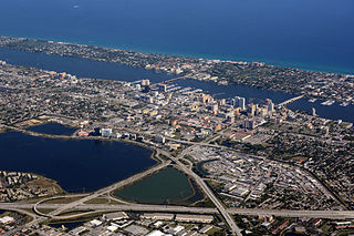
Palm Beach County is a county in the state of Florida that is directly north of Broward County. As of the 2010 census, the population was 1,320,134, making it the third-most populous county in Florida. The largest city and county seat is West Palm Beach. Named after one of its oldest settlements, Palm Beach, the county was established in 1909, after being split from Dade County. The county's modern-day boundaries were established in 1963.
Juno Beach is a town in Palm Beach County, Florida, United States. The population was 3,262 at the 2000 census. As of 2004, the population recorded by the U.S. Census Bureau is 3,391. Juno Beach is home to the headquarters of Florida Power & Light. It was also the original county seat for the area that was then known as Dade County, Florida.

Lake Clarke Shores is a town in Palm Beach County, Florida, United States. The population was 3,451 at the 2000 census. As of 2004, the population recorded by the U.S. Census Bureau was 3,475.

North Palm Beach is an incorporated village in Palm Beach County, Florida, United States. The population was 12,015 at the 2010 census. The village won an award from the National Association of Home Builders as best planned community of 1956. The North Palm Beach Country Club is home to a Jack Nicklaus Signature golf course.

Palm Springs is a village in Palm Beach County, Florida, United States, situated between Greenacres, Lake Clarke Shores, Lake Worth, and West Palm Beach. As of the 2010 United States Census, had a population of 18,928. It is a village within the Miami metropolitan area, which was home to an estimated 6,012,331 people as of 2015.

South Palm Beach is a town located in Palm Beach County, Florida, United States. The town is situated on a barrier island between the Atlantic Ocean and the Intracoastal Waterway. The entire town is approximately 5/8th of a mile (1 km) long along South Ocean Boulevard, its only street, and is bounded by the Town of Palm Beach to the north, and the Town of Lantana public beach to the south. As of 2013, the population recorded by the U.S. Census Bureau was 1,138.

Wellington is a village just west of West Palm Beach in central Palm Beach County, Florida, United States. As of 2017, the city had a population of 64,848 according to the U.S. Census Bureau, making it the most populous village in the state. It is the fifth largest municipality in Palm Beach County by population. Wellington is part of the Miami metropolitan area. Wellington was named Money Magazine's "Top 100" Best Places to Live in 2010. Although Wellington is not a village under any standard definition of the term village in the US, it is referred to officially as the "Village of Wellington". The area is also home to The Mall at Wellington Green and a shopping plaza surrounding it.

The Hillsboro Canal is located in the southeastern portion of Florida within the South Florida Water Management District, and for much of its length forms the border between Broward and Palm Beach counties; however, its western end was entirely in Palm Beach County, until being recently annexed to Broward County-Parkland, FL. It begins at Lake Okeechobee at the S-2 water control structure in South Bay west of Belle Glade, Florida. It passes within the southern border of the Loxahatchee National Wildlife Refuge and flows southeast from there along Loxahatchee Road in a rural, lightly populated area. When it reaches the more heavily built-up region further east, it bends to head due eastward, forming the county line. Near its eastern end at the Intracoastal Waterway, with Boca Raton to the north and Deerfield Beach to the south, it departs from its straight course to go around several curves, but the county boundary continues to follow it at this point. 10 miles of the canal is navigable, and it is popular for recreational boating and fishing.

State Road 804 (SR 804) is a 9.843 miles (15.841 km) long east–west highway serving as a major commercial and commuter road through Boynton Beach in southern Palm Beach County, Florida. It is known locally and signed as Boynton Beach Boulevard for nearly all of its route, with the exception of when the road becomes concurrent with US 1 southward for two blocks, then continues along Ocean Avenue in downtown Boynton Beach to its eastern terminus at SR A1A. The western terminus of SR 804 is at the junction of US 441 / SR 7, close to the eastern boundary of the Loxahatchee National Wildlife Refuge and the historic northern boundary of The Everglades. Boynton Beach Boulevard adheres to Northwest 2nd Avenue in the Boynton Beach street numbering grid.
Twenty Mile Bend is an unofficial landmark located in Palm Beach County, Florida, United States. It is located at the intersection of State Road 80 and State Road 880. This location is both 20 miles (32 km) from West Palm Beach, as well as 20 miles (32 km) from Lake Okeechobee. However, the name is derived from State Road 880. When traveling east from Belle Glade, there are bends in the road at the 9 miles (14 km), 12 miles (19 km), and 20 miles (32 km) points. This bend is located at the 20 miles (32 km) point.

Loxahatchee Groves is a town in Palm Beach County, Florida, United States. As of 2017, the town had a population of 3,528 according to an estimate by the United States Census Bureau. Loxahatchee Groves was incorporated November 1, 2006, as the 38th municipality in Palm Beach County. The first election for town council members was held on March 13, 2007. Although Loxahatchee Groves did not become a municipality until 2006, the area had been settled since 1917. Billing itself as "Florida's Last Frontier", Loxahatchee Groves was primarily incorporated to better protect the area from encroaching urbanization as nearby cities continued to develop and to preserve the area's rural character.
Palm Beach Farms is an unincorporated community in Palm Beach County, Florida, United States. The population is unknown, however. This town is similar to Southwest Ranches because of its semi-rural landscape. The property sizes are mostly an acre large. Major hoghways throughout the community are SR 80/US 98, Florida's Turnpike, Jog Road, and US 441/SR 7.

Singer Island is a peninsula on the Atlantic coast of Palm Beach County, Florida, in the South Florida metropolitan area. Most of it is in the city of Riviera Beach, but the town of Palm Beach Shores occupies its southern tip. Its latitude of is 26.784 N and its longitude is −80.037; West Florida's easternmost point is in Palm Beach Shores. Before the Palm Beach Inlet was created, Singer Island was connected to the island of Palm Beach to the south.
Kreamer Island is a small island in the south-easternmost part of Lake Okeechobee, located in Palm Beach County, Florida just north of Torry Island. Kreamer Island is accessible only by airboat during the wet season and by recreational vehicles during dry season/droughts. A small canal separates Kreamer Island and Torry Island.
Jupiter Ridge Natural Area is a 271-acre (110 ha) area of protected land in Jupiter, Florida, in Palm Beach County. It is located at 1800 South U.S. Highway 1. Habitats include Florida scrub, depression marsh, tidal swamp, and flatwoods.
Juno Dunes Natural Area is a 576-acre (233 ha) nature preserve and park in Palm Beach County, Florida.

Loggerhead Park is a 17-acre recreational area in Juno Beach, Florida with a beach. It includes the Loggerhead Marinelife Center, an ocean conservation organization and sea turtle hospital. Loggerhead Marinelife Center manages the Juno Beach fishing pier, across the street from the park. The park is adjacent to Juno Dunes Natural Area off U.S. Highway 1.
Frenchman's Forest Natural Area is a 158-acre (64 ha) protected area of pine flatwoods, strand swamp, scrubby flatwoods, hydric hammock tidal swamp and wet flatwoods in Palm Beach Gardens, Florida. It is located at 12201 Prosperity Farms Road. There are hiking trails and a boardwalk.
Royal Palm Beach Pines Natural Area is a 773-acre area of protected land in Royal Palm Beach, Florida that includes pine flatwoods and wet prairie. There are hiking and equestrian trails, a nature trail, and boardwalk. The park is located at 110 Nature's Way or the northern entrance on 40th Street and Avocado Boulevard.
Westlake is the 39th and newest municipality in Palm Beach County, Florida, United States. Westlake is located west of Royal Palm Beach and north of Wellington.

