
Combined arms is an approach to warfare that seeks to integrate different combat arms of a military to achieve mutually complementary effects—for example, using infantry and armour in an urban environment in which each supports the other.
Military intelligence is a military discipline that uses information collection and analysis approaches to provide guidance and direction to assist commanders in their decisions. This aim is achieved by providing an assessment of data from a range of sources, directed towards the commanders' mission requirements or responding to questions as part of operational or campaign planning. To provide an analysis, the commander's information requirements are first identified, which are then incorporated into intelligence collection, analysis, and dissemination.

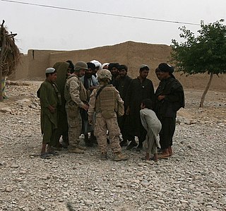
In military operations, military reconnaissance or scouting is the exploration of an area by military forces to obtain information about enemy forces, the terrain, and civil activities in the area of operations. In military jargon, reconnaissance is abbreviated to recce and to recon, both derived from the root word reconnoitre.

A combat engineer is a type of soldier who performs military engineering tasks in support of land forces combat operations. Combat engineers perform a variety of military engineering, tunnel and mine warfare tasks, as well as construction and demolition duties in and out of combat zones.
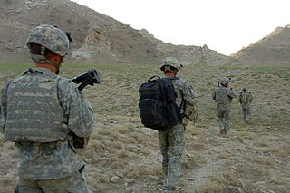
Patrolling is a military tactic. Small groups or individual units are deployed from a larger formation to achieve a specific objective and then return. The tactic of patrolling may be applied to ground troops, armored units, naval units, and combat aircraft. The duration of a patrol will vary from a few hours to several weeks depending on the nature of the objective and the type of units involved.
Long-range surveillance (LRS) teams were elite, specially-trained surveillance units of the United States Army employed for clandestine operation by Military Intelligence for gathering direct human intelligence information deep within enemy territory. Classic LRS employment is to infiltrate deep into enemy territory, construct hide and surveillance sites, and provide continuous surveillance/special reconnaissance of an intelligence target of key interest.

Military geography is a sub-field of geography that is used by the military, as well as academics and politicians, to understand the geopolitical sphere through the military lens. To accomplish these ends, military geographers consider topics from geopolitics to physical locations’ influences on military operations and the cultural and economic impacts of a military presence. On a tactical level, a military geographer might put together the terrain and the drainage system below the surface, so a unit is not at a disadvantage if the enemy uses the drainage system to ambush it, especially in urban warfare. On a strategic level, an emerging field of strategic and military geography seeks to understand the changing human and biophysical environments that alter the security and military domains. Climate change, for example, is adding and multiplying the complexity of military strategy, planning and training. Emerging responsibilities for the military to be involved in: protection of civilian populations, women and ethnic groups; provision of humanitarian aid and disaster response (HADR); new technology and domains of training and operations, such as in cybergeography, make military geography a dynamic frontier.
If a general desired to be a successful actor in the great drama of war, his first duty is to study carefully the theater of operations so that he may see clearly the relative advantages and disadvantages it presents for himself and his enemies.
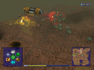
A mini-map or minimap is a miniature map HUD element that is often placed at a screen corner in video games to help players in orienting themselves within the game world. They are often only a small portion of the screen and must be selective in what details they display. Elements included on mini-maps vary by video game genre. However, most minimaps feature at least one or more of the following: the position of the player character, allied units, structures, enemies, objectives, and surrounding terrain.
An Operation Order, often abbreviated to OPORD, is a plan format meant to assist subordinate units with the conduct of military operations. An OPORD describes the situation the unit faces, the mission of the unit, and what supporting activities the unit will conduct in order to achieve their commander's desired end state. Normally an OPORD is generated at the battalion, regimental, brigade, divisional, or corps headquarters and disseminated to its assigned or attached elements. The issuance of an OPORD triggers subordinate unit leadership to develop orders specific to the role or roles that the unit will assume within the operation. This more narrowly focused order borrows information from the original, or base, order and adds additional details that pertain more to the minutiae of the actions a unit is tasked to conduct in support of the overarching operation.
Battlespace or battle-space is a term used to signify a military strategy which integrates multiple armed forces for the military theatre of operations, including air, information, land, sea, cyber and outer space to achieve military goals. It includes the environment, timeframe and other factors, and conditions that must be understood to successfully apply combat power, protect the force, or complete the mission. This includes enemy and friendly armed forces, infrastructure, weather, terrain, and the electromagnetic spectrum within the operational areas and areas of interest.

Special reconnaissance (SR) is conducted by small units, such as a recon team, made up of highly trained military personnel, usually from special forces units and/or military intelligence organizations. Special reconnaissance teams operate behind enemy lines, avoiding direct combat and detection by the enemy. As a role, SR is distinct from commando operations, but both are often carried out by the same units. The SR role frequently includes covert direction of airstrikes and indirect fire, in areas deep behind enemy lines, placement of remotely monitored sensors, and preparations for other special forces. Like other special forces, SR units may also carry out direct action and unconventional warfare, including guerrilla operations.
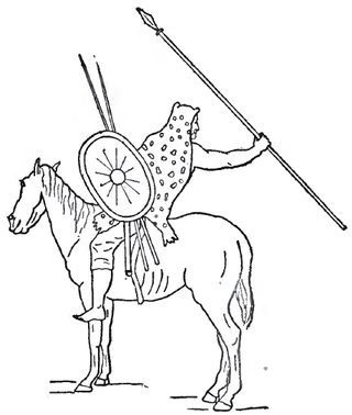
Numidian cavalry was a type of light cavalry developed by the Numidians. They were used by Hannibal during the Second Punic War.
Obstacles to troop movement represent either natural, human habitat originated, constructed, concealed obstacles, or obstructive impediments to movement of military troops and their vehicles, or to their visibility. By impeding strategic, operational or tactical manoeuvre, the obstacle represents an added barrier between opposing combat forces, and therefore prevent achievement of objectives and goals specified in the operational planning schedule. The constructed obstacles are used as an aid to defending a position or area as part of the general defensive plan of the commander. The obstacles that originate from the human habitat can be converted by troops into constructed obstacles by either performing additional construction, or executing demolitions to obstruct movement over the transport network, to create a choke point, or to deny traversing of an area to the enemy. The natural obstacles can be used defensively by securing a more difficult to breach defensive position by for example securing a flank on terrain that is deemed impossible to traverse, thus denying the enemy an ability to close into combat range of direct fire weapons.

Amphibious reconnaissance is ground and naval reconnaissance in the littoral area bordering coastal or ocean areas. Initially, it is used for preliminary reconnaissance in collecting pertinent information about the beachhead in its permeability and usability for main landing assaults. Specialized recon patrols skilled in boatswain and combatant diving using either amphibious vehicles or rubber crafts to obtain and collect information on the enemy, the topology ashore and inland, and hydrographic surveys for underwater obstacles and mines, and for the purpose of affecting a deception.
The reconnaissance mission within the United States Marine Corps is divided into two distinct but complementary aspects; Marine Division Recon and Force Reconnaissance.

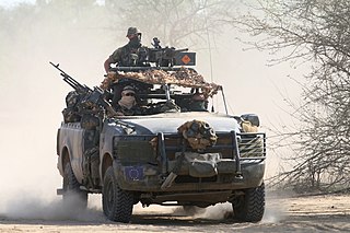
A reconnaissance vehicle, also known as a scout vehicle, is a military vehicle used for forward reconnaissance. Both tracked and wheeled reconnaissance vehicles are in service. In some nations, light tanks such as the M551 Sheridan and AMX-13 have also been used by scout platoons. Their armament ranges from a medium machine gun to a large cannon. Modern examples are often fitted with ATGMs and a wide range of sensors.
Ferme des Greves Aerodrome was a temporary World War I airfield in France. It was located 4.3 miles (6.9 km) ESE of Château-Thierry, in the Aisne department in Picardy in north-eastern France.

The First Army Air Service was an Air Service, United States Army unit that fought on the Western Front during World War I as part of the Air Service, First United States Army. The First Army Air Service was the largest and most diverse Air Service combat organization of the American Expeditionary Forces in France, and most American Air Service combat units were assigned to it when assigned to the front.

The School of Engineers is part of the South African Army Engineer Formation, which provides combat engineering corps training and teaching to military officers and personnel as well as other Military Schools throughout the South African National Defence Force. They are currently the only Military School in Southern Africa to formally present IEDD.
Engineer Troops of the USSR — were special troops of the Soviet Armed Forces, designed for military engineer support: combat operations; engineering reconnaissance, and escort of troops (forces) in the offensive, and so on.