USC&GSS Research

Last updated
Theb0393.jpg
Coast and Geodetic Survey Ship Research (1901-1918) Manila, Philippines 1901.
History
US flag 45 stars.svg Flag of the United States Coast and Geodetic Survey.svg
NameResearch
OwnerPhilippine Insular Government
OperatorU.S. Coast and Geodetic Survey/Philippine Insular Government
Completed1898, Hong Kong
AcquiredPhilippine Commission: 1901
In serviceUSC&GS: 1 October 1901
Out of serviceUSC&GS: 1918
IdentificationSignal: GVWL
FateUnknown
General characteristics
Tonnage95  GRT
Length94.6 ft (28.8 m) Registered
Beam15 ft (4.6 m)
Draft8.2 ft (2.5 m)
Speed9 kn (10 mph; 17 km/h)
Complement4 officers, 23 men
NotesShip was transferred to the Philippine Insular Government for other use. Disappears from C&GS records.

USC&GSS Research was a survey vessel owned by the Philippine Insular Government to be the first vessel operated by the United States Coast and Geodetic Survey in the Philippines from 1901 until 1918.

Contents

Acquisition

Under and appropriation made March 8, 1901 by the United States Philippine Commission a small steamer [Note 1] was acquired and provided with up to $5,000 [1] in funding for repair, refit and funds for coaling for the use of the Coast and Geodetic Survey. [2] The steamer Research was acquired by the Government of the Philippine Islands and undergoing alterations at the end of fiscal year June 30, 1901 to be the first C&GS vessel operating in the Philippines. [3] Research was placed in commission 1 October 1901 and first engaged in surveys on the coast of Luzon and harbors on Mindoro and Culion islands. [4]

For operations in the Philippines the U.S. Government paid salaries, cost of travel to and from the Philippines and expenses for the U.S. Coast and Geodetic Survey officers aboard the ships. The Insular Government paid crew salaries and expenses as well as having ownership of the vessels excepting the Pathfinder. [5] All crews were Filipino. [6]

Research was a wooden vessel built in 1898 at Hong Kong of 95  GRT with registered length of 94.6 ft (28.8 m), registered breadth of 15 ft (4.6 m) and draft of 8.2 ft (2.5 m) with a speed of 9 kn (10 mph; 17 km/h). The vessel's signal was GVWL and complement was 4 officers and 23 men. [7]

Service history

Research, placed in commission October 1, 1901, [8] under the command of Assistant [Note 2] H. W. Rhodes of the Coast and Geodetic Survey, and Filipino crew [8] began survey operations October 10, 1901 in Manila Bay through November 3 when the vessel required repairs. Work continued mainly on harbor surveys with a reconnaissance in Paluan Bay, Mindoro. This work was seriously hampered by the vessel's limited fresh water capacity and the need for frequent and time-consuming replenishment. [9]

Introduction to Assistant R. B. Derickson, commanding ship Research, on page 124 of Report Of The Superintendent Of The Coast And Geodetic Survey Showing The Progress Of The Work From July 1, 1902 To June 30, 1903. The introduction illustrates the general nature of work done, ships officers and use of the term "Assistant" for ship's commanding officer. RESEARCH rptintro 1903ar.jpg
Introduction to Assistant R. B. Derickson, commanding ship Research, on page 124 of Report Of The Superintendent Of The Coast And Geodetic Survey Showing The Progress Of The Work From July 1, 1902 To June 30, 1903. The introduction illustrates the general nature of work done, ships officers and use of the term "Assistant" for ship's commanding officer.

Reports of Assistant R. B. Derickson, commanding Research during the fiscal year 1903 reporting period indicate the nature of the work undertaken. Triangulation and navigation bases were established along with tide gauges and then topographic and hydrographic surveys were begun. Inshore hydrography was done by "the whaleboat and alco-vapor launch" while offshore survey to 20 fathoms was done by casting the lead and in deeper water by the sounding machine. [10]

In 1910 the Research was one of five C&GS vessels surveying in the Philippines, the others being Pathfinder, Romblon, Marinduque and Fathomer all except Pathfinder being owned and largely funded, excepting pay of the USC&GS officers, by the Philippine Government. The ship engaged in hydrographic surveys, including work in the Tanon Strait but spent much of its time supporting shore parties engaged in triangulation and topographic surveys of the south coast of Masbate Island, the north coast of Leyte, the west coast of Samar.

During 1913–1915 Research worked in San Bernardino Strait, the northern part of the Samar Sea and in southern Luzon, Ticao Island and Masbate Island with triangulation, hydrographic and topographic surveys. The ship underwent repairs and outfitting in Manila December 24, 1912 through late February 1913 and again between January 1, 1915 and March 16, 1915 after which proceeded to work in and around Sorsogon Bay, southern Luzon. Triangulation work to link Luzon and Ticao and Masbate Islands completed, the ship's parties began topographic and then hydrographic surveys undertaken by ship's launches and the ship. [11] [12]

In 1918, due to both funding issues and loss of C&GS officers to Army and Navy or sent back to the United States, the Marinduque and Research were recalled and laid up. The Research was transferred to the insular government for other use. The ship had been engaged in surveys of Manila Bay and adjacent topography. The last work of the ship's surveyors was a small area "behind the North Breakwater, Manila Bay" using launches "presumably" for estimating costs of dredging the area. [13]

Fate

After transfer the fate of the ship is not mentioned in C&GS reports. A "steam launch Research," administered by the Province of Sulu, replaced a commercial vessel Antipolo that had ceased operation in March 1918 operating out of Zamboanga serving regional ports and islands including Sulu. [14]

The name was inherited by the second ship surveying for the Survey in the Philippines, the Pathfinder, in 1941 even as that historic ship gave its name to a second Pathfinder. [15]

Notes

  1. No previous name, operator or specifications are mentioned in the sources.
  2. A C&GS title of fairly high rank. The captains or masters of the ships were designated "Assistants" by the Survey in the period covered.

Related Research Articles

<span class="mw-page-title-main">United States Coast and Geodetic Survey</span> Former US government agency

The United States Coast and Geodetic Survey, known from 1807 to 1836 as the Survey of the Coast and from 1836 until 1878 as the United States Coast Survey, was the first scientific agency of the United States Government. It existed from 1807 to 1970, and throughout its history was responsible for mapping and charting the coast of the United States, and later the coasts of U.S. territories. In 1871, it gained the additional responsibility of surveying the interior of the United States and geodesy became a more important part of its work, leading to it being renamed the U.S. Coast and Geodetic Survey in 1878.

USC&GS <i>A. D. Bache</i> (1901)

USC&GS A. D. Bache (1901-1927), often referred to only as Bache, continued the name of the Bache of 1871 and has been confused, including in the Dictionary of American Naval Fighting Ships, with that ship even though an entirely new hull and boiler were built in 1901 and only the name and some machinery and instruments were transferred to the new hull. The Bache of 1901 was transferred to the U.S. Navy for World War I service between 24 September 1917 through 21 June 1919 when she was returned to the Coast and Geodetic Survey.

USC&GS <i>Carlile P. Patterson</i>

USC&GS Carlile P. Patterson was a survey ship of the United States Coast and Geodetic Survey in operation between 1883 and 1918. Subsequently, she had a brief period of naval service and fifteen seasons as a merchant vessel before she was wrecked on the Alaska coast in 1938.

USS <i>Mobjack</i> Tender of the United States Navy

USS Mobjack (AVP-27/AGP-7) was a motor torpedo boat tender in commission in the United States Navy from 1943 to 1946. She saw service in the Pacific theater during the latter portion of World War II.

USC&GS Arago was a survey ship that served in the United States Coast Survey from 1854 to 1878 and in the United States Coast and Geodetic Survey from 1878 to 1881. From October 1861 into 1863 Arago was at times attached to the Navy's South Atlantic Blockading Squadron off South Carolina to provide hydrographic support. She was the first ship of the Coast Survey or Coast and Geodetic Survey to bear the name.

USC&GS <i>Natoma</i> Patrol vessel of the United States Navy

USC&GS Natoma was built as the private motorboat Natoma in 1913 for Charles H. Foster, President of the Cadillac Motor Car Company of Chicago. In 1917 the United States Navy acquired the boat for use in World War I. The vessel was commissioned USS Natoma for Section Patrol duties and designated SP-666. Natoma spent the war years patrolling New York harbor and approaches. On 9 April 1919 the boat was transferred to United States Coast and Geodetic Survey surveying on both coasts until 1935.

<span class="mw-page-title-main">Gilbert T. Rude</span>

Gilbert T. Rude (1881–1962) was an officer in the United States Coast and Geodetic Survey—one of the ancestor organizations of the United States National Oceanic and Atmospheric Administration (NOAA) -- and the United States Navy. He served as Chief of the Division of Coastal Surveys in the Coast and Geodetic Survey. A NOAA ship was named for him.

USC&GS <i>Matchless</i>

USC&GS Matchless was a wood, two masted schooner that served as a survey ship in the United States Coast and Geodetic Survey from 1885 to 1919. She was the only Coast and Geodetic Survey ship to bear the name and the last sailing vessel owned and operated by the Survey.

USC&GS <i>Isis</i>

USC&GS Isis was a survey ship that served in the United States Coast and Geodetic Survey from 1915 to 1917 and from 1919 to 1920.

USC&GS <i>Fathomer</i> (1904) American geodetic survey ship (1905–1942)

The second USC&GS Fathomer was a steamer that served as a survey ship in the United States Coast and Geodetic Survey from 1905 to 1942.

USC&GS <i>Marinduque</i>

USC&GS Marinduque was a steamer, owned by the Philippine Insular Government, that served exclusively in the Philippines. The ship was purchased by the Philippine Bureau of Coast Guard and Transportation to support both government logistical and administrative travel needs as well as the usual functions of a coast guard vessel. The vessel was transferred to the United States Coast and Geodetic Survey serving as a survey ship from 1905 to 1932. Marinduque and Romblon were sister ships, both built in Japan.

USC&GS <i>Romblon</i>

USC&GS Romblon was a steamer, owned by the Philippine Insular Government, that served exclusively in the Philippines. The ship was purchased by the Philippine Bureau of Coast Guard and Transportation to support both government logistical and administrative travel needs as well as the usual functions of a coast guard vessel. The vessel was transferred to the United States Coast and Geodetic Survey serving as a survey ship from 1905 to 1932. Romblon and Marinduque were sister ships, both built in Japan.

USC&GSS <i>Pathfinder</i>

The first USC&GSS Pathfinder, also noted in some NOAA histories as "old Pathfinder", was a United States Coast and Geodetic Survey ship in service from 1899 to 1941, when she was beached in sinking condition on January 30, 1942, after 40 years service in the Philippines.

USC&GS <i>A. D. Bache</i> (1871)

USC&GS A. D. Bache (1871–1900), the second steamer of the U.S. Coast and Geodetic Survey, was named for the former superintendent Alexander Dallas Bache and launched August 1871 at Wilmington, Delaware.

USS <i>Onward</i> (SP-311) Patrol vessel of the United States Navy

USS Onward (SP-311), a former yacht named Galatea and then Ungava was a patrol yacht acquired by the U.S. Navy during World War I. She was transferred to the U.S. Coast and Geodetic Survey where she served briefly until return to the Navy for a brief time before her disposal by sale. She was renamed Thelma Phoebe.

USC&GS <i>Explorer</i> (1904)

The first USC&GS Explorer was a steamer that served as a survey ship in the US Coast & Geodetic Survey (USCGS) from 1904-1939 with brief time 1918-1919 assigned to Navy for patrol in Alaskan waters. After initial service in the Atlantic the ship transferred to Seattle in 1907 to begin survey work in Alaskan waters during summer and more southern waters in winter. On return from the Navy the ship was condemned and due to be sold. Instead the ship was retained as a survey vessel into the fall of 1939 and existed into World War II when it saw service with the United States Army Corps of Engineers as Atkins.
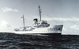
USC&GS <i>Explorer</i> (OSS 28)

The second USC&GS Explorer was a survey ship that served in the United States Coast and Geodetic Survey from 1940 to 1968. She operated in the Pacific Ocean from 1940 to 1960, seeing service there during World War II, and in the Atlantic Ocean from 1960 to 1968.

<span class="mw-page-title-main">Raymond Stanton Patton</span>

Rear Admiral Raymond Stanton Patton was the second Director of the United States Coast and Geodetic Survey and a career officer in the United States Coast and Geodetic Survey Corps, the predecessor of the National Oceanic and Atmospheric Administration Commissioned Officer Corps. He was the first Coast and Geodetic Survey Corps officer to reach flag rank.

<span class="mw-page-title-main">Robert Francis Anthony Studds</span> NOAA admiral

Rear Admiral Robert Francis Anthony Studds was a career officer in the United States Coast and Geodetic Survey Corps, predecessor of the National Oceanic and Atmospheric Administration Commissioned Officer Corps. He served as the fourth Director of the United States Coast and Geodetic Survey.

USS <i>Helianthus</i> Patrol vessel of the United States Navy

USS Helianthus (SP-585) was a patrol vessel in commission in the United States Navy from 1917 to 1919, seeing service in World War I. After her U.S. Navy service, she was in commission in the United States Coast and Geodetic Survey as the survey launch USC&GS Helianthus from 1919 to 1939. She was named after the Helianthus, the genus to which the sunflower belongs.

References

  1. United States Philippine Commission (June 21, 1901). "Act No. 143". Legislation. Retrieved 9 March 2012.
  2. U.S. Government (1901). Annual Report of the Secretary of Commerce, for the Fiscal Year Ended June 30, 1901. Washington: Government Printing Office. p. 188.
  3. NOAA. "Photo Caption: The S.S. Research was the first survey vessel in operation in the Philippines". NOAA Photo Library. National Oceanic & Atmospheric Administration (NOAA). Retrieved 15 January 2012.
  4. "Steamer Research". Report of the Philippine Commission to the Secretary of War. Washington, D.C.: Government Printing Office: 248. 1902. Retrieved 5 November 2018.
  5. U.S. Coast and Geodetic Survey (1910). Report Of The Superintendent Of The Coast And Geodetic Survey Showing The Progress Of The Work From July 1, 1909 To June 30, 1910. Washington, D.C.: U.S. Government Printing Office. p. 48.
  6. Lieutenant Commander Richard R. Lukens, United States Coast and Geodetic Survey (1931). "Surveying The Philippine Islands". NOAA History. National Oceanic & Atmospheric Administration (NOAA). Retrieved 29 January 2012.
  7. Forty-Seventh Annual List of Merchant Vessels of the United States, Year ended June 30, 1915. Washington, D.C.: Department of Commerce and Labor, Bureau of Navigation. 1915. p. 464. Retrieved 5 November 2018.
  8. 1 2 United States Philippine Commission (1902). Third Annual Report of the Philippine Commission-1902-Part I. p. 248. Retrieved 9 March 2012.
  9. U.S. Government (1902). Annual Report of the Secretary of Commerce, for the Fiscal Year Ended June 30, 1902. Washington: Government Printing Office. pp. 168–170.
  10. U.S. Coast and Geodetic Survey (1903). Report Of The Superintendent Of The Coast And Geodetic Survey Showing The Progress Of The Work From July 1, 1902 To June 30, 1903. Washington, D.C.: U.S. Government Printing Office. pp. 124–125.
  11. U.S. Government (1914). Annual Report of the Superintendent, United States Coast And Geodetic Survey To The Secretary of Commerce For The Fiscal Year Ended June 30, 1914. Washington: Government Printing Office. pp. 76–78.
  12. U.S. Government (1915). Annual Report of the Superintendent, United States Coast And Geodetic Survey To The Secretary of Commerce For The Fiscal Year Ended June 30, 1915. Washington: Government Printing Office. pp. 116–118.
  13. U.S. Government (1918). Annual Report of the Superintendent, United States Coast And Geodetic Survey To The Secretary of Commerce For The Fiscal Year Ended June 30, 1918. Washington: Government Printing Office. p. 112.
  14. Governor General of the Philippine Islands (1919). Report of the Governor General of the Philippine Islands to the Secretary of War 1918 (January 1, 1918 to December 31, 1918). p. 91. Retrieved 9 March 2012.
  15. U.S. Government (1941). Annual Report of the Secretary of Commerce, for the Fiscal Year Ended June 30, 1941. Washington: Government Printing Office. p. 124.