USC&GS Drift

Last updated
History
US flag 37 stars.svgUnited States
NameUSC&GS Drift Lightship LV-97
Launched1876
FateRetired 1918 after 22 years as the lightship LV-97, Sold April 27, 1920. Renamed W. J. Townsend, scrapped in 1945.
General characteristics
Tonnage87 tons
Length76 ft 0 in (23.16 m)
Beam19 ft 6 in (5.94 m)
Draught10 ft 8 in (3.25 m)
Propulsionschooner
Complement5 officers, 14 men (1893) [1]

USC&GS Drift was a United States Coast Survey schooner built in 1876 specifically to anchor in offshore waters to undertake current measurements. She was transferred to the United States Lighthouse Board on May 20, 1893 to become the lightship Light Vessel # 97 or (LV-97) on the Bush Bluff station until retirement and sale in 1918 to become the W. J. Townsend which was scrapped in 1945. [2]

Contents

Construction

The Coast Survey had recognized that current information had been lacking in publications but had been hindered by both lack of funding and risks associated with mooring vessels in deep waters or along dangerous coasts in order to collect the information. Congress specifically appropriated funding for such work in the 1875-1876 budget under which the 76 foot schooner Drift was constructed explicitly for this purpose. [3] She was a schooner, 76 ft 0 in (23.16 m) in length with a beam of 19 ft 6 in (5.94 m) and draft of 10 ft 8 in (3.25 m). [4]

Service history

Drift was first sent out in June 1876 under Acting Master Robert Platt, USN, Assistant Coast Survey, to the Gulf of Maine to anchor in depths of up to 140 fathoms (840 feet/256 meters) to measure currents. The value of such measurements became immediately obvious as the Drift took advantage of her own observations in sailing and in a cited incident observed another ship struggling while she used currents effectively. During October–November the ship attempted further work but anchoring and effective measurements were obstructed by weather so the vessel returned to New York at the end of November. During this season, and subsequent work in the area the presence and location of tide rips was noted. There, while undertaking some hydrographic investigations in the entrance to New York harbor Drift was slightly damaged in a winter "hurricane" with temperature at 10°F (-12°C) during which she had to be towed away from the shore by two tugs. The report of the incident noted three other schooners and a steamboat were "thrown on the beach by the hurricane." After refit the Drift returned to the Gulf of Maine for current measurements. [3] The schooner continued to occupy stations between Cape Sable and Nantucket observing currents and tide rips as well as incidental hydrography. Also noted as observed was "what seemed to be a very large round spar projecting twelve to fifteen feet out of the sea" that appeared on one side and then the other of the vessel while becalmed off Race Point, Cape Cod and "near it an object having the form of an enormous dorsal fin" that was observed with "good glasses." It was noted that none could say it was a creature, yet all on board agreed no "floating wreck was anywhere in sight." [5]

Drift next began work in late February, 1879, off the Mississippi River Delta in the Gulf of Mexico. Both current and temperatures were observed at depths of 2 fathoms (3.7 m), 5 fathoms (9.1 m), 10 fathoms (18 m), 20 fathoms (37 m), 30 fathoms (55 m), 45 fathoms (82 m), 80 fathoms (150 m) and 90 fathoms (160 m) depending on depths at the stations. The ship made 497 temperature observations and 2,131 current measurements at thirteen stations before return to New York in late May of 1879. By this time other ships were studying currents, particularly the Blake and Bache with reference to the Gulf Stream. [5] There is no mention of the ship in the fiscal year 1880 report and the report for fiscal year 1881 notes she, along with others, have been laid up for want of means with Drift at Brooklyn, New York. [6]

With the summer of 1882 Drift began preparing in New York for work in Long Island Sound until October when she shifted for current observations to the entrance to Chesapeake Bay and then southward at Cape Hatteras, Cape Fear and Cape Lookout and then with stations in Florida at Cape Florida and Jupiter Inlet where she made a 24-hour current observation in the Stream while anchored in 200 fathoms (370 m). [7]

After a late return from southern work in 1883 the ship was put to summer work in surveys of the bar at New York harbor entrance. This work apparently continued into 1884. [8] The last mention of active survey by Drift is work in summer and fall of 1885 in the East River during multi-ship work in New York harbor. [9]

In summer of 1887 the ship was loaned to New York for oyster bed surveys. The steamer Arago had been offered, but the expense of operating a steamer was too great for the state agency and Drift, out of commission for months and lying in a basin in the Navy Yard, was taken out, equipped and put to use. [10]

Drift, previously on loan to the Lighthouse Board and returned to the Survey for loan to the State of Virginia for oyster bed surveys during the summer of 1892, was towed by the steamer Blake leaving on December 2, 1892 from Norfolk, Virginia to the Washington Navy Yard where the Blake was to prepare for her trip to Chicago and the World's Columbian Exposition. On May 20, 1893 "she was again loaned to the Lighthouse Board for temporary use as a lightship"—a loan that appears to have been permanent. [1]

Transfer to United States Lighthouse Board

LV-97, Bush Bluff Lightship in 1914 LV-97 Bush Bluff Lightship.jpg
LV-97, Bush Bluff Lightship in 1914

After the May 20, 1893 transfer from Coast & Geodetic Survey to the United States Lighthouse Board (became United States Lighthouse Service, 1910) the ship become lightship LV-97 with a lantern lit with 8 oil lamps with reflectors. The light was converted to a 30 candle power electric light powered by batteries taken ashore for recharging with a revolving reflector in 1913 that produced a flash rated at 80,000 candle power and was said to be the first such system in the world. In 1915 this light was replaced with an oil/gas conventional lens lantern. [11] [12]

Stations for the vessel from date of transfer until 1895 and a permanent station include marking Wolf Trap shoal from December 10, 1893 until March 16, 1884 after a boiler explosion had disabled LV-46 on August 28, 1893 and that vessel was withdrawn for repair. [12] [13] The lightship was permanently stationed marking Bush Bluff shoal located in the Elizabeth River in Hampton Roads [14] from 1895-1918 with a brief break 1911/1912 when the ship was replaced by a lighted buoy. LV-97 was temporarily used at other locations in the lower Chesapeake Bay. She was retired in 1918 after twenty-two years as a lightship, condemned, laid up in January 1918 and sold for $150 April 27, 1920. [2] [11]

Private ownership

The new owner installed power propulsion and renamed the ship W. J. Townsend which was scrapped in 1945. [2]

    Related Research Articles

    <span class="mw-page-title-main">Lightvessel</span> Ship that acts as a lighthouse

    A lightvessel, or lightship, is a ship that acts as a lighthouse. They are used in waters that are too deep or otherwise unsuitable for lighthouse construction. Although some records exist of fire beacons being placed on ships in Roman times, the first modern lightvessel was off the Nore sandbank at the mouth of the River Thames in London, England, placed there by its inventor Robert Hamblin in 1734. The type has become largely obsolete; lighthouses replaced some stations as the construction techniques for lighthouses advanced, while large, automated buoys replaced others.

    United States lightship <i>Swiftsure</i> (LV-83)

    Light Vessel Number 83 (LV-83) Swiftsure is a lightship and museum ship owned by Northwest Seaport in Seattle, Washington. Launched in 1904 at Camden, New Jersey and in active service until 1960 after serving on all five of the American west coast's lightship stations, it is the oldest surviving lightship in the United States, the only one still fitted with its original steam engine, and the last lightship with wooden decks. LV-83 was designated a National Historic Landmark in 1989, and has been undergoing major restoration since 2008.

    <span class="mw-page-title-main">United States Coast and Geodetic Survey</span> Former U.S. government scientific agency

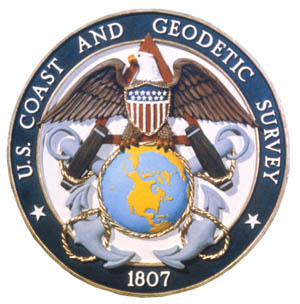
    The United States Coast and Geodetic Survey, known from 1807 to 1836 as the Survey of the Coast and from 1836 until 1878 as the United States Coast Survey, was the first scientific agency of the United States Government. It existed from 1807 to 1970, and throughout its history was responsible for mapping and charting the coast of the United States, and later the coasts of U.S. territories. In 1871, it gained the additional responsibility of surveying the interior of the United States and geodesy became a more important part of its work, leading to it being renamed the U.S. Coast and Geodetic Survey in 1878.

    USC&GS Silliman was a ship of the United States Coast Survey and later the United States Coast and Geodetic Survey named for Benjamin Silliman. She was a schooner built by Fardy and Woodall at Baltimore, Maryland, in 1871. She spent the period between 1871 and 1887 on the Atlantic coast. She was briefly commanded in 1879 by future rear admiral Uriel Sebree.

    USC&GS <i>A. D. Bache</i> (1901)

    USC&GS A. D. Bache (1901-1927), often referred to only as Bache, continued the name of the Bache of 1871 and has been confused, including in the Dictionary of American Naval Fighting Ships, with that ship even though an entirely new hull and boiler were built in 1901 and only the name and some machinery and instruments were transferred to the new hull. The Bache of 1901 was transferred to the U.S. Navy for World War I service between 24 September 1917 through 21 June 1919 when she was returned to the Coast and Geodetic Survey.

    United States lightship <i>LV-117</i> Lightvessel, sunk 1934

    USC&GS Arago was a survey ship that served in the United States Coast Survey from 1854 to 1878 and in the United States Coast and Geodetic Survey from 1878 to 1881. From October 1861 into 1863 Arago was at times attached to the Navy's South Atlantic Blockading Squadron off South Carolina to provide hydrographic support. She was the first ship of the Coast Survey or Coast and Geodetic Survey to bear the name.

    USC&GS <i>Natoma</i> Patrol vessel of the United States Navy

    USC&GS Natoma was built as the private motorboat Natoma in 1913 for Charles H. Foster, President of the Cadillac Motor Car Company of Chicago. In 1917 the United States Navy acquired the boat for use in World War I. The vessel was commissioned USS Natoma for Section Patrol duties and designated SP-666. Natoma spent the war years patrolling New York harbor and approaches. On 9 April 1919 the boat was transferred to United States Coast and Geodetic Survey surveying on both coasts until 1935.

    USC&GS <i>Fathomer</i> (1904) American geodetic survey ship (1905–1942)

    The second USC&GS Fathomer was a steamer that served as a survey ship in the United States Coast and Geodetic Survey from 1905 to 1942.

    USC&GS <i>Marinduque</i>

    USC&GS Marinduque was a steamer, owned by the Philippine Insular Government, that served exclusively in the Philippines. The ship was purchased by the Philippine Bureau of Coast Guard and Transportation to support both government logistical and administrative travel needs as well as the usual functions of a coast guard vessel. The vessel was transferred to the United States Coast and Geodetic Survey serving as a survey ship from 1905 to 1932. Marinduque and Romblon were sister ships, both built in Japan.

    USC&GS <i>Romblon</i>

    USC&GS Romblon was a steamer, owned by the Philippine Insular Government, that served exclusively in the Philippines. The ship was purchased by the Philippine Bureau of Coast Guard and Transportation to support both government logistical and administrative travel needs as well as the usual functions of a coast guard vessel. The vessel was transferred to the United States Coast and Geodetic Survey serving as a survey ship from 1905 to 1932. Romblon and Marinduque were sister ships, both built in Japan.

    USC&GSS <i>Research</i>

    USC&GSS Research was a survey vessel owned by the Philippine Insular Government to be the first vessel operated by the United States Coast and Geodetic Survey in the Philippines from 1901 until 1918.

    USC&GSS <i>Pathfinder</i>

    The first USC&GSS Pathfinder, also noted in some NOAA histories as "old Pathfinder", was a United States Coast and Geodetic Survey ship in service from 1899 to 1941, when she was beached in sinking condition on January 30, 1942, after 40 years service in the Philippines.

    <span class="mw-page-title-main">Blake Plateau</span> Plateau in the Atlantic Ocean

    The Blake Plateau lies in the western Atlantic Ocean off the coasts of North Carolina, South Carolina, Georgia, and Florida in the southeastern United States. The Blake Plateau lies between the North American continental shelf and the deep ocean basin extending about 145 kilometers east and west by 170 kilometers north and south, with a depth of about 500 meters inshore sloping to about 1,000 meters about 375 kilometers off shore, where the Blake Escarpment drops steeply to the deep basin. The Blake Plateau and the associated Blake Ridge and Blake Basin are named for the United States Coast and Geodetic Survey steamer USC&GS George S. Blake, in service from 1874 to 1905, which was the first ship to use steel cable for oceanographic operations and pioneered deep ocean and Gulf Stream exploration. George S. Blake′s hydrographic survey lines first defined the plateau that now bears the ship's name.

    USC&GS <i>George S. Blake</i>

    USC&GS George S. Blake, in service 1874–1905, is, with the U.S. Fish Commission steamer Albatross, one of only two US oceanographic vessels with her name inscribed in the façade of the Oceanographic Museum, Monaco due to her being "the most innovative oceanographic vessel of the Nineteenth Century" with development of deep ocean exploration through introduction of steel cable for sounding, dredging and deep anchoring and data collection for the "first truly modern bathymetric map of a deep sea area."

    USC&GS <i>A. D. Bache</i> (1871)

    USC&GS A. D. Bache, the second steamer of the United States Coast and Geodetic Survey, was named for Alexander Dallas Bache, a former superintendent of the Survey. She was launched in August 1871 at Wilmington, Delaware, and was in commission from 1871 to 1900.

    USS <i>Onward</i> (SP-311) Patrol vessel of the United States Navy

    USS Onward (SP-311), a former yacht named Galatea and then Ungava was a patrol yacht acquired by the U.S. Navy during World War I. She was transferred to the United States Coast and Geodetic Survey where she served briefly until return to the Navy for a brief time before her disposal by sale. She was renamed Thelma Phoebe.

    USC&GS <i>Explorer</i> (1904)

    The first USC&GS Explorer was a steamer that served as a survey ship in the United States Coast and Geodetic Survey from 1904 to 1939 except for a brief time in United States Navy service from 1918 to 1919 for patrol duty in Alaskan waters as USS Explorer during World War I. After initial service along the United States East Coast and off Puerto Rico, the ship transferred to Seattle, Washington in 1907 to begin survey work in Alaskan waters during summer and more southern waters along the United States West Coast in winter. On her return from the Navy in 1919, the ship was condemned and due to be sold but instead was retained as a survey vessel into the fall of 1939. After a stint with the National Youth Administration from 1939 to 1941, she saw service during World War II with the United States Army Corps of Engineers as the freight and supply ship Atkins.

    USFC <i>Grampus</i> U.S. fisheries research ship

    USFC Grampus was a fisheries research ship in commission in the fleet of the United States Commission of Fish and Fisheries, usually called the United States Fish Commission, from 1886 to 1903 and then as USFS Grampus in the fleet of its successor, the United States Bureau of Fisheries, until 1917. She was a schooner of revolutionary design in terms of speed and safety and influenced the construction of later commercial fishing schooners.

    Five Fathom Bank light station was a station for lightvessels in New Jersey, United States. It was located off the south end of Five Fathom Bank, 14.7 miles and 100 degrees from the Cape May Lighthouse. The station was in service from 1837 to 1972 before ultimately being replaced by a horn buoy.

    References

    1. 1 2 U.S. Coast and Geodetic Survey (1893). Report Of The Superintendent of the Coast And Geodetic Survey Showing The Progress Of The Work During The Fiscal Year Ending With June 1893. Washington, D.C.: U.S. Government Printing Office. pp. 125, 129, 133 (complement).
    2. 1 2 3 U.S. Coast Guard. "Drift, 1894". U.S. Coast Guard Cutter History. U.S. Coast Guard. Retrieved 4 March 2012.
    3. 1 2 U.S. Coast and Geodetic Survey (1877). Report Of The Superintendent of the Coast And Geodetic Survey Showing The Progress Of The Work for the Fiscal Year Ending With June, 1877. Washington, D.C.: U.S. Government Printing Office. p. 9.
    4. U.S. Coast and Geodetic Survey (1899). Report Of The Superintendent of the Coast And Geodetic Survey Showing The Progress Of Work From July 1, 1898 To June 30, 1899. Washington, D.C.: U.S. Government Printing Office. pp. 231–232.
    5. 1 2 U.S. Coast and Geodetic Survey (1879). Report Of The Superintendent of the Coast And Geodetic Survey Showing The Progress Of The Work for the Fiscal Year Ending With June, 1879. Washington, D.C.: U.S. Government Printing Office. pp. 2, 19–20, 41.
    6. U.S. Coast and Geodetic Survey (1881). Report Of The Superintendent of the Coast And Geodetic Survey Showing The Progress Of The Work for the Fiscal Year Ending With June, 1881. Washington, D.C.: U.S. Government Printing Office. p. 65.
    7. U.S. Coast and Geodetic Survey (1882). Report Of The Superintendent of the Coast And Geodetic Survey Showing The Progress Of The Work for the Fiscal Year Ending With June, 1882. Washington, D.C.: U.S. Government Printing Office.
    8. U.S. Coast and Geodetic Survey (1885). Report Of The Superintendent of the Coast And Geodetic Survey Showing The Progress Of The Work During The Fiscal Year Ending With June 1885. Washington, D.C.: U.S. Government Printing Office. p. 118.
    9. U.S. Coast and Geodetic Survey (1886). Report Of The Superintendent of the Coast And Geodetic Survey Showing The Progress Of The Work During The Fiscal Year Ending With June 1886. Washington, D.C.: U.S. Government Printing Office. p. 141.
    10. Blackford, Eugene G. Commissioner Of Fisheries (1888). Report Of The Oyster Investigation And Shell-Fish Commission, For The Year Ending November 30th, 1887, Transmitted To The Legislature January 23, 1888. New York (State). Commissioners of Fisheries. pp.  17–18. Retrieved 8 March 2012.
    11. 1 2 U.S. Coast Guard. "VESSEL DESIGNATION: LV 97". U.S. Coast Guard Lightships & Those of the U.S. Lighthouse Service. U.S. Coast Guard. Retrieved 3 March 2012.
    12. 1 2 Kirklin, Wayne (2007). Lightships: Floating Lighthouses of the Mid Atlantic Coast. Charleston, South Carolina: The History Press. pp. 33, 39. ISBN   9781596293502 . Retrieved 9 March 2012.
    13. United States. Light-House Board (1893). Annual report of the Light-House Board of the United States to the Secretary of the Treasury for the Fiscal Year Ended June 30, 1893. Treasury Department, Office of Light-House Board. p. 102. Retrieved 9 March 2012.
    14. "Bush Bluff, Virginia". Lightship Stations... and the ships that served on them. United States Coast Guard Lightship Sailors Association INC. Retrieved 3 March 2012.