
Ust-Orda Buryat Okrug, or Ust-Orda Buryatia, is an administrative division of Irkutsk Oblast, Russia. It was a federal subject of Russia from 1993 to January 1, 2008, when it merged with Irkutsk Oblast. It also had autonomous okrug status from September 26, 1937 to 1993. Prior to the merger, it was called Ust-Orda Buryat Autonomous Okrug.

Agin-Buryat Okrug, or Aga Buryatia, is an administrative division of Zabaykalsky Krai, Russia. It was a federal subject of Russia until it merged with Chita Oblast to form Zabaykalsky Krai on March 1, 2008. Prior to the merger, it was called Agin-Buryat Autonomous Okrug. Its administrative center is the urban-type settlement of Aginskoye.

Listvyanka is an urban locality in Irkutsky District of Irkutsk Oblast, Russia, located 70 kilometres (43 mi) from Irkutsk, near the point where the Angara River leaves Lake Baikal. Population: 1,882 (2010 Census); 1,745 (2002 Census); 2,379 (1989 Census).
Ust-Charyshskaya Pristan is a rural locality, founded in 1773, and the administrative center of Ust-Pristansky District of Altai Krai, Russia, located along the Ob River in the West Siberian Plain, 155 kilometers (96 mi) south of Barnaul. Population: 5,023 (2010 Census); 5,692 (2002 Census); 6,510 (1989 Census).

Bokhansky District is an administrative district of Ust-Orda Buryat Okrug of Irkutsk Oblast, Russia, one of the thirty-three in the oblast. Municipally, it is incorporated as Bokhansky Municipal District. It is located in the south of the oblast. The area of the district is 3,700 square kilometers (1,400 sq mi). Its administrative center is the rural locality of Bokhan. Population: 25,398 (2010 Census); 26,897 ; 26,722 (1989 Census). The population of Bokhan accounts for 20.4% of the district's total population.

Alarsky District is an administrative district of Ust-Orda Buryat Okrug of Irkutsk Oblast, Russia, one of the thirty-three in the oblast. Municipally, it is incorporated as Alarsky Municipal District. It is located in the south of the oblast. The area of the district is 2,700 square kilometers (1,000 sq mi). Its administrative center is the rural locality of Kutulik. As of the 2010 Census, the total population of the district was 21,479, with the population of Kutulik accounting for 22.7% of that number.
Bayandayevsky District is an administrative district of Ust-Orda Buryat Okrug of Irkutsk Oblast, Russia, one of the thirty-three in the oblast. Municipally, it is incorporated as Bayandayevsky Municipal District. It is located in the south of the oblast. The area of the district is 3,756.2 square kilometers (1,450.3 sq mi). Its administrative center is the rural locality of Bayanday. Population: 11,529 (2010 Census); 13,730 ; 14,808 (1989 Census). The population of Bayanday accounts for 23.2% of the district's total population.

Ekhirit-Bulagatsky District is an administrative district of Ust-Orda Buryat Okrug of Irkutsk Oblast, Russia, one of the thirty-three in the oblast. Municipally, it is incorporated as Ekhirit-Bulagatsky Municipal District. It is located in the south of the oblast. The area of the district is 5,200 square kilometers (2,000 sq mi). Its administrative center is the rural locality of Ust-Ordynsky. As of the 2010 Census, the total population of the district was 30,597, with the population of Ust-Ordynsky accounting for 48.7% of that number.

Nukutsky District is an administrative district of Ust-Orda Buryat Okrug of Irkutsk Oblast, Russia, one of the thirty-three in the oblast. Municipally, it is incorporated as Nukutsky Municipal District. It is located in the south of the oblast. The area of the district is 2,400 square kilometers (930 sq mi). Its administrative center is the rural locality of Novonukutsky. Population: 15,743 (2010 Census); 17,209 ; 17,110 (1989 Census). The population of Novo-Nukutsky accounts for 21.8% of the district's total population.
Osinsky District is an administrative district of Ust-Orda Buryat Okrug of Irkutsk Oblast, Russia, one of the thirty-three in the oblast. Municipally, it is incorporated as Osinsky Municipal District. It is located in the south of the oblast. The area of the district is 4,400 square kilometers (1,700 sq mi). Its administrative center is the rural locality of Osa. Population: 20,431 (2010 Census); 20,962 ; 20,668 (1989 Census). The population of Osa accounts for 22.1% of the district's total population.

Barguzin is a rural locality and the administrative center of Barguzinsky District in the Republic of Buryatia, Russia, located on the left bank of the Barguzin River at the southern end of the Barguzin Valley. Barguzin lies at an elevation of 491 meters (1,611 ft) and is 240 kilometers (150 mi) from Ulan-Ude. Population: 5,702 (2010 Census); 6,164 (2002 Census); 6,151 (1989 Census).
Kutulik is a rural locality and the administrative center of Alarsky District of Ust-Orda Buryat Okrug, Irkutsk Oblast, Russia. Population: 4,884 (2010 Census); 5,429 (2002 Census); 5,213 (1989 Census).
Ust-Uda is an urban locality in Ust-Udinsky District of Irkutsk Oblast, Russia. Population: 5,173 (2010 Census); 5,307 (2002 Census); 5,190 (1989 Census).
Kuytun is an urban locality in Kuytunsky District of Irkutsk Oblast, Russia. Population: 10,097 (2010 Census); 10,847 (2002 Census); 11,137 (1989 Census).
Zalari is an urban locality in Zalarinsky District of Irkutsk Oblast, Russia. Population: 9,600 (2010 Census); 10,041 (2002 Census); 10,693 (1989 Census).
Zvyozdny is an urban locality in Ust-Kutsky District of Irkutsk Oblast, Russia. Population: 957 (2010 Census); 1,228 (2002 Census); 2,894 (1989 Census).
Zheleznodorozhny is an urban locality in Ust-Ilimsky District of Irkutsk Oblast, Russia. Population: 7,032 (2010 Census); 7,832 (2002 Census); 9,095 (1989 Census).
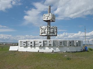
Bayanday is a rural locality and the administrative center of Bayandayevsky District of Ust-Orda Buryat Okrug, Irkutsk Oblast, Russia. Population: 2,672 (2010 Census); 2,874 (2002 Census); 3,383 (1989 Census).
Bokhan is a rural locality and the administrative center of Bokhansky District of Ust-Orda Buryat Okrug, Irkutsk Oblast, Russia. Population: 5,169 (2010 Census); 5,425 (2002 Census); 5,040 (1989 Census).
Novonukutsky is a rural locality and the administrative center of Nukutsky District of Ust-Orda Buryat Okrug, Irkutsk Oblast, Russia. Population: 3,434 (2010 Census); 3,143 (2002 Census); 3,207 (1989 Census).


