
The Appian Way is one of the earliest and strategically most important Roman roads of the ancient republic. It connected Rome to Brindisi, in southeast Italy. Its importance is indicated by its common name, recorded by Statius, of Appia longarum... regina viarum . The road is named after Appius Claudius Caecus, the Roman censor who began and completed the first section as a military road to the south in 312 BC during the Samnite Wars.
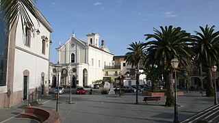
Capua is a city and comune in the province of Caserta, in the region of Campania, southern Italy, situated 25 km (16 mi) north of Naples, on the northeastern edge of the Campanian plain.
The province of Caserta is a province in the Campania region of southern Italy. Its capital is the city of Caserta, situated about 36 kilometres (22 mi) by road north of Naples. The province has an area of 2,651.35 square kilometres (1,023.69 sq mi), and had a total population of 924,414 in 2016. The Palace of Caserta is located near to the city, a former royal residence which was constructed for the Bourbon kings of Naples. It was the largest palace and one of the largest buildings erected in Europe during the 18th century. In 1997, the palace was designated a UNESCO World Heritage Site.

The Via Latina was a Roman road of Italy, running southeast from Rome for about 200 kilometers.

Teano is a town and comune in the province of Caserta, Campania, southern Italy, 30 kilometres (19 mi) northwest of Caserta on the main line to Rome from Naples. It stands at the southeast foot of an extinct volcano, Rocca Monfina. Its St. Clement's cathedral is the see of the Roman Catholic Diocese of Teano-Calvi, which started as the Diocese of Teano circa AD 300.
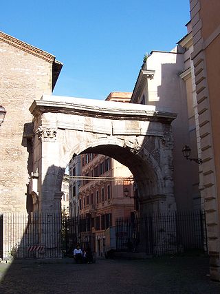
The Via Labicana was an ancient road of Italy, leading east-southeast from Rome. It seems possible that the road at first led to Tusculum, that it was then extended to Labici, and later still became a road for through traffic; it may even have superseded the Via Latina as a route to the southeast, for, while the distance from Rome to their main junction at Ad Bivium is practically identical, the summit level of the former is 22 metres (72 ft) lower than that of the latter, a little to the west of the pass of Mount Algidus. After their junction it is probable that the road bore the name Via Latina rather than Via Labicana. The course of the road after the first six miles from Rome is not identical with that of any modern road, but can be clearly traced by remains of pavement and buildings along its course.

Caserta is the capital of the province of Caserta in the Campania region of Italy. An important agricultural, commercial, and industrial comune and city, Caserta is located 36 Kilometers north of Naples on the edge of the Campanian plain at the foot of the Campanian Subapennine mountain range. The city is best known for the 18th-century Bourbon Royal Palace of Caserta.
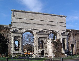
The Porta Maggiore, or Porta Prenestina, is one of the eastern gates in the ancient but well-preserved 3rd-century Aurelian Walls of Rome. Through the gate ran two ancient roads: the Via Praenestina and the Via Labicana. The Via Prenestina was the eastern road to the ancient town of Praeneste. The Via Labicana heads southeast from the city.

The First Battle of Capua was fought in 212 BC between Hannibal and two Roman consular armies. The Roman force was led by two consuls, Quintus Fulvius Flaccus and Appius Claudius Pulcher. The Roman force was defeated, but managed to escape. Hannibal temporarily managed to raise the siege of Capua. A tactical Carthaginian victory, it ultimately did not help the Capuans.
Casilinum was an ancient city of Campania, Italy, situated some 3 miles north-west of the ancient Capua. The position of Casilinum at the junction of the Via Appia and Via Latina, at their crossing of the river Volturnus by a still-existing three-arched bridge, gave the town considerable strategic importance during the Roman Republic.

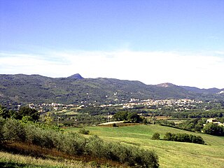
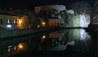
Alife is a town and comune in the Province of Caserta (Campania), Italy. It is located in the Volturno valley, and is a flourishing centre of agricultural production. The comune was formerly inhabited by Arbëreshë and Jewish communities, who have since assimilated.

Santa Maria Capua Vetere is a town and comune in the province of Caserta, in the region of Campania, in southern Italy.
Terra di Lavoro is the name of a historical region of Southern Italy. It corresponds roughly to the modern southern Lazio and northern Campania and upper north west and west border area of Molise regions of Italy.
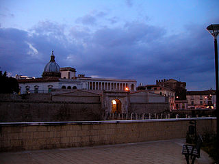
Calvi Risorta is a comune (municipality) and former bishopric in the Province of Caserta in the Italian region Campania, located across the Via Casilina about 40 kilometres (25 mi) northwest of Naples and about 25 kilometres (16 mi) northwest of Caserta.
Castel Volturno is a comune (municipality) in the Province of Caserta in the Italian region Campania, located about 35 kilometres (22 mi) northwest of Naples and about 35 kilometres (22 mi) west of Caserta on the Volturno river. In 2010 Castel Volturno was inhabited by 25,000 locals and about 18,000 African refugees. Today (2019) there are still about 25,000 people, estimated two-thirds of them are immigrants.

Trebula or Trebula Balliensis or Trebula Baliensis, was an ancient city of Campania, Italy, the location of which is occupied by the modern village of Treglia in the comune of Pontelatone. The Monti Trebulani, a small mountain group in the modern province of Caserta, take their name from it.
Valle Latina is an Italian geographical and historical region that extends from the south of Rome to Cassino, corresponding to the eastern area of ancient Roman Latium.
The Rome–Cassino–Naples railway is a railway in Italy, the first of the three existing railway lines between the capitals of Latium and Campania to be opened when it was completed by the Società per le strade ferrate romane in 1863. The line is now fully electrified at 3 kV DC. It is now mainly used by regional trains, some trains to and from the Adriatic coast and a few night trains. The Rome–Naples high-speed railway line generally follows the same route.
The Campanians were an ancient Italic tribe, part of the Osci nation, speaking an Oscan language.

The Amphitheatre of Capua was a Roman amphitheatre in the city of Capua, second only to the Colosseum in size and probably the model for it. It may have been the first amphitheatre to be built by the Romans. and was the location of the first and most famous gladiator school.