
The York River is a navigable estuary, approximately 34 miles (55 km) long, in eastern Virginia in the United States. It ranges in width from 1 mile (1.6 km) at its head to 2.5 miles (4.0 km) near its mouth on the west side of Chesapeake Bay. Its watershed drains an area of the coastal plain of Virginia north and east of Richmond.

The Pamunkey River is a tributary of the York River, about 93 miles (150 km) long, in eastern Virginia in the United States. Via the York River it is part of the watershed of Chesapeake Bay.

Tuscarora Creek in Berkeley County, West Virginia is an 11.4-mile-long (18.3 km) tributary of Opequon Creek, which drains into the Potomac River in the Chesapeake Bay watershed.
The Hampton River is a 3.2-mile-long (5.1 km) tidal estuary which empties into Hampton Roads near its mouth. Hampton Roads in turn empties into the southern end of Chesapeake Bay, in southeast Virginia, United States. The Hampton River is located entirely within the city of Hampton.
Chuckatuck Creek is a 13.3-mile-long (21.4 km) tributary of the James River in the U.S. state of Virginia. The creek rises in Isle of Wight County and flows southeast to Chuckatuck in the city of Suffolk, where it turns northeast as it passes under State Route 10/State Route 32. Becoming tidal, the creek continues northeast to the mouth of Brewers Creek, where it broadens considerably and becomes the boundary between Isle of Wight County and the city of Suffolk. If proceeds under the Crittenden Bridge at Crittenden and reaches the James River at Batten Bay.
Fishtrap Lake is a 1,130-acre (5 km2) reservoir in Pike County, Kentucky. Dedicated by President Lyndon B. Johnson in 1968, the lake was formed by the impounding of the Levisa Fork of the Big Sandy River at the 195-foot-high Fishtrap Dam by the United States Army Corps of Engineers.
Dragon Swamp, also known as Dragon Run, is a 36.7-mile-long (59.1 km) stream in the U.S. state of Virginia, flowing through King and Queen, Essex, Middlesex, and Gloucester counties. It is the main freshwater tributary of the Piankatank River.
The Eastern Branch Elizabeth River is a 9.0-mile-long (14.5 km) tidal river in the Hampton Roads area of the U.S. state of Virginia. The river flows from east to west, starting in Virginia Beach. At its crossing by Interstate 64 it becomes the boundary between Virginia Beach and the city of Norfolk, and farther west it is the boundary between Norfolk and the city of Chesapeake. For its final 3 miles (5 km) it is entirely within the city of Norfolk.
The Harris River is a 2.5-mile-long (4.0 km) tidal river within the city of Hampton in the U.S. state of Virginia. It is a southerly arm of the Back River, an inlet of Chesapeake Bay.
The Little River is a 44.7-mile-long (71.9 km) river in Louisa and Hanover counties in the U.S. state of Virginia. It is a tributary of the North Anna River, and via the North Anna, Pamunkey, and York rivers is part of the Chesapeake Bay watershed.
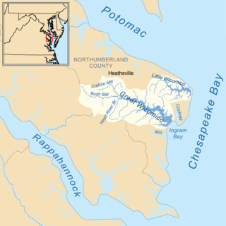
The Little Wicomico River is a 9-mile-long (14 km) river in the United States state of Virginia. The river, mostly tidal, flows into Chesapeake Bay at the junction of the south shore of the Potomac River, which is also the Maryland-Virginia boundary, with Chesapeake Bay.
The North River is a 7.6-mile-long (12.2 km) tidal river in the U.S. state of Virginia. It is an arm of Mobjack Bay, itself part of Chesapeake Bay. The North River forms the boundary between Mathews and Gloucester counties.
The Perrin River is a 1.3-mile-long (2.1 km) tidal river in the U.S. state of Virginia. It is a small inlet on the north shore of the York River near that river's mouth at Chesapeake Bay.
The Poropotank River is a 16.0-mile-long (25.7 km) river in the U.S. state of Virginia. It is a tributary of the York River and forms part of the boundary between King and Queen and Gloucester counties.
Sandy River is a 12.9-mile-long (20.8 km) tributary of the Bush River in the U.S. state of Virginia. Via the Bush River and the Appomattox River, it is part of the James River watershed. It rises in Prince Edward County northeast of the village of Green Bay and flow north through Prince Edward State Forest and farmland, joining the Bush River less than one mile south of that river's confluence with the Appomattox near the town of Farmville.
The Severn River is a 2-mile-long (3 km) tidal river in the United States state of Virginia. It is a tributary of Mobjack Bay, which is an arm of Chesapeake Bay.
The Southern Branch Elizabeth River is a 14.5-mile-long (23.3 km), primarily tidal river in the U.S. state of Virginia. It flows from south to north through the city of Chesapeake and forms the boundary between the cities of Portsmouth and Chesapeake for its northernmost 3 miles (5 km). It is a tributary of the Elizabeth River, connecting to the harbor of Hampton Roads to the north. It is part of the Intracoastal Waterway of the Atlantic coast of the United States, connecting by it to the North Landing River, which flows into North Carolina.
Flippos Corner is an unincorporated community in Caroline County, in the U.S. state of Virginia.
York River Pines is an unincorporated community in Gloucester County, in the U. S. state of Virginia.
Cedar Run is a 37.5-mile-long (60.4 km) tributary of the Occoquan River in the U.S. state of Virginia.


