Waterman Township, O'Brien County, Iowa

Last updated

Waterman Township is a township in O'Brien County, Iowa, USA. [1]

A township in the United States is a small geographic area.

OBrien County, Iowa County in the United States

O'Brien County is a county located in the U.S. state of Iowa. As of the 2010 census, the population was 14,398. The county seat is Primghar.

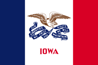
Iowa State of the United States of America

Iowa is a state in the Midwestern United States, bordered by the Mississippi River to the east and the Missouri River and Big Sioux River to the west. It is bordered by six states; Wisconsin to the northeast, Illinois to the east, Missouri to the south, Nebraska to the west, South Dakota to the northwest and Minnesota to the north.

History

Waterman Township was founded in 1869. It was named for Hannibal H. Waterman, a pioneer settler. [2]

Related Research Articles

Floyd Township is a township in O'Brien County, Iowa, USA.

Franklin Township is a township in O'Brien County, Iowa, USA.

Hartley Township is a township in O'Brien County, Iowa, USA.

Carroll Township is a township in O'Brien County, Iowa, USA.

Summit Township is a township in O'Brien County, Iowa, USA.

Center Township is a township in O'Brien County, Iowa, USA.

Omega Township is a township in O'Brien County, Iowa, USA.

Baker Township is a township in O'Brien County, Iowa, USA.

Dale Township is a township in O'Brien County, Iowa, USA.

Highland Township is a township in O'Brien County, Iowa, USA.

Grant Township is a township in O'Brien County, Iowa, USA.

Caledonia Township is a township in O'Brien County, Iowa in the United States.

Union Township is a township in O'Brien County, Iowa, USA.

Township is a township in O'Brien County, Iowa, USA.

Wilson Township is a township in Osceola County, Iowa, USA. The township is home to Hawkeye Point, the highest natural point in Iowa, at 1,670 ft.

Viola Township is a township in Osceola County, Iowa, USA. Viola Township is located on the Minnesota-Iowa border.

Gilman Township is a township in Osceola County, Iowa, USA. The city of Ashton is located in Gilman Township.

Baker Township is a township in Osceola County, Iowa, in the United States. The city of Melvin is located in Baker Township.

Harrison Township is a township in Osceola County, Iowa, USA. Harrison Township includes the unincorporated town of May City, Iowa. The Ocheyedan River flows through Harrison Township.

References

Coordinates: 42°57′11″N95°26′49″W / 42.953°N 95.447°W / 42.953; -95.447

Geographic coordinate system Coordinate system

A geographic coordinate system is a coordinate system that enables every location on Earth to be specified by a set of numbers, letters or symbols. The coordinates are often chosen such that one of the numbers represents a vertical position and two or three of the numbers represent a horizontal position; alternatively, a geographic position may be expressed in a combined three-dimensional Cartesian vector. A common choice of coordinates is latitude, longitude and elevation. To specify a location on a plane requires a map projection.