
Lafayette County, sometimes spelled La Fayette County, is a county located in the U.S. state of Wisconsin. It was part of the Wisconsin Territory at the time of its founding. As of the 2010 census, the population was 16,836. Its county seat is Darlington. The county was named in honor of the Marquis de Lafayette, the French general who rendered assistance to the Continental Army in the American Revolutionary War.
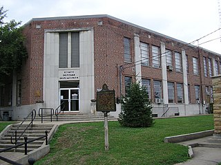
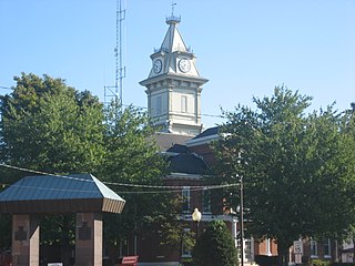
Wayne County is a county located in the U.S. state of Kentucky. As of the 2010 census, the population was 20,813. Its county seat is Monticello. The county was named for Gen. Anthony Wayne. It is a prohibition or dry county.

Union County is a county located in the U.S. state of Illinois. According to the 2010 United States Census, it had a population of 17,808. Its county seat is Jonesboro. It is located in the southern portion of Illinois known locally as "Little Egypt".

Franklin County is a county located in the U.S. state of Illinois. According to the 2010 census, it has a population of 39,561. Its county seat is Benton. It is located in the southern portion of Illinois known locally as "Little Egypt".
Edwards County is a county located in the U.S. state of Illinois. As of the 2010 census, the population was 6,721. Its county seat is Albion. It is located in the southern portion known locally as "Little Egypt".

Edgar County is a county located in the U.S. state of Illinois. As of the 2010 United States Census, the population was 18,576. Its county seat is Paris.

Wayne is a village in DuPage and Kane counties, Illinois, United States. The eastern portion, in DuPage County, is in Wayne Township, while the western portion, in Kane County, is in St. Charles Township. The population was 2,431 at the 2010 census. and 2,490 as a 2012-2016 five year population estimate with over 70% of families reporting income over $100,000 in census figures.

Crest Hill is a city in Lockport Township, Will County, Illinois, United States. The 2010 census put Crest Hill's population at 20,837.
Illinois Route 242 is a 18.67-mile (30.05 km) north–south state highway in southern Illinois that runs from Illinois Route 142 in McLeansboro north to Illinois Route 15 in Wayne City. The route serves as a spur of Illinois Route 142, which runs north–south from Mount Vernon to Equality. Route 242 also connects two east–west trunk routes, Illinois Route 14 and Illinois 15. Route 242 passes through the counties of Hamilton and Wayne. The highway is maintained by the Illinois Department of Transportation.

U.S. Route 30 (US 30) is a road in the United States Numbered Highway System that runs from Astoria, Oregon to Atlantic City, New Jersey. In Indiana, the route runs from the Illinois state line at Dyer to the Ohio state line east of Fort Wayne and New Haven. The 155.96 miles (250.99 km) of US 30 that lie within Indiana serve as a major conduit. The entire length of U.S. Route 30 in Indiana is included in the National Highway System (NHS). The highway includes four-lane, rural sections, an urbanized, four-lane divided expressway, and several high-traffic, six-lane areas. First designated as a US Highway in 1926, US 30 replaced the original State Road 2 (SR 2) and SR 44 designation of the highway which dated back to the formation of the Indiana State Road system. A section of the highway originally served as part of the Lincoln Highway. Realignment and construction projects have expanded the highway to four lanes across the state. There are over 40 traffic signals between I-65 at Merrillville and I-69 at Fort Wayne.

The 14th congressional district of Illinois is currently represented by Democrat Lauren Underwood.
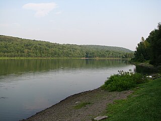
Prompton State Park is a Pennsylvania state park on 2,000 acres (809 ha) in Clinton and Dyberry Townships, Wayne County, Pennsylvania in the United States. This park, which was established in 1962, is officially listed by the Pennsylvania Department of Conservation and Natural Resources as being undeveloped. This means that it is officially a state park but the PA-DCNR is not currently managing the park. However, the lands of the park are open to visitors. Friends of Prompton State Park, a grassroots organization is working to take over management of the park in much the same way that Salt Springs State Park in Susquehanna County is managed by The Friends of Salt Springs Park. Northeast Sports Ltd. of Honesdale sponsors several outdoor sports events that are held at the park. Prompton State Park is 4.2 miles (6.8 km) west of Honesdale on Pennsylvania Route 170.

The 15th Congressional District of Illinois is located in eastern and southeastern Illinois. Republican John Shimkus represents the district.

Big Foot Prairie is an unincorporated community in both McHenry County, Illinois and Walworth County, Wisconsin, United States. The Illinois portion of the community, which is larger, is located in Chemung Township, while the Wisconsin portion is located in the Town of Walworth. Big Foot Prairie is located on U.S. Route 14, 5 miles (8.0 km) north of Harvard.
Plum Hill is an unincorporated community in Plum Hill Township, Washington County, Illinois, United States. Plum Hill is located along Illinois Route 15, 7.1 miles (11.4 km) west-northwest of Nashville.
Monaville is an unincorporated community in Lake Villa Township, Lake County, Illinois, United States. Monaville is located at the junction of County Routes 18A and 65V near the southern border of Lake Villa.
West Miltmore is an unincorporated community in Lake Villa Township, Lake County, Illinois, United States. West Miltmore is located on County Route 18A near the northern border of Round Lake Beach.
Pyramid is an unincorporated community in Ashley Township, Washington County, Illinois, United States. The community is located at the junction of U.S. Route 51 and Illinois Route 15. It was once the site of the Egyptian Bus Company, which was later bought by Greyhound.


