Bosnia and Herzegovina is located in Southeastern Europe. Situated in the western Balkans, it has a 932 km (579 mi) border with Croatia to the north and southwest, a 357 km (222 mi) border with Serbia to the east, and a 249 km (155 mi) border with Montenegro to the southeast. It borders the Adriatic Sea along its 20 km (12 mi) coastline.

Bosnia and Herzegovina has facilities for road, rail and air transport. There are five international road routes and 20 state highways, with bus connections to many countries. Railways total just over 1,000 km with links to Croatia and Serbia. There are 25 airports, seven of them with paved runways. The Sava River is navigable, but its use is limited.

The Posavina Canton is one of ten cantons of the Federation of Bosnia and Herzegovina in Bosnia and Herzegovina. It is the smallest canton with an area of only 330.85 km2 (128 sq mi). The canton is an exclave of Federation of Bosnia and Herzegovina, being bordered by Republika Srpska and Brčko District to the south and the river Sava and Croatia to the north. Its capital is Orašje and the largest town is Odžak.

The Sava is a river in Central and Southeast Europe, a right-bank and the longest tributary of the Danube. It flows through Slovenia, Croatia and along its border with Bosnia and Herzegovina, and finally through Serbia, feeding into the Danube in its capital, Belgrade. The Sava forms the main northern limit of the Balkan Peninsula, and the southern edge of the Pannonian Plain.

The Bosna is the third longest river in Bosnia and Herzegovina, and is considered one of the country's three major internal rivers, along with the Neretva and the Vrbas. The other three major rivers of Bosnia and Herzegovina are the Una, to the northwest; the Sava, to the north, and the Drina, to the east. This river is the namesake of Bosnia. The river Bosna flows for 282 kilometers (175 mi).

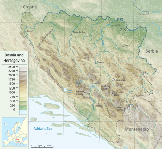
The Vrbas is a major river with a length of 250 kilometres (160 mi), in western Bosnia and Herzegovina. It is a right tributary of the Sava river. The city of Banja Luka is located on the river banks.

Šamac, formerly Bosanski Šamac is a town and municipality in Republika Srpska, Bosnia and Herzegovina. There are also small, uninhabited, parts located in the municipalities of Odžak and Domaljevac-Šamac, Federation of Bosnia and Herzegovina.

Gradiška, formerly Bosanska Gradiška, is a city in Republika Srpska, Bosnia and Herzegovina. As of 2013, it has a population of 51,727 inhabitants, while the city of Gradiška has a population of 14,368 inhabitants.
Bistrica or Bistrice, from Proto-Slavic *bystrъ 'quickly flowing, rushing', may refer to:
Slavonski Šamac is a village and municipality located on the river Sava in Croatia. It is located in Brod-Posavina county in the region of Slavonia. On the opposite side of the river lies the Bosnian town of Šamac. Slavonski Šamac is located on the D7 road, a part of the European route E73.

Odžak is a town and municipality located in Posavina Canton of the Federation of Bosnia and Herzegovina, an entity of Bosnia and Herzegovina. It is situated in the northern part of Bosnia and Herzegovina, near the river Sava, 10 km (6.2 mi) from the border with Croatia. The name is derived from Turkish Ocak, during its time as a frontier town of the Ottoman Empire, and means "fireplace" in Turkish and "chimney" in modern Bosnian.

Brod, formerly Bosanski Brod and Srpski Brod, is a town and municipality in Republika Srpska, Bosnia and Herzegovina. It is situated on the south bank of the river Sava, in the western part of the Posavina region. As of 2013, the town has a population of 7,637 inhabitants, while the municipality has a population of 16,619 inhabitants.

European route E73 forms part of the United Nations International E-road network, connecting Hungary and eastern Croatia to Bosnia and Herzegovina and the Adriatic Sea in the vicinity of the port of Ploče. This 679-kilometre (422 mi) route is also designated as the Pan-European Corridor Vc, a branch of the fifth Pan-European corridor. The route largely consists of two-lane roads with at-grade intersections, although in the 2000s, about a third of the route was upgraded to motorway standards. The remainder of the route is currently being upgraded in all the countries spanned. The longest part of this corridor goes through Bosnia and Herzegovina and is widely touted as a road instrumental to the development of the country. The road also serves as the shortest connection of the eastern and southern parts of Croatia.

Sremska Rača is a village located in the city of Sremska Mitrovica, Serbia. As of 2011 census, the village has a population of 624 inhabitants. A border crossing between Serbia and Bosnia and Herzegovina is located in the village.
Operation Corridor 92 was the largest operation conducted during the Bosnian War by the Army of Republika Srpska (VRS) against the forces of the Croatian Defence Council (HVO) and the Croatian Army (HV) in the Bosanska Posavina region of northern Bosnia and Herzegovina between 24 June and 6 October 1992. The objective of the offensive was to re-establish a road link between the city of Banja Luka in the west of the country and the eastern parts of the territory controlled by the Bosnian Serbs. The offensive was prompted by the capture of Derventa by the HV and the HVO – a move that blocked the single overland road between the VRS-controlled territories.
Brezovo Polje is a town in north-eastern Bosnia and Herzegovina and is located within the Brčko District.

Posavina is a geographical region that stretches along the Sava river, encompassing only the inner areas of the Sava river basin, that are adjacent or near to the Sava river itself, namely catch region spanning from the Julian Alps in the northwest to the confluence with the Danube in the southeast. It passes through several countries of former Yugoslavia, namely Slovenia, Croatia, Bosnia and Herzegovina and Serbia. In Slovene, the term Posavina is not used to describe the parts of Slovenia that lie by the Sava river. Instead, the terms Posavje, Zasavje and Zgornjesavska dolina are used.

Between 13 and 18 May 2014 a low-pressure cyclone designated Tamara and Yvette affected a large area of Southeastern and Central Europe, causing floods and landslides. Serbia and Bosnia and Herzegovina suffered the greatest damage, as the rain was the heaviest in 120 years of recorded weather measurements. By 20 May, at least 62 people had died as a result of the flooding, and hundreds of thousands had been forced from their homes. Towns of Obrenovac in Serbia and Doboj in Bosnia and Herzegovina account for most victims, after being inundated by several-meter high waters from nearby rivers.

The Sisak Fortress is an early modern lowland fortification built on the bank of the Kupa River before its mouth into the Sava. It is situated in the suburb of modern-day city of Sisak, Sisak-Moslavina County, central Croatia.

The Bosanski Šamac ethnic cleansing refers to war crimes, including murder, looting, ethnic cleansing and persecution committed against Bosniaks and Croats in the Bosanski Šamac area by the Yugoslav People's Army and Serb paramilitary units from 17 April until November 1992 during the Bosnian war. The area was later incorporated into the newly formed proto-state Republika Srpska.