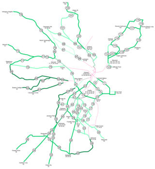
10 E Broad / W Broad

Last updated
10 E Broad / W Broad
COTA XN40 bus.jpg
A New Flyer XN40 on West Broad St. in 2020
Overview
Operator Central Ohio Transit Authority
Vehicle Gillig Low Floor and New Flyer XN40, CNG-fueled, 40-ft buses
StatusIn service
Route
Route typeFrequent local service
Locale Columbus, Ohio
Communities served Prairie Township, the Hilltop, Franklinton, Downtown Columbus, Near East Side, Wolfe Park, Bexley, East Columbus, Whitehall, Reynoldsburg
StartWestwoods Blvd.
(Prairie Township)
Via Broad St.
EndLimited Pkwy.
(Reynoldsburg)
Length20.2 miles (32.5 km)
Service
Frequency15 minutes or better
Operates7 days per week
Timetable 10 E Broad/W Broad timetable
Map 10 E Broad/W Broad route map

The 10 E Broad / W Broad is a Central Ohio Transit Authority (COTA) bus service in Columbus, Ohio. The line operates on Broad Street, the city's main east-west thoroughfare.

Contents

The 10 replaced the West Broad Street streetcar line, an early streetcar line in Columbus, built by the Glenwood and Green Lawn Railroad Company in 1875. This line initially served West Broad Street with horsecars, and horse-drawn omnibuses followed a similar route. The horsecars were replaced with electric streetcars in 1890, and later with trolleybuses. In 1965, the trolleybus line was replaced with a bus line similar to the modern-day 10 E Broad / W Broad.

Route and ridership

Route 10 traverses Prairie Township, the Hilltop, Franklinton, Downtown Columbus, Near East Side, Wolfe Park, Bexley, East Columbus, Whitehall, and Reynoldsburg. It is classified as a local line with frequent service (every 15 minutes or better). [1] [2]

The 10 starts at Westwoods Park & Ride, traveling north on Westwoods Boulevard for a short distance to West Broad Street. The route then travels east on West Broad Street to Broad & High, where at late-night times it travels north to Spring Street for the late-night lineup. At all hours, the bus proceeds east on East Broad Street through Columbus, Bexley, and Whitehall into Reynoldsburg, where it exits onto Limited Parkway at the L Brands office. [2] [3]

Landmarks and parks along the line include COSI, the National Veterans Memorial and Museum, the Discovery Bridge, the Scioto Mile (including Dorrian Green, Genoa Park, Battelle Riverfront Park, and the Scioto Mile Promenade), the Palace Theatre, the Ohio Statehouse, the Jubilee Museum, Franklin County Memorial Hall, the Washington Gladden Social Justice Park, the Columbus Museum of Art, the Main Library, Topiary Park, and Franklin Park and the Franklin Park Conservatory. [3]

The 10 bus has the second-highest ridership in the transit system, only second to the No. 2 bus. [4] The 10 West Broad bus was also the second-most popular as early as 1987, while the 10 East Broad route was the sixth most popular. [5] In 1992, the year of AmeriFlora '92, the route was the system's busiest. [6]

10 E Broad / W Broad
10 E Broad / W Broad route map

History

Streetcar lines in 1906, showing the West Broad Street line; streetcars never operated on East Broad The Street railway journal (1906) (14574540870).jpg
Streetcar lines in 1906, showing the West Broad Street line; streetcars never operated on East Broad

Broad Street has seen public transportation as early as 1860, with a horse-drawn omnibus route run by W. B. Hawkes & Co. [7] :230 The road subsequently was used for horsecars, streetcars, and trolleybuses operating only on West Broad Street (streetcars never operated on East Broad [8] ).

In 1875, the newly-formed Glenwood and Green Lawn Railroad Company built a horsecar line from High Street west on Broad to the city's western boundary, with a branch to Green Lawn Cemetery. [7] :231 That line was the first successfully electrified to utilize streetcars, completed in August 1890. [7] :232 The line was later converted to utilize trolleybuses. On January 4, 1965, buses replaced the West Broad trolleybuses, amid the Columbus Transit Company's conversion into 100 percent bus service. [9]

In the 1980s, accessibility became an issue. COTA requested a waiver for a U.S. Department of Transportation regulation that required wheelchair lifts on all buses; COTA hoped the waiver would potentially save money. A 1981 ruling removed the requirement, giving transit authorities more flexibility. [10] An transit accessibility advocacy organization opposed COTA's move. [11] In 1982, a handicapped passenger moved from his wheelchair onto the steps of the bus, preventing the bus from moving in protest. [12] In 1988, routes 10 and 2 were proposed for the first wheelchair lifts to allow handicapped passengers to ride. [13] The first buses were equipped in 1991, [14] and today all buses are wheelchair-accessible.

In 2019, COTA officials stated the 10 route may become the next bus rapid transit (BRT) line in the city, after the CMAX. The route 10 line could support bus-only lanes on West Broad Street, an improvement over the limited BRT features the CMAX offers. [4] LinkUS, a COTA-Columbus-MORPC partnership, is evaluating the corridor the line operates on. LinkUS began the evaluation in 2020 as one of several highly-trafficked routes to investigate upgrading transit service on. [15] The route received some federal funding in 2020, to be released around 2024. [16] BRT was decided as the transit mode for the corridor in July 2021. Construction will be relatively fast as the route is straight and wide; it is aimed to start along with the northwest route by the end of the decade. [17]

See also

Related Research Articles

<span class="mw-page-title-main">Boston-area streetcar lines</span>

As with many large cities, a large number of Boston-area streetcar lines once existed, and many continued operating into the 1950s. However, only a few now remain, namely the four branches of the Green Line and the Ashmont–Mattapan High-Speed Line, with only one running regular service on an undivided street.

<span class="mw-page-title-main">Engine House No. 12</span> Historic building in Columbus, Ohio

Engine House No. 12 is a former fire station in the Olde Towne East neighborhood of Columbus, Ohio. Today it primarily houses Gemüt Biergarten, a German restaurant, brewery, and biergarten, with its second story used for offices. It is a contributing property to the Columbus Near East Side District, a national historic district established in 1978.

<span class="mw-page-title-main">Scioto Audubon Metro Park</span> Park and nature preserve in Columbus, Ohio, U.S.

Scioto Audubon Metro Park is a public park and nature preserve in Columbus, Ohio. The park is managed by the Columbus and Franklin County Metro Parks and is part of the Scioto Mile network of parks and trails around Downtown Columbus. The park features numerous trails, wetlands, rock climbing, volleyball and bocce courts, and numerous other amenities. At the western edge is the Grange Insurance Audubon Center, considered the first nature center built in close proximity to a downtown area.

<span class="mw-page-title-main">Public transit in Columbus, Ohio</span> Overview of public transportation in Columbus, Ohio

Public transit has taken numerous forms in Columbus, the largest city and capital of Ohio. Transit has variously used passenger trains, horsecars, streetcars, interurbans, trolley coaches, and buses. Current service is through the Central Ohio Transit Authority's bus system, numerous intercity bus companies, and through bikeshare, rideshare, and electric scooter services.

<span class="mw-page-title-main">CMAX</span> Bus rapid transit line in Columbus, Ohio

CMAX is a bus rapid transit (BRT) service in Central Ohio, operated by the Central Ohio Transit Authority (COTA). The line begins in Downtown Columbus, traveling northeast to Westerville. CMAX is Central Ohio's first bus rapid transit line; it began operation in 2018.

<span class="mw-page-title-main">Great Flood of 1913 in Columbus, Ohio</span> 1913 flood in the United States

The Great Flood of 1913 severely affected Columbus, Ohio. The area most affected was Franklinton, also known as the Bottoms, for its low elevation near the Scioto River. Among many infrastructure projects, a 7.2-mile floodwall was built from 1993 to 2004 to protect most of Franklinton from flooding.

<span class="mw-page-title-main">Budd Dairy Food Hall</span> Food hall in Columbus, Ohio

Budd Dairy Food Hall is a food hall in the Italian Village neighborhood of Columbus, Ohio. The Cameron Mitchell Restaurants-run hall holds ten foodservice locations, three bars, and indoor, patio, and rooftop seating. It is situated in the historic Budd Dairy Company building, a former milk processing and distribution facility. The space was renovated beginning in 2018, and opened in April 2021.
<span class="mw-page-title-main">CBUS</span> Bus line in Columbus, Ohio

The CBUS was a free downtown circulator bus in Columbus, Ohio. The service was operated by the Central Ohio Transit Authority. The CBUS service primarily traveled along High Street between the Brewery District and the Short North. The service had uniquely-branded 30-foot buses stopping at round "CBUS" signs. The service operated every 10–15 minutes, seven days per week. The service began operation on May 5, 2014.

<span class="mw-page-title-main">2 E Main / N High</span> Bus line in Columbus, Ohio

The 2 E Main / N High is a Central Ohio Transit Authority (COTA) bus service in Columbus, Ohio. The line operates on High Street, the city's main north-south thoroughfare.

<span class="mw-page-title-main">Columbus Bus Station</span> Intercity bus station in Columbus, Ohio

The Columbus Bus Station is an intercity bus station in Downtown Columbus, Ohio. The station, managed by Greyhound Lines, also serves Barons Bus Lines, Miller Transportation, GoBus, and other carriers. The current building was constructed in 1969. Since 1979, with the demolition of Union Station and a short-lived replacement, the Greyhound station has been the only intercity transit center in the city.
<span class="mw-page-title-main">Columbus City Hall (1872–1921)</span> Former city hall for Columbus, Ohio, U.S.

Columbus City Hall was the city hall for Columbus, Ohio, located on Capitol Square in the city's downtown. The building served the mayor and city council from its construction in 1872 until its demolition in 1921. The building was the founding site for the United Mine Workers of America in 1890. In 1928, the site became home to the Ohio Theatre, and the current Columbus City Hall opened nearby.

<span class="mw-page-title-main">Columbus Developmental Center</span> School for developmental disabilities in Columbus, Ohio

The Columbus Developmental Center (CDC) is a state-supported residential school for people with developmental disabilities, located in the Hilltop neighborhood of Columbus, Ohio. The school, founded in 1857, was the third of these programs developed by a U.S. state, after Massachusetts in 1848 and New York in 1851.

<span class="mw-page-title-main">Engine House No. 7 (Columbus, Ohio)</span> Former fire station in Columbus, Ohio

Engine House No. 7 is a former Columbus Fire Department station in the Weinland Park neighborhood of Columbus, Ohio. It was built in 1894 and was listed on the Columbus Register of Historic Properties in 1994. Today the building houses a local branch of the Communications Workers of America, Local 4501.

<span class="mw-page-title-main">Engine House No. 10 (Columbus, Ohio)</span> Former fire station in Columbus, Ohio

Engine House No. 10 is a Columbus Division of Fire station in the Franklinton neighborhood of Columbus, Ohio. The original firehouse was built in 1897, while its neighboring replacement, also known as Station 10, was completed in 2008.

<span class="mw-page-title-main">Lazarus House</span> Historic house in Columbus, Ohio

The Lazarus House is a historic house in Downtown Columbus, Ohio. It was built in 1886 for Frederick Lazarus Sr., president of the F&R Lazarus & Company, and was designed in the French Second Empire style. It has undergone numerous renovations since its construction, including for conversion into office space, into apartments, and back to predominantly single-family occupancy. The house is a contributing property of the East Town Street Historic District, on the National Register of Historic Places and Columbus Register of Historic Properties.

<span class="mw-page-title-main">Renaissance Columbus Downtown Hotel</span>

The Renaissance Columbus Downtown Hotel is a Renaissance Hotel in Downtown Columbus, Ohio. The hotel has 22 stories, and was designed by Columbus architects Kellam & Foley in the International style.

<span class="mw-page-title-main">Park Hotel (Columbus, Ohio)</span> Hotel in Columbus, Ohio

The Park Hotel was a hotel in Columbus, Ohio. It was later in its history known successively as the Northern Hotel, the Railway Y.M.C.A., and as the Goodale Hotel. The building stood at the northwest corner of North High Street and Goodale Street.

LinkUS is a transportation initiative in Central Ohio, United States. The project aims to create approximately five rapid transit corridors to support the metro population of Columbus, the capital and largest city in Ohio.

William Byron Ireland, was a nationally known American architect. He was known for his design of the Ohio History Center, which Architectural Record considered the most architecturally significant public structure constructed in the state since the Ohio Statehouse was completed in the 1860s.

References

  1. "Long Range Transit Plan" (PDF). Central Ohio Transit Authority. 2016. p. 44. Retrieved May 14, 2021.
  2. 1 2 "Ride COTA" (PDF).
  3. 1 2 Google (May 16, 2021). "Broad Street" (Map). Google Maps . Google. Retrieved May 16, 2021.
  4. 1 2 Ferenchik, Mark (January 30, 2019). "West Broad Street might get the next rapid-transit bus line, COTA officials say". ThisWeek Community News.
  5. "Reference at infoweb-newsbank-com.webproxy3.columbuslibrary.org".
  6. "Reference at infoweb-newsbank-com.webproxy3.columbuslibrary.org".
  7. 1 2 3 Hooper, Osman Castle (1920). History of the City of Columbus Ohio. Columbus-Cleveland: The Memorial Publishing Company.
  8. Vitale, Robert (April 14, 2008). "When streetcars ruled". The Columbus Dispatch.
  9. "Reference at infoweb-newsbank-com.webproxy3.columbuslibrary.org".
  10. "Reference at infoweb-newsbank-com.webproxy3.columbuslibrary.org".
  11. "Reference at infoweb-newsbank-com.webproxy3.columbuslibrary.org".
  12. "Reference at infoweb-newsbank-com.webproxy3.columbuslibrary.org".
  13. "Reference at infoweb-newsbank-com.webproxy3.columbuslibrary.org".
  14. "Reference at infoweb-newsbank-com.webproxy3.columbuslibrary.org".
  15. "East-West Corridor Online Open House". ArcGIS StoryMaps.
  16. Warren, Brent (November 12, 2020). "Federal Funds Directed Toward Two Transit Corridor Projects". Columbus Underground.
  17. Ghose, Carrie (June 29, 2021). "Columbus to get first dedicated bus rapid transit line along Olentangy River Road". Columbus Business First.